File:Guinea Bissau Map.jpg

Size of this preview: 557 × 600 pixels. Other resolutions: 223 × 240 pixels | 446 × 480 pixels | 713 × 768 pixels | 1,040 × 1,120 pixels.
Original file (1,040 × 1,120 pixels, file size: 228 KB, MIME type: image/jpeg)
Captions
Captions
Add a one-line explanation of what this file represents
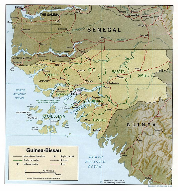
| Description | Shaded relief map of Guinea-Bissau. | |||
| Date | ||||
| Source | [1] from the Perry-Castañeda Library Map Collection. | |||
| Author | CIA | |||
| Permission (Reusing this file) |
|

![[1]](http://www.lib.utexas.edu/maps/africa/guinea_bissau_rel93.jpg)
File history
Click on a date/time to view the file as it appeared at that time.
| Date/Time | Thumbnail | Dimensions | User | Comment | |
|---|---|---|---|---|---|
| current | 13:14, 22 February 2006 | | 1,040 × 1,120 (228 KB) | Lupo (talk | contribs) | Shaded relief map of Guinea-Bissau. Source: [http://www.lib.utexas.edu/maps/africa/guinea_bissau_rel93.jpg] from the [http://www.lib.utexas.edu/maps/africa.html Perry-Castañeda Library Map Collection]. {{PD-USGov-CIA}} [[Category:Maps of Guinea Bi |
You cannot overwrite this file.
File usage on Commons
The following 2 pages use this file:
File usage on other wikis
The following other wikis use this file:
- Usage on ca.wikipedia.org
- Usage on en.wikipedia.org
- Usage on es.wikipedia.org
- Usage on fa.wikipedia.org
- Usage on ha.wikipedia.org
- Usage on hr.wiktionary.org
- Usage on it.wikipedia.org
- Usage on ja.wikipedia.org
- Usage on lt.wikipedia.org
- Usage on nl.wikipedia.org
- Usage on no.wikipedia.org
- Usage on pl.wikipedia.org
- Usage on pt.wikipedia.org
- Usage on ru.wiktionary.org
- Usage on sa.wikipedia.org
- Usage on uk.wikipedia.org
- Usage on uz.wikipedia.org
- Usage on vec.wikipedia.org