File:GwaliorKart.svg

Size of this PNG preview of this SVG file: 596 × 565 pixels. Other resolutions: 253 × 240 pixels | 506 × 480 pixels | 810 × 768 pixels | 1,080 × 1,024 pixels | 2,160 × 2,048 pixels.
Original file (SVG file, nominally 596 × 565 pixels, file size: 57 KB)
Captions
Captions
Add a one-line explanation of what this file represents
Summary edit
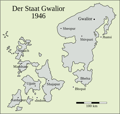
| Description |
Deutsch: Karte von Gwalior. |
|||
| Date | ||||
| Source |
This file was derived from: GwaliorKart.jpg by Dr. Andreas Birken |
|||
| Author | Dr. Andreas Birken, vectorized by Furfur | |||
| Permission (Reusing this file) |
This file is licensed under the Creative Commons Attribution-Share Alike 3.0 Germany license.
 |
|||
| Other versions |
|


File history
Click on a date/time to view the file as it appeared at that time.
| Date/Time | Thumbnail | Dimensions | User | Comment | |
|---|---|---|---|---|---|
| current | 12:28, 6 October 2022 | | 596 × 565 (57 KB) | Furfur (talk | contribs) | 1946 (one year before independence), not 1956 (States Reorganisation Act) |
| 10:16, 6 October 2022 |  | 596 × 565 (57 KB) | Furfur (talk | contribs) | ... again | |
| 10:14, 6 October 2022 |  | 596 × 565 (123 KB) | Furfur (talk | contribs) | new color scheme | |
| 14:23, 20 September 2022 |  | 596 × 565 (30 KB) | Furfur (talk | contribs) | == {{int:filedesc}} == {{Information |Description={{de|1=Karte von Gwalior.}} |Source={{Derived from|GwaliorKart.jpg|by=}} |Date=2009-01-07 |Author=Dr. Andreas Birken, vectorized by {{U|Furfur}} |Permission={{Bild-CC-by-sa/3.0/de}} |other_versions={{bva}} }} Category:Gwalior State Category:SVG maps showing history in German |
You cannot overwrite this file.
File usage on Commons
The following 2 pages use this file:
File usage on other wikis
The following other wikis use this file:
- Usage on de.wikipedia.org