File:H1N1 Chile Map.svg

Size of this PNG preview of this SVG file: 110 × 598 pixels. Other resolutions: 44 × 240 pixels | 88 × 480 pixels | 141 × 768 pixels | 188 × 1,024 pixels | 377 × 2,048 pixels | 370 × 2,010 pixels.
Original file (SVG file, nominally 370 × 2,010 pixels, file size: 884 KB)
Captions
Captions
Add a one-line explanation of what this file represents
Summary edit
| Description |
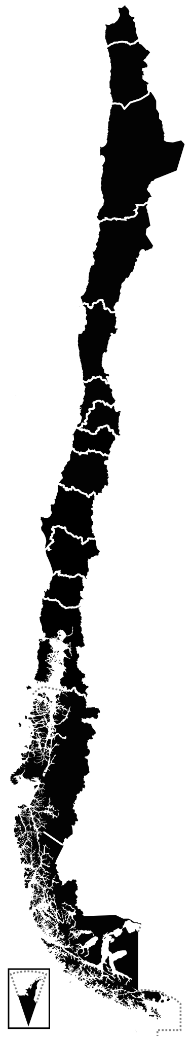
English: A map about the 2009 A (H1N1) flu outbreak in Chile
death confirmed
confirmed cases Español: Un mapa sobre el brote de gripe A (H1N1) en Chile de 2009
muertes confirmadas
casos confirmados |
| Date | |
| Source | Own work |
| Author | Vrysxy |
| Other versions |
|
Licensing edit
I, the copyright holder of this work, hereby publish it under the following licenses:
This file is licensed under the Creative Commons Attribution-Share Alike 3.0 Unported license.
- You are free:
- to share – to copy, distribute and transmit the work
- to remix – to adapt the work
- Under the following conditions:
- attribution – You must give appropriate credit, provide a link to the license, and indicate if changes were made. You may do so in any reasonable manner, but not in any way that suggests the licensor endorses you or your use.
- share alike – If you remix, transform, or build upon the material, you must distribute your contributions under the same or compatible license as the original.

|
Permission is granted to copy, distribute and/or modify this document under the terms of the GNU Free Documentation License, Version 1.2 or any later version published by the Free Software Foundation; with no Invariant Sections, no Front-Cover Texts, and no Back-Cover Texts. A copy of the license is included in the section entitled GNU Free Documentation License. |
You may select the license of your choice.
File history
Click on a date/time to view the file as it appeared at that time.
| Date/Time | Thumbnail | Dimensions | User | Comment | |
|---|---|---|---|---|---|
| current | 01:27, 29 October 2009 | 370 × 2,010 (884 KB) | Fonadier (talk | contribs) | Fixed map | |
| 03:29, 14 September 2009 |  | 962 × 2,092 (949 KB) | Fonadier (talk | contribs) | Fixed map | |
| 02:05, 24 August 2009 |  | 962 × 2,092 (1,015 KB) | Fonadier (talk | contribs) | Todas las regiones ya tienen muertes confirmadas | |
| 02:10, 4 August 2009 |  | 962 × 2,092 (1,015 KB) | Fonadier (talk | contribs) | Updating - Actualizando | |
| 01:03, 5 July 2009 |  | 962 × 2,092 (1,015 KB) | Fonadier (talk | contribs) | First death in Magallanes y Antártica Chilena region - Primera muerte en la Región de Magallanes y Antártica Chilena | |
| 00:51, 5 July 2009 |  | 962 × 2,092 (1,015 KB) | Fonadier (talk | contribs) | First death in Magallanes y Antártica Chilena region - Primera muerte en la Región de Magallanes y Antártica Chilena | |
| 00:30, 5 July 2009 |  | 962 × 2,092 (1,015 KB) | Fonadier (talk | contribs) | Updating - Actualizando | |
| 03:08, 28 June 2009 |  | 962 × 2,092 (1,015 KB) | Fonadier07 (talk | contribs) | Fixed colors | |
| 02:56, 28 June 2009 |  | 962 × 2,092 (1,018 KB) | Fonadier07 (talk | contribs) | Added Biobío, Araucanía & Los Ríos | |
| 20:43, 22 June 2009 | 400 × 2,000 (2.64 MB) | Vrysxy (talk | contribs) | Primer muerto en O'Higgins |
You cannot overwrite this file.
File usage on Commons
The following 3 pages use this file:
File usage on other wikis
The following other wikis use this file:
- Usage on en.wikipedia.org
- 2009 swine flu pandemic in South America
- Talk:2009 swine flu pandemic in South America
- Talk:2009 swine flu pandemic in Oceania
- Talk:2009 swine flu pandemic by country/Archive 2
- Talk:2009 flu pandemic in Chile
- Talk:2009 swine flu pandemic/Archive 7
- Wikipedia:Graphics Lab/Image workshop/Archive/Jul 2009
- Wikipedia talk:WikiProject Antarctica/Archive 1
- Usage on fr.wikipedia.org
- Usage on pl.wikipedia.org