File:Haarlem location map.png
Haarlem_location_map.png (246 × 374 pixels, file size: 185 KB, MIME type: image/png)
Captions
Captions
Summary edit
| Description |
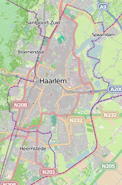
Polski: Mapa Haarlemu, Holandia
English: Map of Haarlem, Netherland |
|||||||||
| Date | ||||||||||
| Source | You may find a page on the OpenStreetMap wiki page for Haarlem | |||||||||
| Creator |
OpenStreetMap contributors OpenStreetMap contributors |
|||||||||
| Permission (Reusing this file) |
OpenStreetMap data is available under the Open Database License (details). Map tiles are licensed under the Creative Commons Attribution-ShareAlike 2.0 license (CC-BY-SA 2.0).
This file is licensed under the Creative Commons Attribution-Share Alike 2.0 Generic license.
|
|||||||||
| Geotemporal data | ||||||||||
| Bounding box |
|
|||||||||
| Georeferencing | If inappropriate please set warp_status = skip to hide. | |||||||||
Licensing edit
| This work contains information from OpenStreetMap, which is made available under the Open Database License (ODbL).
The ODbL does not require any particular license for maps produced from ODbL data. Prior to 1 August 2020, map tiles produced by the OpenStreetMap Foundation were licensed under the CC-BY-SA-2.0 license. Maps produced by other people may be subject to other licences. |
File history
Click on a date/time to view the file as it appeared at that time.
| Date/Time | Thumbnail | Dimensions | User | Comment | |
|---|---|---|---|---|---|
| current | 10:44, 1 December 2013 | | 246 × 374 (185 KB) | Smat (talk | contribs) | User created page with UploadWizard |
You cannot overwrite this file.
File usage on Commons
There are no pages that use this file.
File usage on other wikis
The following other wikis use this file:
- Usage on fr.wikipedia.org
- Usage on fy.wikipedia.org
- Usage on nl.wikipedia.org
- Kathedrale basiliek Sint Bavo
- Hal (Frans Hals Museum)
- Patronaat (Haarlem)
- Koepelgevangenis van Haarlem
- Kenaupark
- Haarlemmerhout
- Sint Johannes de Deoziekenhuis
- Kraantje Lek
- Veerplas
- Schoterbrug
- Paviljoen Welgelegen
- Schoterveense Molen
- Spaarnekerk
- De Veer (molen)
- Tweede divisie 1962/63
- Heilig Hartkerk (Haarlem)
- Onder Dak
- Drijfriemenfabriek (Haarlem)
- Gebruiker:Dqfn13/Kladblok
- Bedrijventerrein Waarderpolder
- Van der Pigge
- Burgemeester Reinaldapark
- Schoteroog
- Sjabloon:Positiekaart Haarlem
- Dreefzicht
- Zaanenpark
- Schoterbos
- Lutherse Kerk (Haarlem)
- Onze-Lieve-Vrouw Onbevlekt Ontvangenkerk (Overveen)
- Haarlemmer Kweektuin
- De Houtvaart
- Draaiorgelmuseum (Haarlem)
- Drinkwatermuseum
- Schoterrechthuis
- Egelantier (Haarlem)
- Vredestempel (Haarlem)
- Nelson Mandelapark (Haarlem)
- Brouwerij Uiltje
- Frederikspark
- Slachthuis (Haarlem)
- Haarlemmer Stroom
- Tuinbouwgebied
- Moeder-van-de-Verlosserkerk
- Aziëpark
- H. Pastoor van Arskerk
View more global usage of this file.