File:Haiyan 2013-11-07 1800Z surface analysis.png

Size of this preview: 600 × 600 pixels. Other resolutions: 240 × 240 pixels | 480 × 480 pixels | 768 × 768 pixels | 1,024 × 1,024 pixels | 2,000 × 2,000 pixels.
Original file (2,000 × 2,000 pixels, file size: 193 KB, MIME type: image/png)
Captions
Captions
Add a one-line explanation of what this file represents
Summary edit
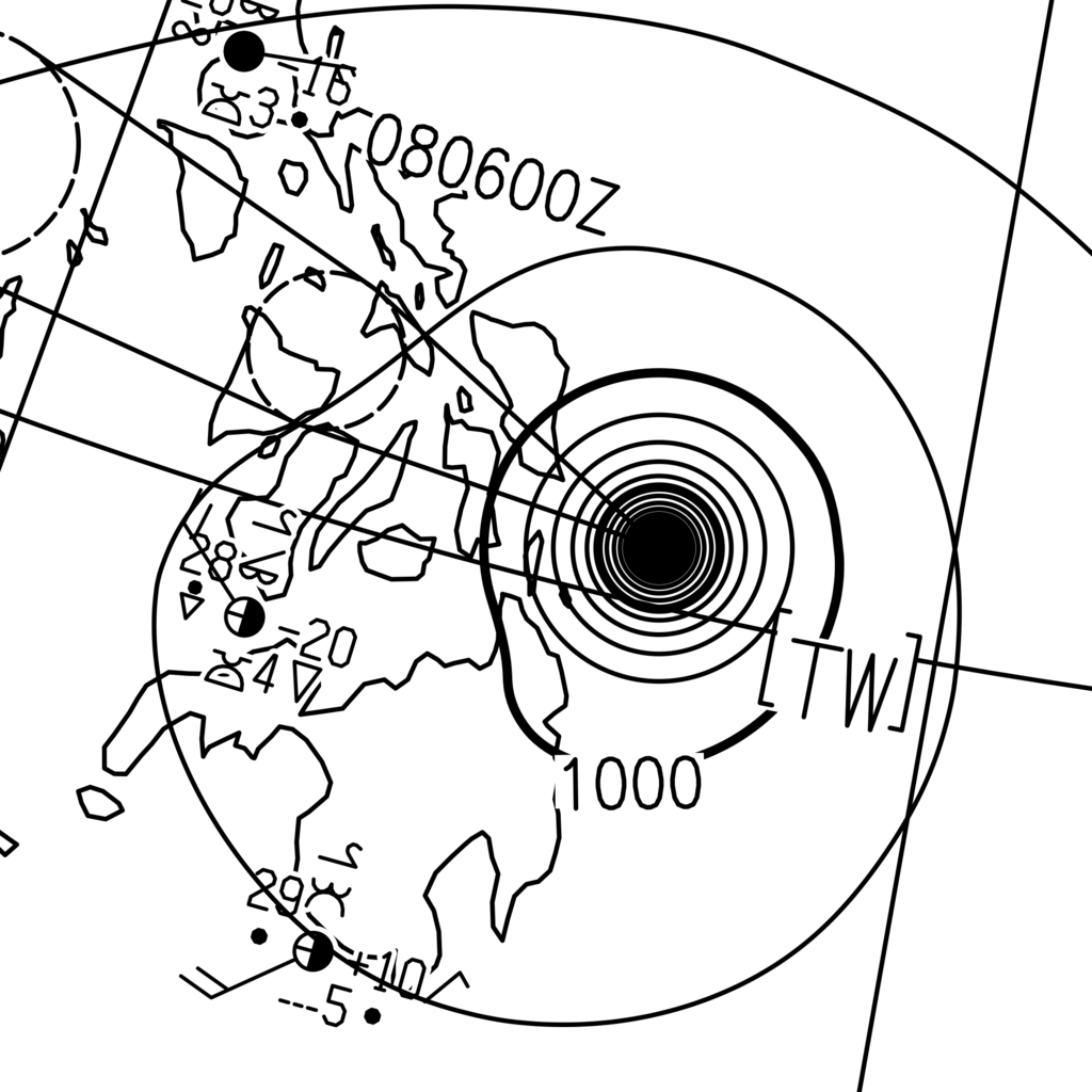
| Description |
English: The surface analysis of Typhoon Haiyan on 8 November 2013 at 02:00 Philippine Standard Time (on 7 November 2013 at 18:00 Coordinated Universal Time), released the by Japan Meteorological Agency. The central pressure, which is not labeled over Haiyan on the image, was 895 hPa. |
| Date | |
| Source | http://www.jma.go.jp/jp/g3/images/asia/pdf/asas.pdf |
| Author | The Japan Meteorological Agency |
| Camera location | | View this and other nearby images on: OpenStreetMap |
|---|
Licensing edit
This image was produced by the Japan Meteorological Agency. The legal notice (archive) stated that all the images published on their website is compatible with the Creative Commons Attribution 4.0 License, which means that all the images on this website is published under the Creative Commons Attribution 4.0 License unless otherwise specified.
This file is licensed under the Creative Commons Attribution 4.0 International license. Attribution: Japan Meteorological Agency
|
 |

File history
Click on a date/time to view the file as it appeared at that time.
| Date/Time | Thumbnail | Dimensions | User | Comment | |
|---|---|---|---|---|---|
| current | 05:24, 4 January 2015 | | 2,000 × 2,000 (193 KB) | Meow (talk | contribs) | Doubled the width and height. |
| 04:49, 4 January 2015 |  | 1,000 × 1,000 (93 KB) | Meow (talk | contribs) | User created page with UploadWizard |
You cannot overwrite this file.
File usage on Commons
There are no pages that use this file.