File:Halalii Lake on topo map of southern Niihau Island, Hawaii.jpg

No higher resolution available.
Halalii_Lake_on_topo_map_of_southern_Niihau_Island,_Hawaii.jpg (609 × 592 pixels, file size: 196 KB, MIME type: image/jpeg)
Captions
Captions
Add a one-line explanation of what this file represents
Summary edit
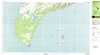
| Description |
English: Halalii Lake |
| Date | |
| Source |
http://store.usgs.gov/b2c_usgs/usgs/maplocator/%28ctype=areaDetails&xcm=r3standardpitrex_prd&carea=%24ROOT&layout=6_1_61_48&uiarea=2%29/.do File:Niihau South K21160G1 geo.pdf |
| Author | USGS |
Licensing edit
This image is in the public domain in the United States because it only contains materials that originally came from the United States Geological Survey, an agency of the United States Department of the Interior. For more information, see the official USGS copyright policy.
|
File history
Click on a date/time to view the file as it appeared at that time.
| Date/Time | Thumbnail | Dimensions | User | Comment | |
|---|---|---|---|---|---|
| current | 08:51, 27 May 2017 | | 609 × 592 (196 KB) | KAVEBEAR (talk | contribs) | |
| 08:46, 27 May 2017 |  | 796 × 619 (249 KB) | PawełMM (talk | contribs) | new bigger area version | |
| 05:43, 27 May 2017 |  | 735 × 550 (105 KB) | PawełMM (talk | contribs) | User created page with UploadWizard |
You cannot overwrite this file.
File usage on Commons
The following 2 pages use this file:
File usage on other wikis
The following other wikis use this file:
- Usage on en.wikipedia.org