File:Hallam-NE-tornado-map.jpg
Size of this preview: 800 × 518 pixels. Other resolutions: 320 × 207 pixels | 640 × 414 pixels | 1,024 × 663 pixels | 1,280 × 828 pixels | 1,700 × 1,100 pixels.
Original file (1,700 × 1,100 pixels, file size: 205 KB, MIME type: image/jpeg)
Captions
Captions
Add a one-line explanation of what this file represents
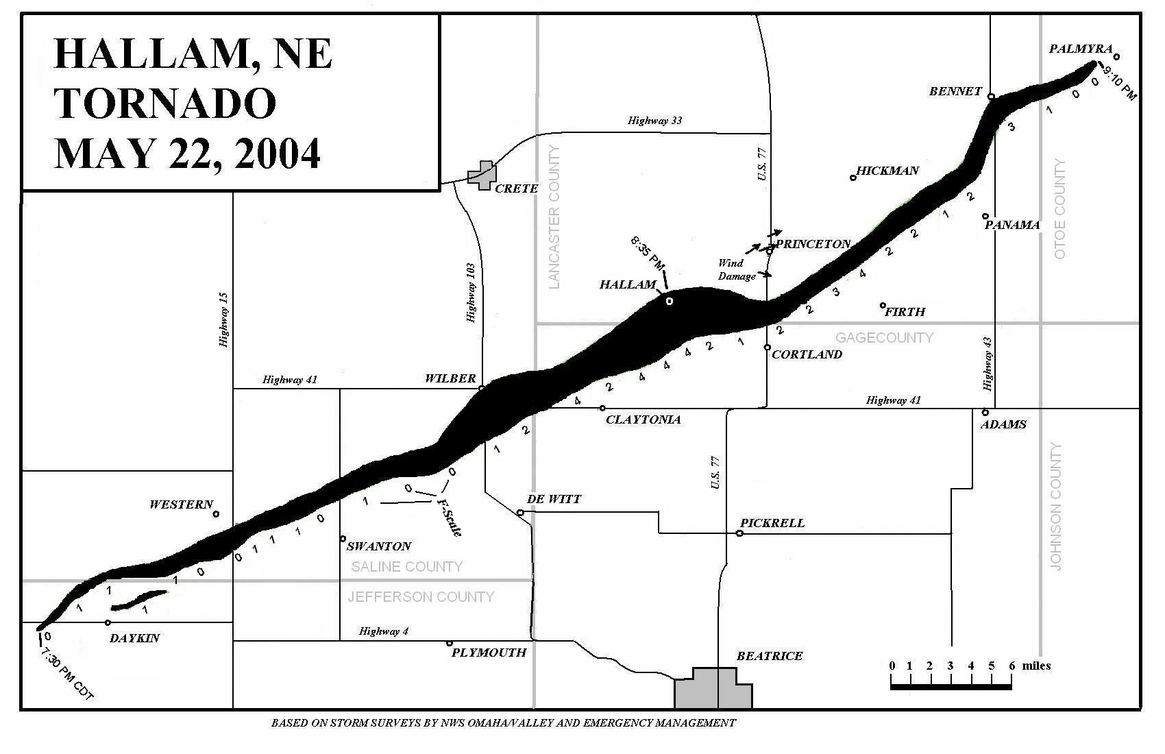
This is a map from a NWS damage survey of the Hallam tornado of 22 May 2004.
http://www.spc.noaa.gov/faq/tornado/hallamap.jpg
This image is in the public domain because it contains materials that originally came from the U.S. National Oceanic and Atmospheric Administration, taken or made as part of an employee's official duties.
|
File history
Click on a date/time to view the file as it appeared at that time.
| Date/Time | Thumbnail | Dimensions | User | Comment | |
|---|---|---|---|---|---|
| current | 20:12, 19 January 2006 | | 1,700 × 1,100 (205 KB) | Swid (talk | contribs) | This is a map from a NWS damage survey of the Hallam tornado of 22 May 2004. http://www.spc.noaa.gov/faq/tornado/hallamap.jpg Category:Tornadoes {{PD-USGov-NOAA}} |
You cannot overwrite this file.
File usage on Commons
There are no pages that use this file.
File usage on other wikis
The following other wikis use this file:
- Usage on en.wikipedia.org