File:Han Dynasty 3.2.2021 M.R.png
Size of this preview: 800 × 369 pixels. Other resolutions: 320 × 147 pixels | 640 × 295 pixels | 1,024 × 472 pixels | 1,280 × 590 pixels | 3,500 × 1,613 pixels.
Original file (3,500 × 1,613 pixels, file size: 463 KB, MIME type: image/png)
Captions
Captions
Add a one-line explanation of what this file represents
Summary edit
| Description |
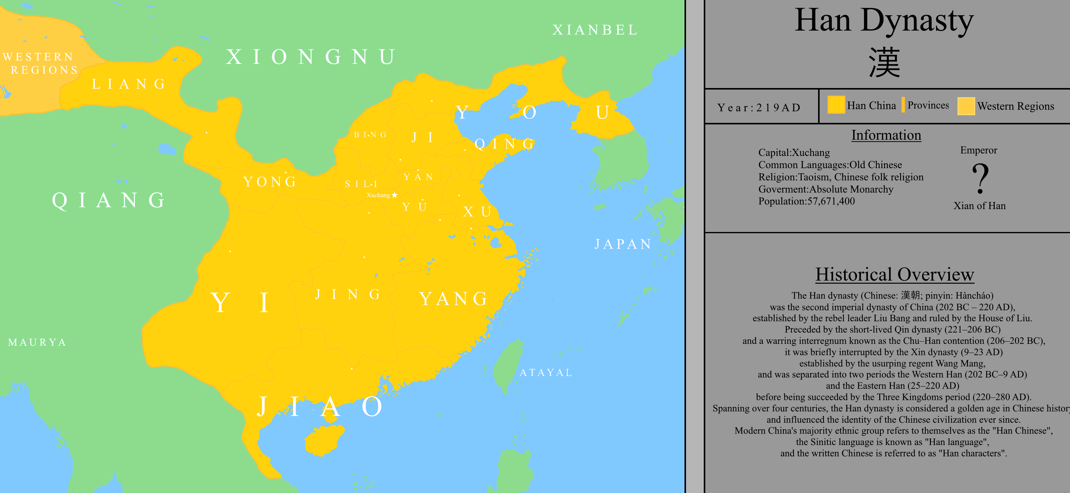
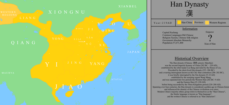
English: This is a map of China in the Han Dynasty on 219 A.D with his provinces and major cities.
Español: Este es un mapa de China en la Dinastía Han en el año 219 D.C Con sus Provincias y Ciudades Importantes. |
| Date | |
| Source | Own work |
| Author | M11111134567 |
Licensing edit
I, the copyright holder of this work, hereby publish it under the following license:
This file is licensed under the Creative Commons Attribution-Share Alike 4.0 International license.
- You are free:
- to share – to copy, distribute and transmit the work
- to remix – to adapt the work
- Under the following conditions:
- attribution – You must give appropriate credit, provide a link to the license, and indicate if changes were made. You may do so in any reasonable manner, but not in any way that suggests the licensor endorses you or your use.
- share alike – If you remix, transform, or build upon the material, you must distribute your contributions under the same or compatible license as the original.
File history
Click on a date/time to view the file as it appeared at that time.
| Date/Time | Thumbnail | Dimensions | User | Comment | |
|---|---|---|---|---|---|
| current | 16:05, 1 December 2022 | | 3,500 × 1,613 (463 KB) | M11111134567 (talk | contribs) | Cities and Capital is are white now. |
| 16:03, 1 December 2022 |  | 3,500 × 1,613 (462 KB) | M11111134567 (talk | contribs) | Minor changes, Han Dynasty color is yellow now. | |
| 20:22, 3 February 2021 |  | 3,500 × 1,613 (492 KB) | M11111134567 (talk | contribs) | Uploaded own work with UploadWizard |
You cannot overwrite this file.
File usage on Commons
There are no pages that use this file.