File:Harvey 2017-08-26 2245Z.jpg
Size of this preview: 785 × 599 pixels. Other resolutions: 315 × 240 pixels | 629 × 480 pixels | 1,006 × 768 pixels | 1,280 × 977 pixels | 1,661 × 1,268 pixels.
Original file (1,661 × 1,268 pixels, file size: 964 KB, MIME type: image/jpeg)
Captions
Captions
Add a one-line explanation of what this file represents
Summary edit
| Description |
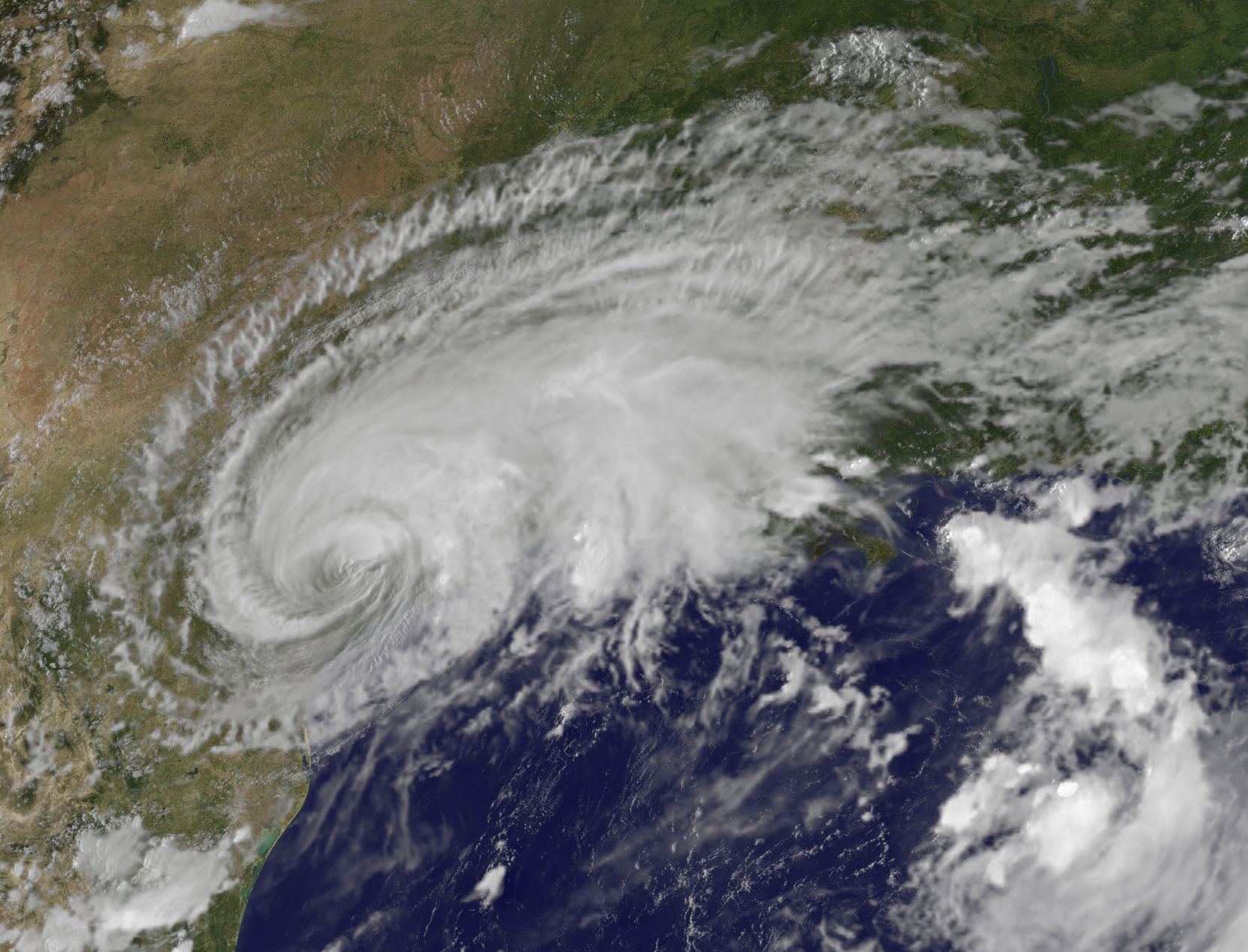
English: NOAA's GOES-East satellite captured this visible image of Hurricane Harvey in the western Gulf of Mexico on Aug. 26 at 6:45 p.m. EDT (2245 UTC). |
| Date | |
| Source | https://www.nasa.gov/feature/goddard/2017/harvey-atlantic-ocean |
| Author | NASA/NOAA |
Licensing edit
This image is in the public domain because it contains materials that originally came from the U.S. National Oceanic and Atmospheric Administration, taken or made as part of an employee's official duties.
|
File history
Click on a date/time to view the file as it appeared at that time.
| Date/Time | Thumbnail | Dimensions | User | Comment | |
|---|---|---|---|---|---|
| current | 08:34, 6 February 2018 | | 1,661 × 1,268 (964 KB) | A1Cafel (talk | contribs) | original size |
| 09:15, 29 September 2017 |  | 985 × 752 (112 KB) | A1Cafel (talk | contribs) | User created page with UploadWizard |
You cannot overwrite this file.
File usage on Commons
The following page uses this file: