File:Harz map-es.png

Size of this preview: 800 × 474 pixels. Other resolutions: 320 × 189 pixels | 640 × 379 pixels | 1,024 × 606 pixels | 1,280 × 758 pixels | 2,577 × 1,526 pixels.
Original file (2,577 × 1,526 pixels, file size: 3.21 MB, MIME type: image/png)
Captions
Captions
Add a one-line explanation of what this file represents
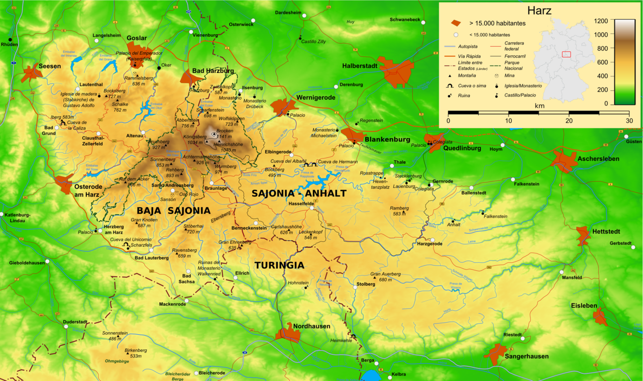
Map of the Macizo del Harz in Germany (PNG-VERSION in Spanish).
![]()
Detailed map of large dimension. For a better viewing, click on the link of the image above.
Mapa detallado de gran dimensión. Para una visualización óptima, cliquea en el enlace de la imagen superior.
Summary edit
| Description | Map of the Macizo del Harz in Germany with mountains, rivers, lakes, reservoirs, all highways, all Bundesstraßen, Harzquerbahn, Brockenbahn, Selketalbahn, major towns and sights(PNG-VERSION in Spanish). |
| Date | |
| Source | Own work |
| Author | Bamse / Translator=molorco |
| Other versions |
[]
|


The map has been created with the Generic Mapping Tools: https://www.generic-mapping-tools.org/ using one or more of these public-domain datasets for the relief:
|

|
Permission is granted to copy, distribute and/or modify this document under the terms of the GNU Free Documentation License, Version 1.2 or any later version published by the Free Software Foundation; with no Invariant Sections, no Front-Cover Texts, and no Back-Cover Texts. A copy of the license is included in the section entitled GNU Free Documentation License. |
| This file is licensed under the Creative Commons Attribution-Share Alike 3.0 Unported license. | ||
| ||
| This licensing tag was added to this file as part of the GFDL licensing update. |

|
This map has been made or improved in the German Kartenwerkstatt (Map Lab). You can propose maps to improve as well.
|
File history
Click on a date/time to view the file as it appeared at that time.
| Date/Time | Thumbnail | Dimensions | User | Comment | |
|---|---|---|---|---|---|
| current | 03:17, 25 March 2008 | | 2,577 × 1,526 (3.21 MB) | Molorco (talk | contribs) | Map of the Macizo del Harz in Germany (PNG-VERSION in Spanish). {{GFDL-GMT}} |
You cannot overwrite this file.
File usage on Commons
The following 3 pages use this file:
File usage on other wikis
The following other wikis use this file:
- Usage on es.wikipedia.org