File:Havana Map - Santiago de las Vegas (Boyeros).png
Size of this preview: 800 × 445 pixels. Other resolutions: 320 × 178 pixels | 640 × 356 pixels | 1,298 × 722 pixels.
Original file (1,298 × 722 pixels, file size: 110 KB, MIME type: image/png)
Captions
Captions
Add a one-line explanation of what this file represents

|
This locator map image could be re-created using vector graphics as an SVG file. This has several advantages; see Commons:Media for cleanup for more information. If an SVG form of this image is available, please upload it and afterwards replace this template with
{{vector version available|new image name}}.
It is recommended to name the SVG file “Havana Map - Santiago de las Vegas (Boyeros).svg”—then the template Vector version available (or Vva) does not need the new image name parameter. |
Summary
edit.png&action=edit§ion=1)
| Description |
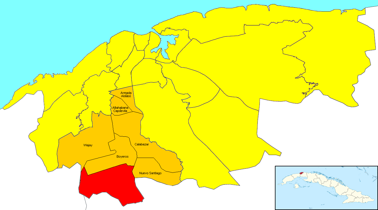
English: Locator map of the ward of Santiago de las Vegas (shown in red) within the municipal borough of Boyeros (orange) and the city of Havana (yellow). The little Cuban map in the corner shows Havana (dark red) within the island. Note: to obtain the borders of Santiago de las Vegas I followed the description on EcuRed. |
| Date | |
| Source | Derived from the original File:Havana Municipalities.png by Habanero36. the little Cuban map derives from the File:La Habana in Cuba.svg by TUBS. |
| Author | Dэя-Бøяg |
Licensing
edit.png&action=edit§ion=2)
I, the copyright holder of this work, hereby publish it under the following licenses:

|
Permission is granted to copy, distribute and/or modify this document under the terms of the GNU Free Documentation License, Version 1.2 or any later version published by the Free Software Foundation; with no Invariant Sections, no Front-Cover Texts, and no Back-Cover Texts. A copy of the license is included in the section entitled GNU Free Documentation License. |
| This file is licensed under the Creative Commons Attribution-Share Alike 3.0 Unported license. | ||
| ||
| This licensing tag was added to this file as part of the GFDL licensing update. |
You may select the license of your choice.
File history
Click on a date/time to view the file as it appeared at that time.
| Date/Time | Thumbnail | Dimensions | User | Comment | |
|---|---|---|---|---|---|
| current | 04:34, 18 June 2018 | | 1,298 × 722 (110 KB) | DerBorg (talk | contribs) | {{Convert to SVG|locator map}} == {{int:filedesc}} == {{Information |Description={{en|1=Locator map of the ward of Santiago de las Vegas (shown in red) within the municipal borough of Boyeros (orange) and the city of Havana (yellow). The little Cuban map in the corner shows Havana (dark red) within the island. Note: to obtain the borders of Calabazar I followed the [https://www.ecured.cu/Santiago_de_las_Vegas_(Boyeros) description on EcuRed].}} |Source=Derived from the original '''[[:File:Hav... |
You cannot overwrite this file.
File usage on Commons
The following page uses this file:
File usage on other wikis
The following other wikis use this file:
- Usage on en.wikipedia.org
- Usage on es.wikipedia.org
- Usage on ht.wikipedia.org
- Usage on pt.wikipedia.org
- Usage on ru.wikinews.org
- Usage on tum.wikipedia.org
- Usage on www.wikidata.org
.png&oldid=508995849)