File:Hawaii-Emperor dt.png
Size of this preview: 579 × 599 pixels. Other resolutions: 232 × 240 pixels | 464 × 480 pixels | 742 × 768 pixels | 989 × 1,024 pixels | 1,596 × 1,652 pixels.
Original file (1,596 × 1,652 pixels, file size: 3.78 MB, MIME type: image/png)
Captions
Captions
Add a one-line explanation of what this file represents
Summary edit
| Description |
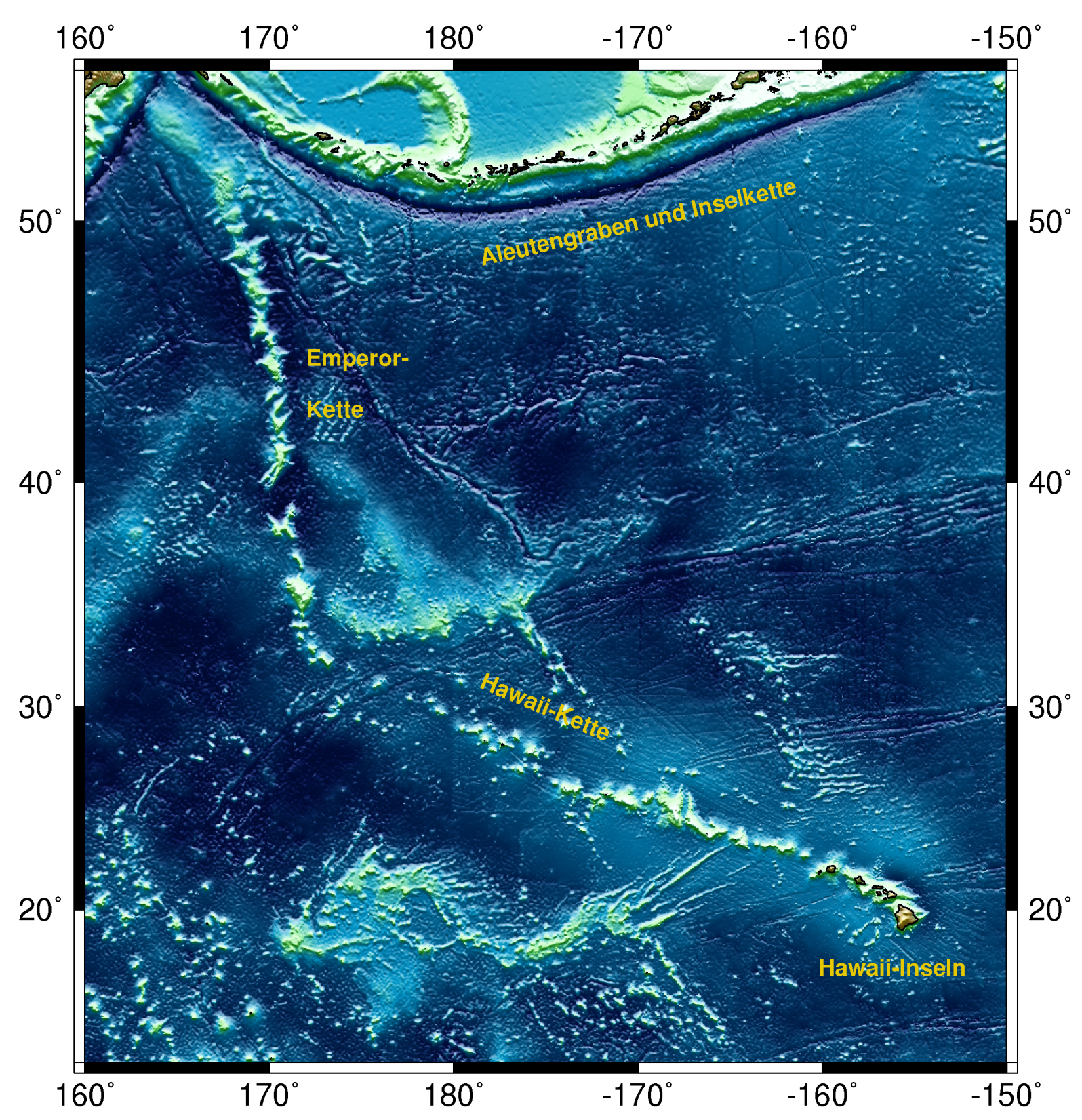
English: Map of the Hawaii-Emperor seamount chain with seafloor topography
Deutsch: Karte der Hawaii-Emperor-Kette mit umliegender Meeresbodentopografie
Plattdüütsch: Koort vun de Hawaii-Emperor-Keed mit Seebodden-Topografie |
| Date | |
| Source | Eigenes Werk (own work), created with GMT software |
| Author | Iwoelbern |
| Other versions | Hawaii-Emperor_engl.png |
Licensing edit
| I, the copyright holder of this work, release this work into the public domain. This applies worldwide. In some countries this may not be legally possible; if so: I grant anyone the right to use this work for any purpose, without any conditions, unless such conditions are required by law. |
File history
Click on a date/time to view the file as it appeared at that time.
| Date/Time | Thumbnail | Dimensions | User | Comment | |
|---|---|---|---|---|---|
| current | 17:13, 4 July 2008 | | 1,596 × 1,652 (3.78 MB) | Iwoelbern (talk | contribs) | |
| 09:21, 19 June 2008 |  | 2,343 × 2,387 (4.35 MB) | Iwoelbern (talk | contribs) | {{Information |Description={{en|1=Map of the Hawaii-Emperor seamount chain with seafloor topography}} {{de|1=Karte der Hawaii-Emperor-Kette mit umliegender Meeresbodentopografie}} {{nds|1=Koort vun de Hawaii-Emperor-Keed mit Seebodden-Topografie}} |Source |
You cannot overwrite this file.
File usage on Commons
The following 3 pages use this file:
File usage on other wikis
The following other wikis use this file:
- Usage on de.wikipedia.org
- Usage on he.wikipedia.org
- Usage on nds.wikipedia.org
- Usage on www.wikidata.org