File:HawkesBayRegionPopulationDensity.png
Size of this preview: 509 × 600 pixels. Other resolutions: 204 × 240 pixels | 407 × 480 pixels | 652 × 768 pixels | 1,061 × 1,250 pixels.
Original file (1,061 × 1,250 pixels, file size: 113 KB, MIME type: image/png)
Captions
Captions
Add a one-line explanation of what this file represents
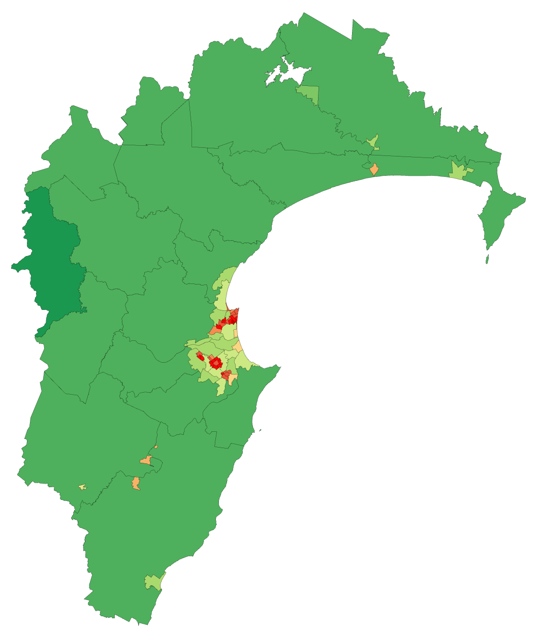
Less than 1 person per square km
1 person per square km and above
5 people per square km and above
10 people per square km and above
50 people per square km and above
100 people per square km and above
250 people per square km and above
500 people per square km and above
750 people per square km and above
1000 people per square km and above
2000 people per square km and above
3000 people per square km and above
4000 people per square km and above
Summary edit
| Description | Map showing population density of a region of New Zealand (by Statistics NZ Area Unit) as of the 2006 census |
| Date | |
| Source | self-made, using data from Statistics NZ and an existing colourscheme for such maps |
| Author | Vardion |
Licensing edit
I, the copyright holder of this work, hereby publish it under the following licenses:
This file is licensed under the Creative Commons Attribution-Share Alike 3.0 Unported license.
- You are free:
- to share – to copy, distribute and transmit the work
- to remix – to adapt the work
- Under the following conditions:
- attribution – You must give appropriate credit, provide a link to the license, and indicate if changes were made. You may do so in any reasonable manner, but not in any way that suggests the licensor endorses you or your use.
- share alike – If you remix, transform, or build upon the material, you must distribute your contributions under the same or compatible license as the original.

|
Permission is granted to copy, distribute and/or modify this document under the terms of the GNU Free Documentation License, Version 1.2 or any later version published by the Free Software Foundation; with no Invariant Sections, no Front-Cover Texts, and no Back-Cover Texts. A copy of the license is included in the section entitled GNU Free Documentation License. |
You may select the license of your choice.
File history
Click on a date/time to view the file as it appeared at that time.
| Date/Time | Thumbnail | Dimensions | User | Comment | |
|---|---|---|---|---|---|
| current | 04:42, 8 May 2008 | | 1,061 × 1,250 (113 KB) | Vardion (talk | contribs) | {{Information |Description=Map showing population density of a region of New Zealand (by Statistics NZ Area Unit) as of the 2006 census |Source=self-made, using data from Statistics NZ and an existing colourscheme for such maps |Date=8 May 2008 |Author= [ |
You cannot overwrite this file.
File usage on Commons
The following page uses this file:
File usage on other wikis
The following other wikis use this file:
- Usage on fr.wikipedia.org
- Usage on he.wikipedia.org
- Usage on nn.wikipedia.org
- Usage on uk.wikipedia.org