File:Heidenklinge Wassertunnel.jpg

Size of this preview: 800 × 600 pixels. Other resolutions: 320 × 240 pixels | 640 × 480 pixels | 1,024 × 768 pixels | 1,280 × 960 pixels | 1,920 × 1,440 pixels.
Original file (1,920 × 1,440 pixels, file size: 490 KB, MIME type: image/jpeg)
Captions
Captions
Add a one-line explanation of what this file represents
Summary
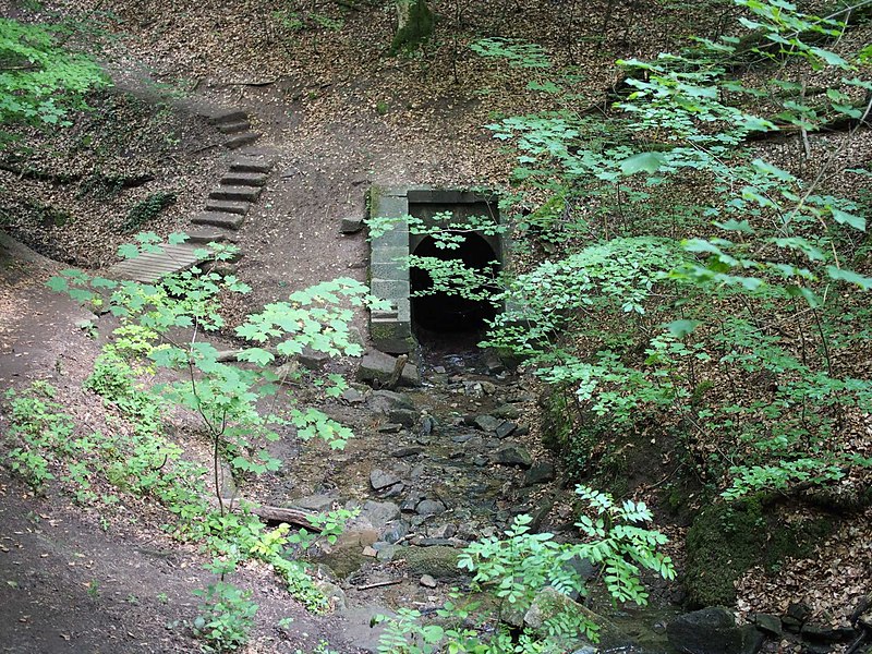
edit| Description | Die Heidenklinge und die Heslacher Wasserfälle setzten sich hier ursprünglich weiter bergab fort. Der Bahndamm der Gäubahn hat die Schlucht versperrt, das Wasser wird durch einen Tunnel geleitet. |
| Date | |
| Source | Own work |
| Author | Ikar.us |
| Permission (Reusing this file) |
I, the copyright holder of this work, hereby publish it under the following license: This file is licensed under the Creative Commons Attribution 3.0 Germany license.
 |
| Other versions |
|


| Camera location | | View this and other nearby images on: OpenStreetMap |
|---|
File history
Click on a date/time to view the file as it appeared at that time.
| Date/Time | Thumbnail | Dimensions | User | Comment | |
|---|---|---|---|---|---|
| current | 12:40, 20 June 2021 | | 1,920 × 1,440 (490 KB) | Ikar.us (talk | contribs) | {{Information |Description=Die Heidenklinge und die Heslacher Wasserfälle setzten sich hier ursprünglich weiter bergab fort. Der Bahndamm der Gäubahn hat die Schlucht versperrt, das Wasser wird durch einen Tunnel geleitet. |Source={{own}} |Date=2021-06 |Author= Ikar.us |Permission={{self|cc-by-3.0-de}} |other_versions=thumb|left|Das Ende des Tunnels. 600m weiter, 200m tiefer. }}{{Location|48.7575|9.1236|heading:ESE}} [[Category:Hes... |
You cannot overwrite this file.
File usage on Commons
The following 3 pages use this file:
File usage on other wikis
The following other wikis use this file:
- Usage on de.wikipedia.org