File:Heihe Tengchonlijn.svg

Size of this PNG preview of this SVG file: 800 × 560 pixels. Other resolutions: 320 × 224 pixels | 640 × 448 pixels | 1,024 × 717 pixels | 1,280 × 896 pixels | 2,560 × 1,791 pixels | 1,692 × 1,184 pixels.
Original file (SVG file, nominally 1,692 × 1,184 pixels, file size: 77 KB)
Captions
Captions
Heihe Tengchonline
Summary edit
| Description |
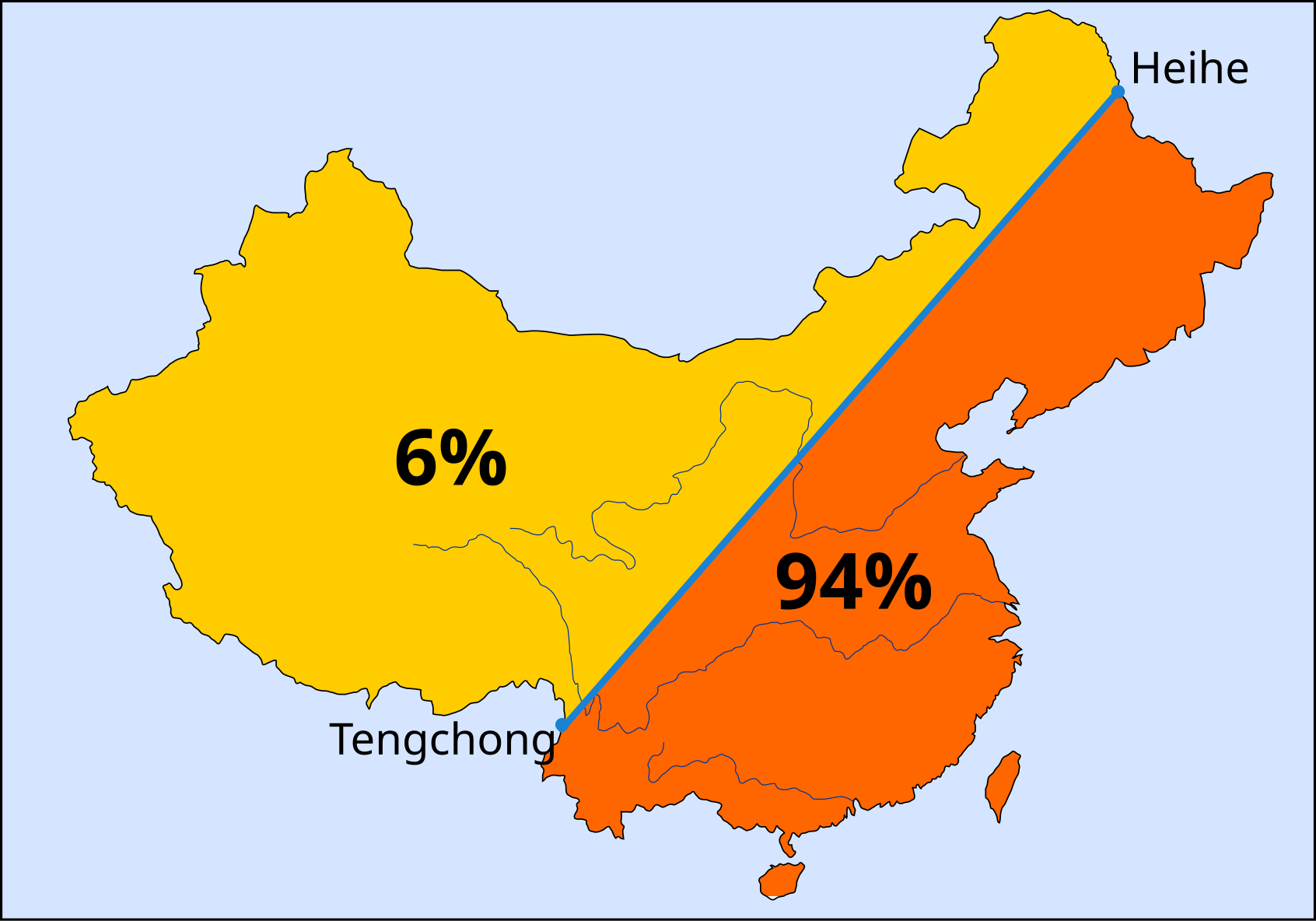
Nederlands: De Heihe-Tengchonlijn verdeelt China in ruwweg 2 gelijke delen. De bevolking ten westen van de lijn bedraagt 6%, ten oosten 94%. |
| Date | |
| Source | Own work |
| Author | Tomaatje12 |
| SVG development |
Licensing edit
I, the copyright holder of this work, hereby publish it under the following license:
| This file is made available under the Creative Commons CC0 1.0 Universal Public Domain Dedication. | |
| The person who associated a work with this deed has dedicated the work to the public domain by waiving all of their rights to the work worldwide under copyright law, including all related and neighboring rights, to the extent allowed by law. You can copy, modify, distribute and perform the work, even for commercial purposes, all without asking permission.
|
File history
Click on a date/time to view the file as it appeared at that time.
| Date/Time | Thumbnail | Dimensions | User | Comment | |
|---|---|---|---|---|---|
| current | 20:29, 12 December 2020 | | 1,692 × 1,184 (77 KB) | Tom Igodt (talk | contribs) | Uploaded own work with UploadWizard |
You cannot overwrite this file.
File usage on Commons
There are no pages that use this file.
File usage on other wikis
The following other wikis use this file:
- Usage on nl.wikipedia.org