File:Henricus Hondius II, Nova totius terrarum orbis geographica ac hydrographica tabula (FL10521679 2718553) (crop1).jpg

Size of this preview: 800 × 561 pixels. Other resolutions: 320 × 224 pixels | 640 × 449 pixels | 1,024 × 718 pixels | 1,280 × 897 pixels | 2,560 × 1,794 pixels | 12,888 × 9,032 pixels.
Original file (12,888 × 9,032 pixels, file size: 87.07 MB, MIME type: image/jpeg)
Captions
Captions
Add a one-line explanation of what this file represents
Summary edit
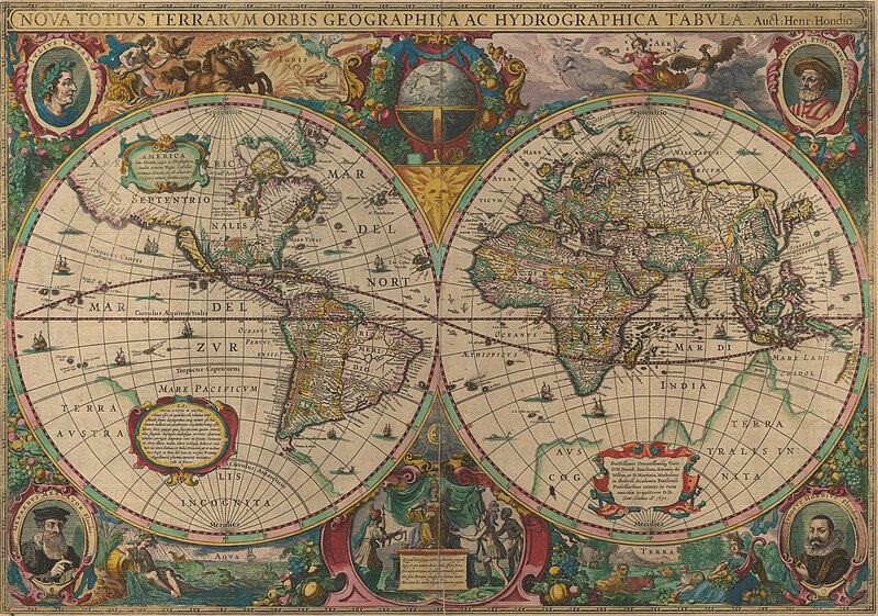
| Jodocus Hondius II: Nova totius terrarum orbis geographica ac hydrographica tabula
|
||||||||||||||||||||||||
|---|---|---|---|---|---|---|---|---|---|---|---|---|---|---|---|---|---|---|---|---|---|---|---|---|
| Artist |
|
_(crop1).jpg) | ||||||||||||||||||||||
| Title |
Nova totius terrarum orbis geographica ac hydrographica tabula |
|||||||||||||||||||||||
| Publisher | ||||||||||||||||||||||||
| Object type |
world map / antique map / manuscript map / double hemisphere world map / early world maps |
|||||||||||||||||||||||
| Genre |
map |
|||||||||||||||||||||||
| Description |
Nova totius terrarum orbis geographica ac hydrographica tabula / Auct Henr Hondio. |
|||||||||||||||||||||||
| Language |
Latin |
|||||||||||||||||||||||
| Publication date |
1630 |
|||||||||||||||||||||||
| Dimensions |
height: 54 cm (21.2 in) |
|||||||||||||||||||||||
| Collection |
|
|||||||||||||||||||||||
| Current location |
|
|||||||||||||||||||||||
| Place of publication |
unknown |
|||||||||||||||||||||||
| Notes | ||||||||||||||||||||||||
| IE PID | IE10521677 | |||||||||||||||||||||||
| Rosetta filename | FL10521695 | |||||||||||||||||||||||
| NNL item ID (P3959) | 990027185530205171 | |||||||||||||||||||||||
| Source/Photographer |
|
|||||||||||||||||||||||
| Other versions | ||||||||||||||||||||||||
| search Merhav catalog | Henricus Hondius II, world map, antique map, manuscript map, unknown, double hemisphere world map, early world maps | |||||||||||||||||||||||

.jpg)
_(crop1A).jpg)

_(crop1).jpg&action=edit§ion=1)
Licensing edit
_(crop1).jpg&action=edit§ion=2)
|
This work is in the public domain in its country of origin and other countries and areas where the copyright term is the author's life plus 100 years or fewer. This work is in the public domain in the United States because it was published (or registered with the U.S. Copyright Office) before January 1, 1929. | |
| This file has been identified as being free of known restrictions under copyright law, including all related and neighboring rights. | |
File history
Click on a date/time to view the file as it appeared at that time.
| Date/Time | Thumbnail | Dimensions | User | Comment | |
|---|---|---|---|---|---|
| current | 11:43, 12 July 2023 | | 12,888 × 9,032 (87.07 MB) | Geagea (talk | contribs) | c:User:Rillke/bigChunkedUpload.js: =={{int:filedesc}}== {{Artwork |artist = {{Creator|wikidata=Q983261}} |author = |title = Nova totius terrarum orbis geographica ac hydrographica tabula |publisher = {{label|1=Q24238356}} |description = Nova totius terrarum orbis geographica ac hydrographica tabula / Auct Henr Hondio. |language = {{Label|1=Q397}} |date = |publication date = 1630 |medium = |dimensions = {{size|cm|38|54}} |institution = {{Institution:National Library of Israe... |
You cannot overwrite this file.
File usage on Commons
The following 16 pages use this file:
- File:America. Henricus Hondius II, Nova totius terrarum orbis geographica ac hydrographica tabula (FL10521679 2718553) (crop1 light) (cropped).jpg
- File:Clavdivs Ptolomævs Ale. Henricus Hondius II, Nova totius terrarum orbis geographica ac hydrographica tabula (FL10521679 2718553) (crop1 light) (cropped).jpg
- File:Henricus Hondius II, Nova totius terrarum orbis geographica ac hydrographica tabula (FL10521679 2718553).jpg
- File:Henricus Hondius II, Nova totius terrarum orbis geographica ac hydrographica tabula (FL10521679 2718553).tif
- File:Henricus Hondius II, Nova totius terrarum orbis geographica ac hydrographica tabula (FL10521679 2718553) (crop1).jpg
- File:Henricus Hondius II, Nova totius terrarum orbis geographica ac hydrographica tabula (FL10521679 2718553) (crop1 light).jpg
- File:Henricus Hondius II, Nova totius terrarum orbis geographica ac hydrographica tabula (FL10521679 2718553) (crop1 light) (cropped2).jpg
- File:Henricus Hondius II, Nova totius terrarum orbis geographica ac hydrographica tabula (FL10521679 2718553) (crop1 light) (cropped3).jpg
- File:Henricus Hondius II, Nova totius terrarum orbis geographica ac hydrographica tabula (FL10521679 2718553) (crop2 light).jpg
- File:Ignis. Henricus Hondius II, Nova totius terrarum orbis geographica ac hydrographica tabula (FL10521679 2718553) (crop1 light) (cropped).jpg
- File:Ivdocvs Hondivs Flander. Henricus Hondius II, Nova totius terrarum orbis geographica ac hydrographica tabula (FL10521679 2718553) (crop1A).jpg
- File:Nova totius Terrarum Orbis geographica ac hydrographica tabula (Hendrik Hondius) balanced.jpg
- File:Nova totius Terrarum Orbis geographica ac hydrographica tabula (Hendrik Hondius) balanced (Japan).jpg
- File:Nova totius terrarum orbis geographica ac hydrographica tabula (8431021048).jpg
- File:Terra. Henricus Hondius II, Nova totius terrarum orbis geographica ac hydrographica tabula (FL10521679 2718553) (crop1 light) (cropped).jpg
- Category:Henricus Hondius II, Nova totius terrarum orbis geographica ac hydrographica tabula, 1630
_(crop1_light)_(cropped).jpg)
_(crop1_light)_(cropped).jpg)
_(crop1_light).jpg)
_(crop1_light)_(cropped2).jpg)
_(crop1_light)_(cropped3).jpg)
_(crop2_light).jpg)
_(crop1_light)_(cropped).jpg)
_balanced.jpg)
_balanced_(Japan).jpg)
.jpg)
_(crop1_light)_(cropped).jpg)
File usage on other wikis
The following other wikis use this file:
- Usage on fr.wikipedia.org
- Usage on he.wikipedia.org
- Usage on www.wikidata.org
_(crop1).jpg&oldid=869437193)