File:Hiiumaa OnEarth WMS.png

Size of this preview: 788 × 600 pixels. Other resolutions: 316 × 240 pixels | 631 × 480 pixels | 1,009 × 768 pixels | 1,280 × 974 pixels | 2,560 × 1,948 pixels.
Original file (2,560 × 1,948 pixels, file size: 5.16 MB, MIME type: image/png)
Captions
Captions
Add a one-line explanation of what this file represents
Summary edit
| Description |
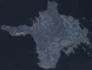
English: Satellite image of Hiiumaa. OnEarth WMS global mosaic visual colour image. |
| Date | 31 January 2007 (upload date) |
| Source | Satellite imagery taken from NASA World Wind software (by screenshot) |
| Author | NASA |
| Object location | | View this and other nearby images on: OpenStreetMap |
|---|
Licensing edit
| This image is in the public domain because it is a screenshot from NASA’s globe software World Wind using a public domain layer, such as Blue Marble, MODIS, Landsat, SRTM, USGS or GLOBE.
|
 |
File history
Click on a date/time to view the file as it appeared at that time.
| Date/Time | Thumbnail | Dimensions | User | Comment | |
|---|---|---|---|---|---|
| current | 19:05, 31 January 2007 | | 2,560 × 1,948 (5.16 MB) | Hautala (talk | contribs) | {{PD-WorldWind}} Satellite image of Hiiumaa. Screenshot from NASA World Wind, OnEarth WMS global mosaic visual colour layer. Coordinates: worldwind://goto/world=Earth&lat=58.88777&lon=22.56207&alt=55607 Category:Hiiu maakond [[Category:Satellite p |
You cannot overwrite this file.
File usage on Commons
There are no pages that use this file.
File usage on other wikis
The following other wikis use this file:
- Usage on de.wikipedia.org
- Usage on pl.wikipedia.org