File:Historic American Buildings Survey (Fed.) Stanley P. Mixon, Photographer July 16, 1940 (C) EXTERIOR, DETAIL OF DOOR AND WINDOW, FRONT OF BUILDING FROM SOUTH WEST. - Town Hall, HABS CONN,8-BROOK,3-3.tif
Size of this JPG preview of this TIF file: 432 × 599 pixels. Other resolutions: 173 × 240 pixels | 346 × 480 pixels | 554 × 768 pixels | 738 × 1,024 pixels | 1,476 × 2,048 pixels | 3,605 × 5,000 pixels.
Original file (3,605 × 5,000 pixels, file size: 17.19 MB, MIME type: image/tiff)
Captions
Captions
Add a one-line explanation of what this file represents
Summary edit
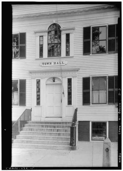
| Historic American Buildings Survey (Fed.) Stanley P. Mixon, Photographer July 16, 1940 (C) EXTERIOR, DETAIL OF DOOR AND WINDOW, FRONT OF BUILDING FROM SOUTH WEST. - Town Hall, Brooklyn, Windham County, CT | ||||
|---|---|---|---|---|
| Title |
Historic American Buildings Survey (Fed.) Stanley P. Mixon, Photographer July 16, 1940 (C) EXTERIOR, DETAIL OF DOOR AND WINDOW, FRONT OF BUILDING FROM SOUTH WEST. - Town Hall, Brooklyn, Windham County, CT |
|||
| Depicted place | Connecticut; Windham County; Brooklyn | |||
| Dimensions | 5 x 7 in. | |||
| Current location |
Library of Congress Prints and Photographs Division Washington, D.C. 20540 USA http://hdl.loc.gov/loc.pnp/pp.print |
|||
| Accession number |
HABS CONN,8-BROOK,3-3 |
|||
| Credit line |
|
|||
| Source | https://www.loc.gov/pictures/item/ct0220.photos.025099p | |||
| Permission (Reusing this file) |
|
|||

| Camera location | | View this and other nearby images on: OpenStreetMap |
|---|
File history
Click on a date/time to view the file as it appeared at that time.
| Date/Time | Thumbnail | Dimensions | User | Comment | |
|---|---|---|---|---|---|
| current | 22:30, 7 July 2014 |  | 3,605 × 5,000 (17.19 MB) | Fæ (talk | contribs) | GWToolset: Creating mediafile for Fæ. HABS 06 July 2014 (611:700) |
You cannot overwrite this file.
File usage on Commons
The following page uses this file: