File:Hoover Dam aerial view.png
Size of this preview: 800 × 571 pixels. Other resolutions: 320 × 229 pixels | 640 × 457 pixels | 1,024 × 731 pixels | 1,280 × 914 pixels | 2,100 × 1,500 pixels.
Original file (2,100 × 1,500 pixels, file size: 6.19 MB, MIME type: image/png)
Captions
Captions
Add a one-line explanation of what this file represents
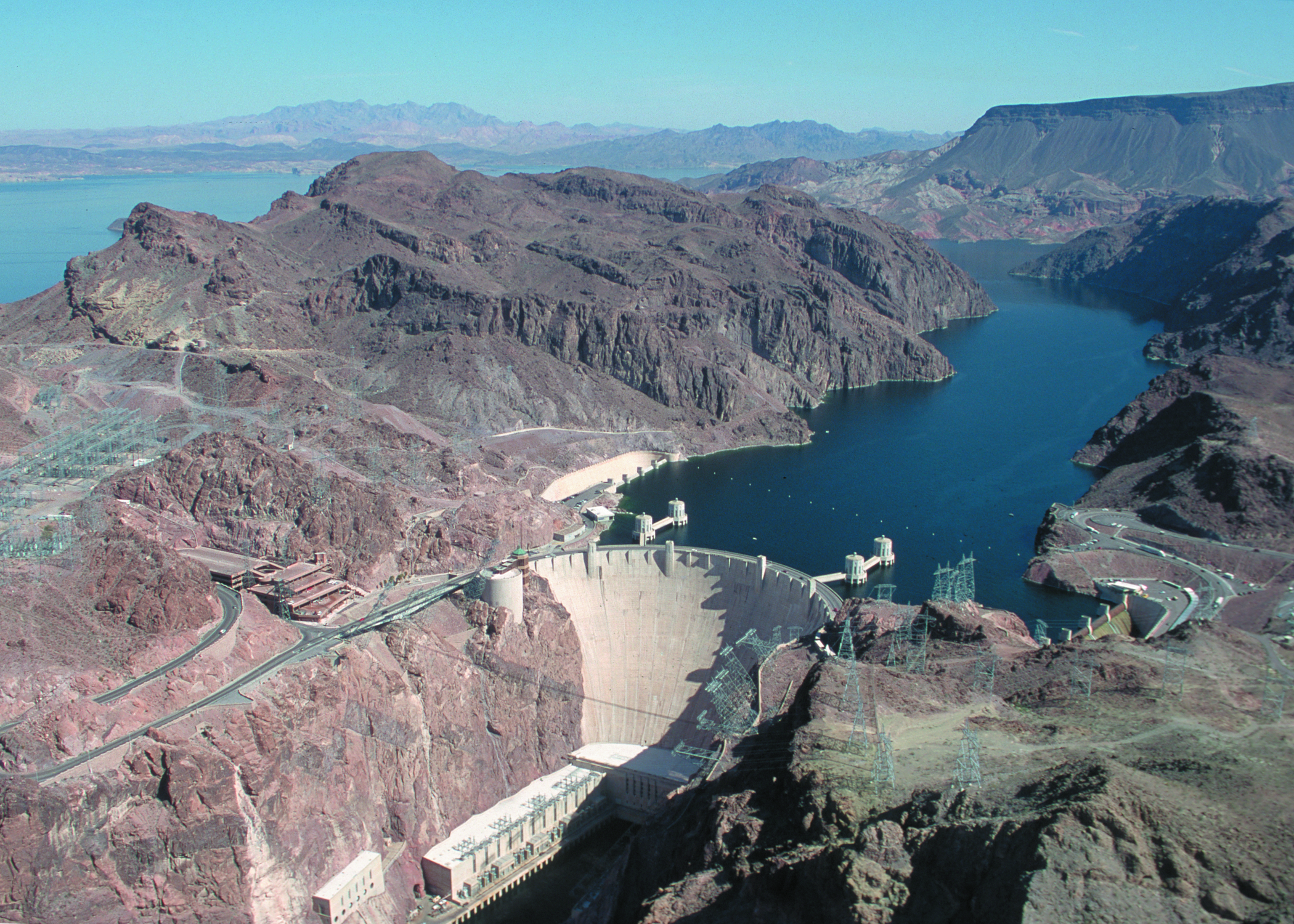
| Description | Hoover Dam from air, Clark County, NV |
| Date | |
| Source | USDA/NRCS |
| Author | Lynn Betts |
| Permission (Reusing this file) |
PD |
| Other versions | http://photogallery.nrcs.usda.gov/JPG/NV/NRCSNV00029.JPG |
| This image is a work of the Natural Resources Conservation Service, part of the United States Department of Agriculture, taken or made as part of an employee's official duties. As a work of the U.S. federal government, the image is in the public domain in the United States. |
File history
Click on a date/time to view the file as it appeared at that time.
| Date/Time | Thumbnail | Dimensions | User | Comment | |
|---|---|---|---|---|---|
| current | 19:35, 29 April 2008 | | 2,100 × 1,500 (6.19 MB) | Zimbres (talk | contribs) | {{Information |Description=Hoover Dam from air, Clark County, NV |Source=USDA/NRCS |Date=2000 |Author=Lynn Betts |Permission=PD |other_versions=http://photogallery.nrcs.usda.gov/JPG/NV/NRCSNV00029.JPG }} {{PD-USGov-USDA-NRCS}} |
You cannot overwrite this file.
File usage on Commons
The following 2 pages use this file:
- Colorado River
- File:NRCSNV00029.png (file redirect)
File usage on other wikis
The following other wikis use this file:
- Usage on ar.wikipedia.org
- Usage on azb.wikipedia.org
- Usage on cs.wikipedia.org
- Usage on es.wikipedia.org