File:Housty bastle - geograph.org.uk - 647091.jpg
No higher resolution available.
Housty_bastle_-_geograph.org.uk_-_647091.jpg (640 × 480 pixels, file size: 103 KB, MIME type: image/jpeg)
Captions
Captions
Add a one-line explanation of what this file represents
Summary edit
| Description |
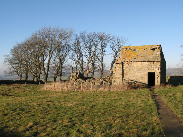
English: Housty bastle 'Housty is a farm on the east side of the East Allen valley. The farmhouse is dated 1736, but to the north of it is an open area, or green, between ranges of earlier houses. On the north side of the green is an 18th or 19th century byre that is built onto the east end of a bastle, which in turn is built on the east gable of an earlier bastle. All that remains of the earliest bastle is the lower part of the east end, the wall being 1.21m thick. An impressive byre doorway stands in the centre of the wall and has a monolithic lintel. The second bastle is also a ruin and has walls 0.85m thick built of massive stones. Other building foundations to the south may also contain remains of bastles.' {Source: "Keys to the Past" website. } |
| Date | |
| Source | From geograph.org.uk |
| Author | Mike Quinn |
| Attribution (required by the license) | Mike Quinn / Housty bastle / |
| Camera location | | View this and other nearby images on: OpenStreetMap |
|---|
_heading:315.00&language=en)
| Object location | | View this and other nearby images on: OpenStreetMap |
|---|
_heading:315.00&language=en)
Licensing edit

|
This image was taken from the Geograph project collection. See this photograph's page on the Geograph website for the photographer's contact details. The copyright on this image is owned by Mike Quinn and is licensed for reuse under the Creative Commons Attribution-ShareAlike 2.0 license.
|
This file is licensed under the Creative Commons Attribution-Share Alike 2.0 Generic license.
Attribution: Mike Quinn
- You are free:
- to share – to copy, distribute and transmit the work
- to remix – to adapt the work
- Under the following conditions:
- attribution – You must give appropriate credit, provide a link to the license, and indicate if changes were made. You may do so in any reasonable manner, but not in any way that suggests the licensor endorses you or your use.
- share alike – If you remix, transform, or build upon the material, you must distribute your contributions under the same or compatible license as the original.
File history
Click on a date/time to view the file as it appeared at that time.
| Date/Time | Thumbnail | Dimensions | User | Comment | |
|---|---|---|---|---|---|
| current | 12:56, 7 February 2011 | | 640 × 480 (103 KB) | GeographBot (talk | contribs) | == {{int:filedesc}} == {{Information |description={{en|1=Housty bastle 'Housty is a farm on the east side of the East Allen valley. The farmhouse is dated 1736, but to the north of it is an open area, or green, between ranges of earlier houses. On the nor |
You cannot overwrite this file.
File usage on Commons
There are no pages that use this file.