File:Hoya de Málaga.png
No higher resolution available.
Hoya_de_Málaga.png (118 × 117 pixels, file size: 28 KB, MIME type: image/png)
Captions
Captions
Add a one-line explanation of what this file represents
| Description |
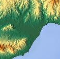
Español: Mapa topográfico del Valle del Guadalhorce |
||||||||
| Date | |||||||||
| Source | www.maps-for-free.com | ||||||||
| Author | Té y kriptonita | ||||||||
| Permission (Reusing this file) |
|
||||||||
| Other versions |


File history
Click on a date/time to view the file as it appeared at that time.
| Date/Time | Thumbnail | Dimensions | User | Comment | |
|---|---|---|---|---|---|
| current | 08:15, 10 July 2023 | | 118 × 117 (28 KB) | Cesnaro89 (talk | contribs) | File:Valle del Guadalhorce.png cropped 61 % horizontally, 53 % vertically using CropTool with lossless mode. |
You cannot overwrite this file.
File usage on Commons
The following page uses this file: