File:Huahine topographic map - with communes associées.svg

Size of this PNG preview of this SVG file: 516 × 600 pixels. Other resolutions: 206 × 240 pixels | 413 × 480 pixels | 661 × 768 pixels | 881 × 1,024 pixels | 1,762 × 2,048 pixels | 714 × 830 pixels.
Original file (SVG file, nominally 714 × 830 pixels, file size: 332 KB)
Captions
Captions
Add a one-line explanation of what this file represents
Summary edit
| Description |
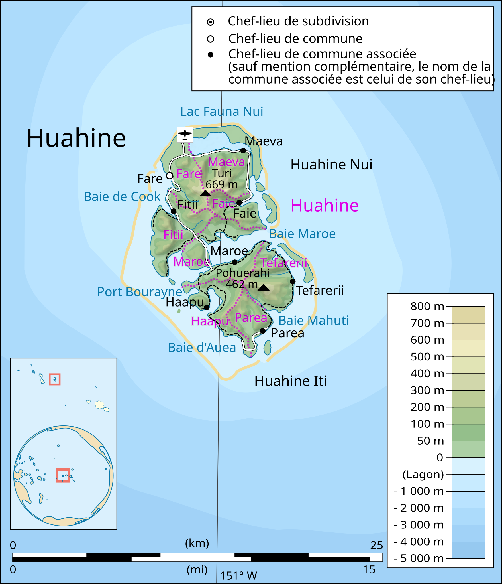
English: Topographic map in French of the island of Huahine, Society Islands, French Polynesia.
Français : Carte topographique en français de l'île de Huahine, îles de la Société, Polynésie Française. |
| Date | |
| Source |
Œuvre personnelle.
Données :
Logiciels utilisés :
Autres informations :
|
| Author | Sardon, derivative work of the original work by Maximilian Dörrbecker (Chumwa) |
| Other versions | Macedonian |
Licensing edit
| I, the copyright holder of this work, release this work into the public domain. This applies worldwide. In some countries this may not be legally possible; if so: I grant anyone the right to use this work for any purpose, without any conditions, unless such conditions are required by law. |
File history
Click on a date/time to view the file as it appeared at that time.
| Date/Time | Thumbnail | Dimensions | User | Comment | |
|---|---|---|---|---|---|
| current | 06:22, 12 May 2015 | | 714 × 830 (332 KB) | Chumwa (talk | contribs) | == {{int:filedesc}} == {{Information |Description={{en|1=Topographic map in French of the island of Huahine, Society Islands, French Polynesia.}} {{fr|1=Carte topographique en français de l'île de Huahine, îles de la... |
You cannot overwrite this file.
File usage on Commons
The following page uses this file:
File usage on other wikis
The following other wikis use this file:
- Usage on de.wikipedia.org
- Usage on es.wikipedia.org