File:Hubackertobel.jpg

Size of this preview: 800 × 600 pixels. Other resolutions: 320 × 240 pixels | 640 × 480 pixels | 1,024 × 768 pixels | 1,280 × 960 pixels | 2,560 × 1,920 pixels | 2,816 × 2,112 pixels.
Original file (2,816 × 2,112 pixels, file size: 2.49 MB, MIME type: image/jpeg)
Captions
Captions
Add a one-line explanation of what this file represents
Summary edit
| Description |
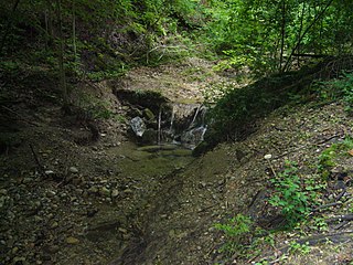
Deutsch: Wasserfall im Hubackertobel (Name auf der Siegfriedkarte. Heute fliesst dort der Jungholztobelbach - Name des Steigbach auf Gemeindegebiet von Brütten) zwischen Brütten und Winterthur. |
| Date | |
| Source | Own work |
| Author | Abderitestatos |
| Camera location | | View this and other nearby images on: OpenStreetMap |
|---|
Licensing edit
I, the copyright holder of this work, hereby publish it under the following license:
This file is licensed under the Creative Commons Attribution 3.0 Unported license.
- You are free:
- to share – to copy, distribute and transmit the work
- to remix – to adapt the work
- Under the following conditions:
- attribution – You must give appropriate credit, provide a link to the license, and indicate if changes were made. You may do so in any reasonable manner, but not in any way that suggests the licensor endorses you or your use.
File history
Click on a date/time to view the file as it appeared at that time.
| Date/Time | Thumbnail | Dimensions | User | Comment | |
|---|---|---|---|---|---|
| current | 16:55, 24 June 2008 | | 2,816 × 2,112 (2.49 MB) | Abderitestatos (talk | contribs) | {{Information |Description={{de|1=Wasserfall im Hubackertobel zwischen Brütten und Winterthur.}} |Source=Own work by uploader |Author=Abderitestatos |Date=18. Juni 2008 |Permission= |other_versions= }} {{Location|47|28|25.334|N|8| |
You cannot overwrite this file.
File usage on Commons
The following page uses this file:
File usage on other wikis
The following other wikis use this file:
- Usage on da.wikipedia.org
- Usage on de.wikipedia.org
- Usage on en.wikipedia.org
- Usage on www.wikidata.org
- Usage on zh.wikipedia.org