File:Hudson River from Waryas Park in Poughkeepsie, NY 2.JPG
Size of this preview: 800 × 536 pixels. Other resolutions: 320 × 214 pixels | 640 × 428 pixels | 1,024 × 685 pixels | 1,280 × 857 pixels | 2,560 × 1,714 pixels | 3,872 × 2,592 pixels.
Original file (3,872 × 2,592 pixels, file size: 3.59 MB, MIME type: image/jpeg)
Captions
Captions
Add a one-line explanation of what this file represents
| Description |
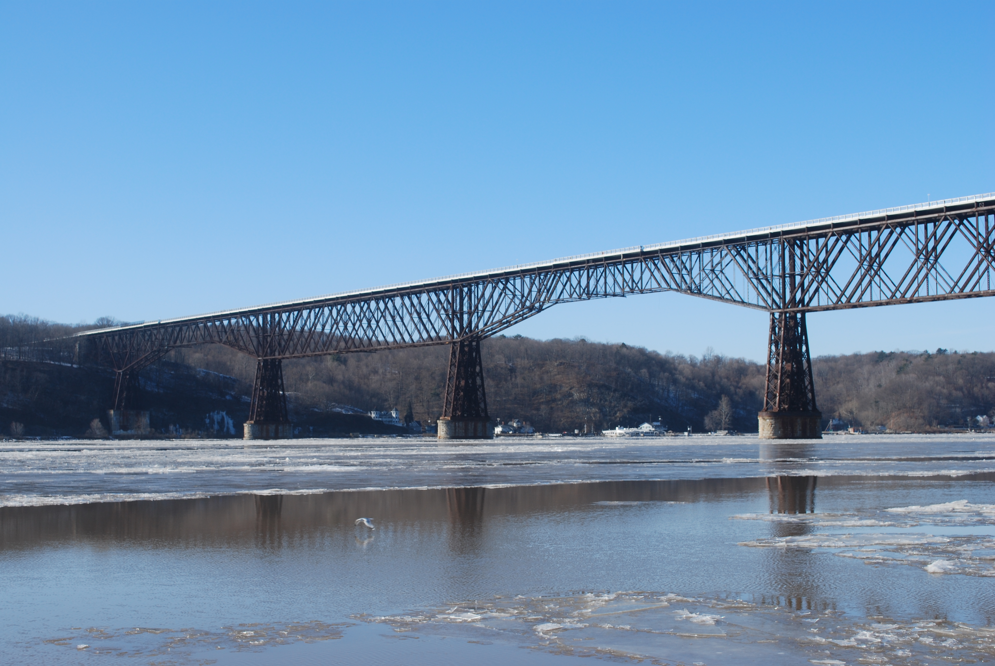
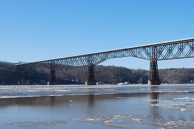
English: A view of the Hudson River, including the Poughkeepsie Railroad Bridge, from Waryas Park in Poughkeepsie, New York. |
||
| Date | |||
| Source | Own work | ||
| Author | Juliancolton | ||
| Permission (Reusing this file) |
|
File history
Click on a date/time to view the file as it appeared at that time.
| Date/Time | Thumbnail | Dimensions | User | Comment | |
|---|---|---|---|---|---|
| current | 21:09, 31 January 2010 | | 3,872 × 2,592 (3.59 MB) | Juliancolton (talk | contribs) | {{Information |Description={{en|1=A view of the Hudson River, including the {{w|Poughkeepsie Railroad Bridge}}, from Waryas Park in Poughkeepsie, New York. }} |Source={{own}} |Author=Juliancolton |Date=2010-01-31 |Permission={{PD-sel |
You cannot overwrite this file.
File usage on Commons
The following 2 pages use this file:
File usage on other wikis
The following other wikis use this file:
- Usage on en.wikipedia.org
- East Coast Greenway
- High Line
- Walkway over the Hudson
- Rutland Trail
- Genesee Valley Greenway
- North County Trailway
- Wallkill Valley Rail Trail
- Catskill Scenic Trail
- South County Trailway
- List of rail trails in New York
- Oswego Recreational Trail
- Mount Beacon Incline Railway
- Dutchess Rail Trail
- Harlem Valley Rail Trail
- Category:Rail trails in New York (state)
- Cato–Fair Haven Trail
- Cayuga Hojack Trail
- Webster Hojack Trail
- Putnam County Trailway
- Orange Heritage Trailway
- Mohawk-Hudson Bike-Hike Trail
- Dunderberg Mountain
- Walden–Wallkill Rail Trail
- Ontario Pathways Rail Trail
- Template:Rail trails in New York
- Hudson Valley Rail Trail
- Rosendale Trestle
- Allegheny River Valley Trail
- Auburn Trail
- Pat McGee Trail
- Empire State Trail
- Old Erie Path
- Raymond G. Esposito Trail
- Joseph B. Clarke Rail Trail
- Usage on es.wikipedia.org
- Usage on fy.wikipedia.org
- Usage on simple.wikipedia.org