File:Hunga Tonga eruption January 2015.jpg
Size of this preview: 450 × 600 pixels. Other resolutions: 180 × 240 pixels | 600 × 800 pixels.
Original file (600 × 800 pixels, file size: 60 KB, MIME type: image/jpeg)
Captions
Captions
Add a one-line explanation of what this file represents
Summary edit
| Description |
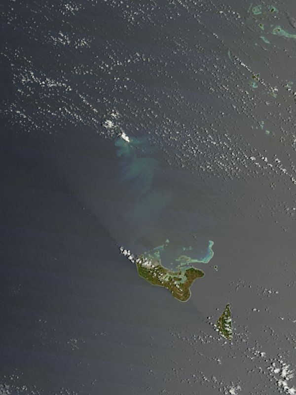
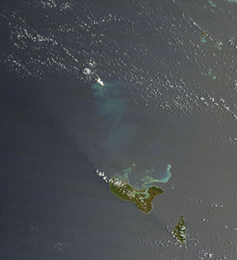
English: True-color image taken by the Moderate Resolution Imaging Spectroradiometer (MODIS) on NASA’s Terra satellite on December 29, 2014, showing a white plume rising over the undersea volcano Hunga Ha’apai, near Hunga Tonga in the South Pacific. Discolored water suggests an underwater release of gases and rock by the eruption. |
| Date | |
| Source | http://modis.gsfc.nasa.gov/gallery/images/image01092015_md.jpg |
| Author | NASA |
Licensing edit
| This file is in the public domain in the United States because it was solely created by NASA. NASA copyright policy states that "NASA material is not protected by copyright unless noted". (See Template:PD-USGov, NASA copyright policy page or JPL Image Use Policy.) | ||
 |
Warnings:
|
File history
Click on a date/time to view the file as it appeared at that time.
| Date/Time | Thumbnail | Dimensions | User | Comment | |
|---|---|---|---|---|---|
| current | 17:05, 12 December 2017 | | 600 × 800 (60 KB) | Szczureq (talk | contribs) | full size |
| 05:23, 10 January 2015 |  | 337 × 370 (22 KB) | Tim1965 (talk | contribs) | User created page with UploadWizard |
You cannot overwrite this file.
File usage on Commons
There are no pages that use this file.
File usage on other wikis
The following other wikis use this file:
- Usage on ceb.wikipedia.org
- Usage on uk.wikipedia.org