File:Huon Peninsula and the Straits.png

Size of this preview: 800 × 406 pixels. Other resolutions: 320 × 162 pixels | 640 × 325 pixels | 1,024 × 520 pixels | 1,280 × 650 pixels | 2,500 × 1,269 pixels.
Original file (2,500 × 1,269 pixels, file size: 1.48 MB, MIME type: image/png)
Captions
Captions
Add a one-line explanation of what this file represents
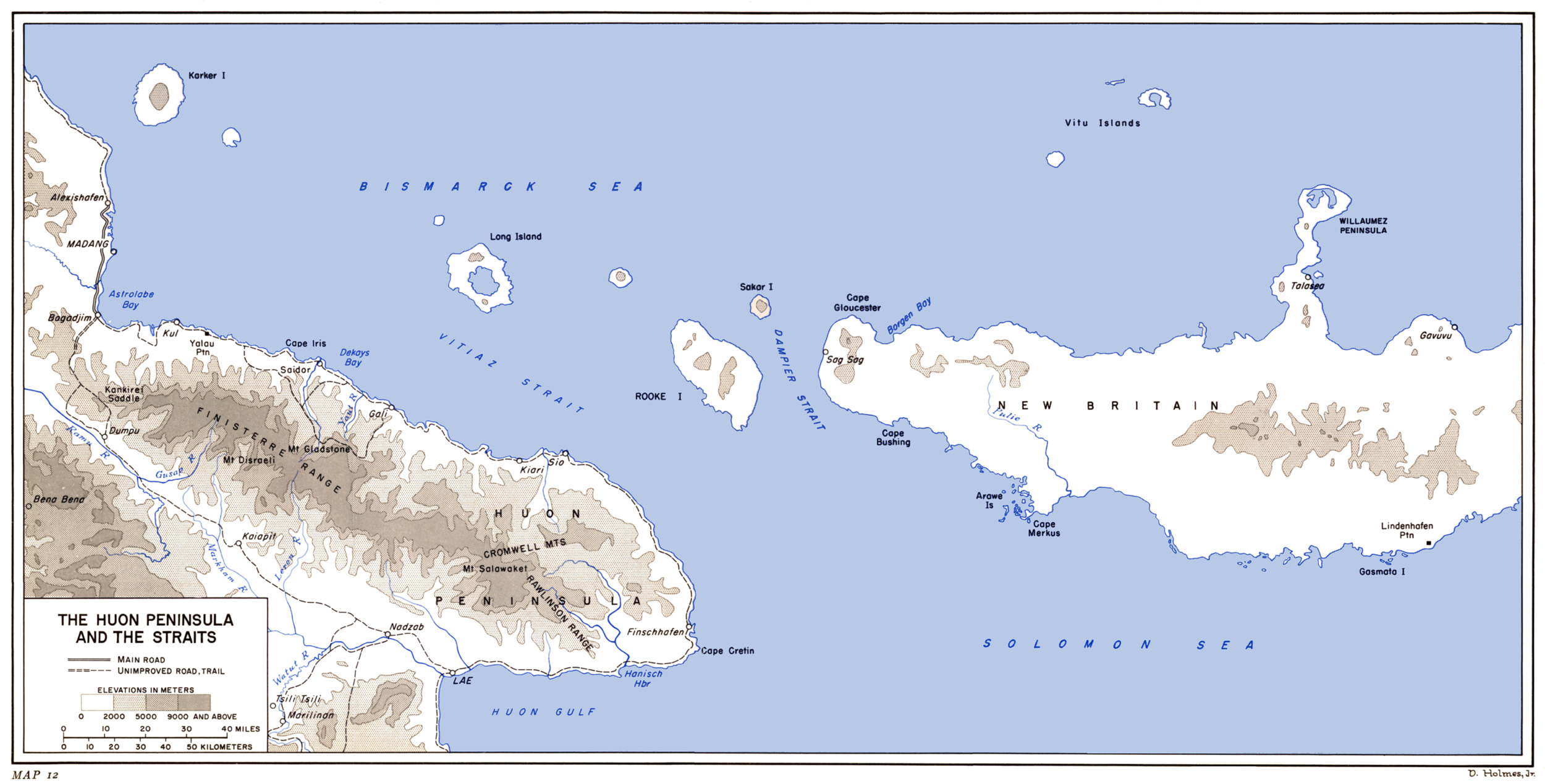
- Description: Huon Peninsula and the Straits - New Guinea
- Source: selfmade Map User:W.wolny based upon PD-Map ibiblio-source: http://www.ibiblio.org/hyperwar/USA/USA-P-Rabaul/maps/USA-P-Rabaul-12.jpg
- Licence: GNU/FDL

|
Permission is granted to copy, distribute and/or modify this document under the terms of the GNU Free Documentation License, Version 1.2 or any later version published by the Free Software Foundation; with no Invariant Sections, no Front-Cover Texts, and no Back-Cover Texts. A copy of the license is included in the section entitled GNU Free Documentation License. |
| This file is licensed under the Creative Commons Attribution-Share Alike 3.0 Unported license. | ||
| ||
| This licensing tag was added to this file as part of the GFDL licensing update. |
File history
Click on a date/time to view the file as it appeared at that time.
| Date/Time | Thumbnail | Dimensions | User | Comment | |
|---|---|---|---|---|---|
| current | 09:03, 14 August 2006 | | 2,500 × 1,269 (1.48 MB) | W.wolny (talk | contribs) |
You cannot overwrite this file.
File usage on Commons
The following page uses this file: