File:Hurricane Irene full earth view NASA.jpg
Size of this preview: 600 × 600 pixels. Other resolutions: 240 × 240 pixels | 480 × 480 pixels | 768 × 768 pixels | 1,024 × 1,024 pixels | 2,048 × 2,048 pixels | 3,072 × 3,072 pixels.
Original file (3,072 × 3,072 pixels, file size: 1.31 MB, MIME type: image/jpeg)
Captions
Captions
Add a one-line explanation of what this file represents
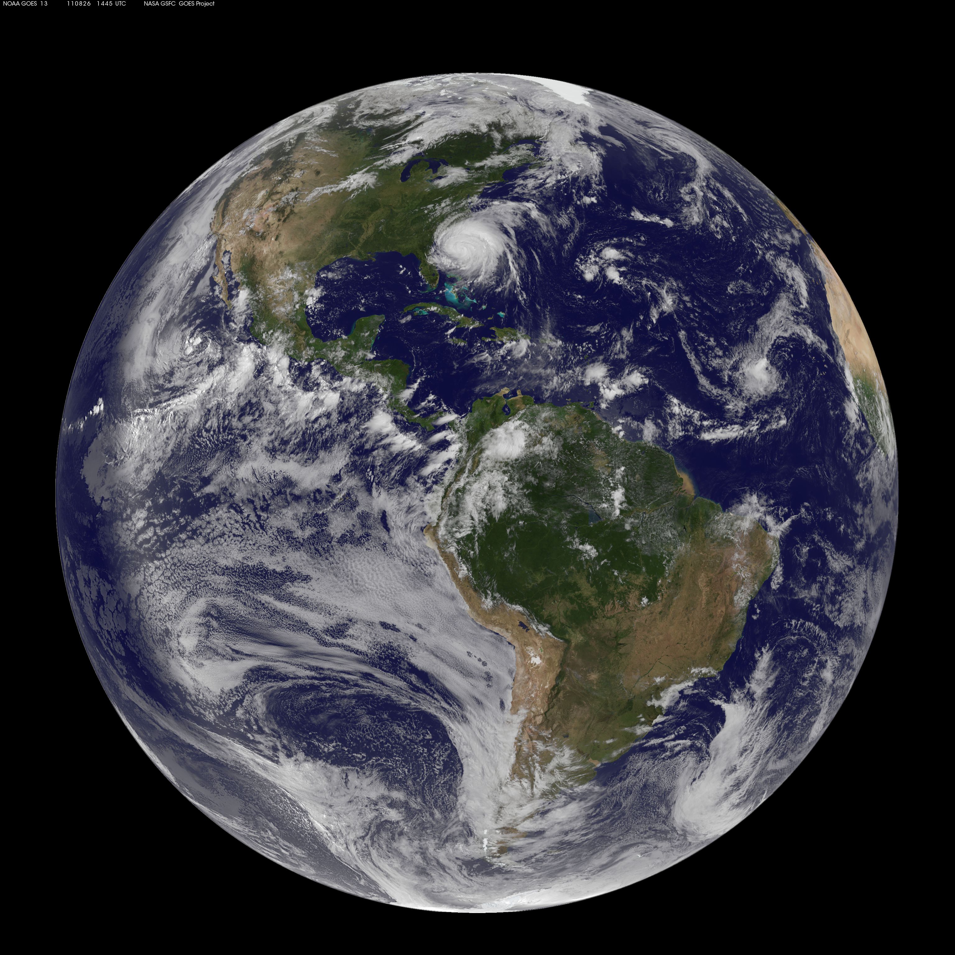
| Description | NASA / NOAA GOES-13 satellite image showing Earth on August 26, 2011 at 14:45 UTC (10:45 a.m. EDT). Hurricane Irene can been seen on the U.S. East Coast, about 510 miles across at the time. | |||||
| Date | ||||||
| Source | http://mashable.com/2011/08/26/hurricane-irene-from-space/ (direct image URL [1]) | |||||
| Author | NOAA/NASA GOES Project | |||||
| Permission (Reusing this file) |
|
|||||
| Other versions | https://www.flickr.com/photos/gsfc/6083128930 |

![[1]](http://7.mshcdn.com/wp-content/uploads/2011/08/Irene-huge.jpg)
| Annotations | This image is annotated: View the annotations at Commons |
File history
Click on a date/time to view the file as it appeared at that time.
| Date/Time | Thumbnail | Dimensions | User | Comment | |
|---|---|---|---|---|---|
| current | 05:53, 14 September 2011 | | 3,072 × 3,072 (1.31 MB) | Clindberg (talk | contribs) | {{Information |Description= NASA / NOAA GOES-13 satellite image showing Earth on August 26, 2011 at 14:45 UTC (10:45 a.m. EDT). w:Hurricane Irene (2011) can been seen on the U.S. East Coast, about 510 miles across at the time. |Source=http://mashable |
You cannot overwrite this file.
File usage on Commons
The following page uses this file: