File:Isabel 2003-09-17 1509Z.jpg
(Redirected from File:Hurricane Isabel 17 sept 2003 1509Z.jpg)

Size of this preview: 463 × 599 pixels. Other resolutions: 185 × 240 pixels | 371 × 480 pixels | 593 × 768 pixels | 791 × 1,024 pixels | 1,582 × 2,048 pixels | 6,800 × 8,800 pixels.
Original file (6,800 × 8,800 pixels, file size: 8.49 MB, MIME type: image/jpeg)
Captions
Captions
Add a one-line explanation of what this file represents
| Warning | The original file is very high-resolution. It might not load properly or could cause your browser to freeze when opened at full size. |
|---|
Summary edit
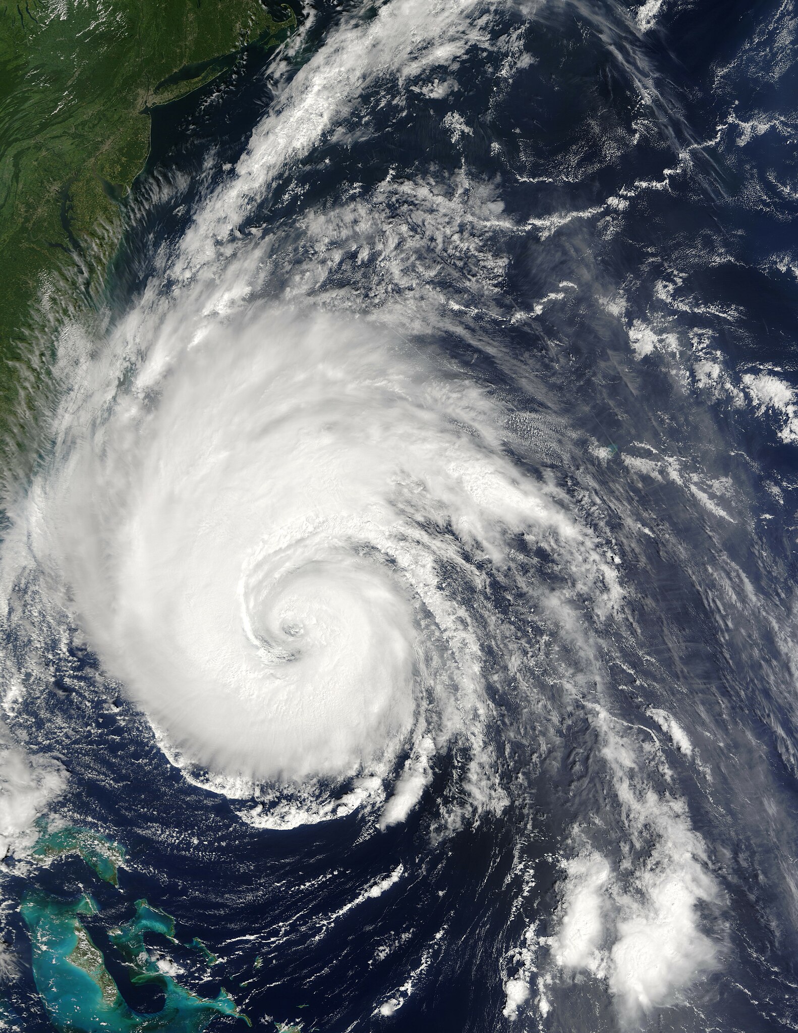
| Description | Hurricane Isabel creeps closer to the US east coast in this true-color Moderate Resolution Imaging Spectroradiometer (MODIS) image taken by the Terra satellite on September 17, 2003 at 11:09 am, US Eastern time. Though downgraded to a powerful Category 2 hurricane, Isabel was packing sustained winds of 110 miles per hour. The storm is about 400 miles south-southeast of Cape Hatteras, North Carolina, in this image. | |||||
| Date | ||||||
| Source | http://visibleearth.nasa.gov/view_rec.php?id=5866 | |||||
| Author | Jacques Descloitres, MODIS Rapid Response Team, NASA/GSFC | |||||
| Permission (Reusing this file) |
|

File history
Click on a date/time to view the file as it appeared at that time.
| Date/Time | Thumbnail | Dimensions | User | Comment | |
|---|---|---|---|---|---|
| current | 18:03, 9 November 2006 | | 6,800 × 8,800 (8.49 MB) | Good kitty (talk | contribs) | == Summary == {{Information |Description=Hurricane Isabel creeps closer to the US east coast in this true-color Moderate Resolution Imaging Spectroradiometer (MODIS) image taken by the Terra satellite on September 17, 2003 at 11:09 am, US Eastern time. Th |
You cannot overwrite this file.
File usage on Commons
The following 3 pages use this file: