File:Hydrologic unit map-1974, States of Maryland and Delaware. LOC 76695070.tif

Size of this JPG preview of this TIF file: 800 × 511 pixels. Other resolutions: 320 × 204 pixels | 640 × 409 pixels | 1,024 × 654 pixels | 1,280 × 817 pixels | 2,560 × 1,635 pixels | 10,692 × 6,828 pixels.
Original file (10,692 × 6,828 pixels, file size: 208.87 MB, MIME type: image/tiff)
Captions
Captions
Add a one-line explanation of what this file represents
Summary edit
| Description |
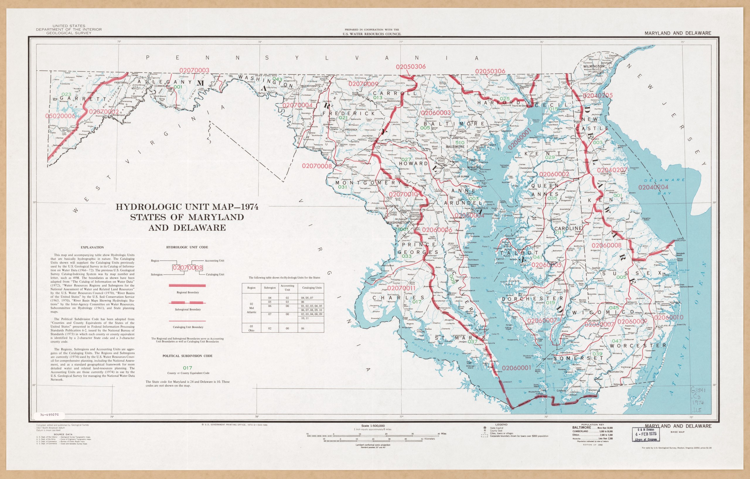
English: Scale 1:500,000; 1 in. equals approx. 8 miles. Relief shown by spot heights. "Lambert conformal conic projection, standard parallels 33⁰ and 45⁰." Base map "Edition of 1950." Includes text and table of hydrologic units. Available also through the Library of Congress Web site as a raster image. AACR2 |
||
| Title | Hydrologic unit map--1974, States of Maryland and Delaware. | ||
| Shelf ID | G3841.C3 1974 .U5 | ||
| Date | |||
| Source | https://www.loc.gov/item/76695070/ | ||
| Author | Geological Survey (U.S.); Water Resources Council (U.S.) | ||
| Permission (Reusing this file) |
|
||
| Other versions |
|
||
| Location | United States · Maryland. · Maryland · Delaware · Delaware. | ||
| Part of | American Memory · General Maps · Catalog · Geography And Map Division · Additional Conservation And Environment Cartographic Items | ||
| Subject | United States · Maps · Maryland · Delaware · Hydrology |


Licensing edit
| This work is from the Library of Congress. According to the library, there are no known copyright restrictions on the use of this work. |  |
File history
Click on a date/time to view the file as it appeared at that time.
| Date/Time | Thumbnail | Dimensions | User | Comment | |
|---|---|---|---|---|---|
| current | 20:50, 24 May 2018 |  | 10,692 × 6,828 (208.87 MB) | Fæ (talk | contribs) | LOC Maps https://www.loc.gov/item/76695070/ #14439 |
You cannot overwrite this file.
File usage on Commons
The following page uses this file: