File:Hydrologic unit map-1988, states of Massachusetts, Rhode Island, and Connecticut LOC 89693472.jpg

Size of this preview: 800 × 471 pixels. Other resolutions: 320 × 189 pixels | 640 × 377 pixels | 1,024 × 603 pixels | 1,280 × 754 pixels | 2,560 × 1,508 pixels | 11,593 × 6,830 pixels.
Original file (11,593 × 6,830 pixels, file size: 10.75 MB, MIME type: image/jpeg)
Captions
Captions
Add a one-line explanation of what this file represents
Summary edit
| Warning | The original file is very high-resolution. It might not load properly or could cause your browser to freeze when opened at full size. |
|---|
| Description |
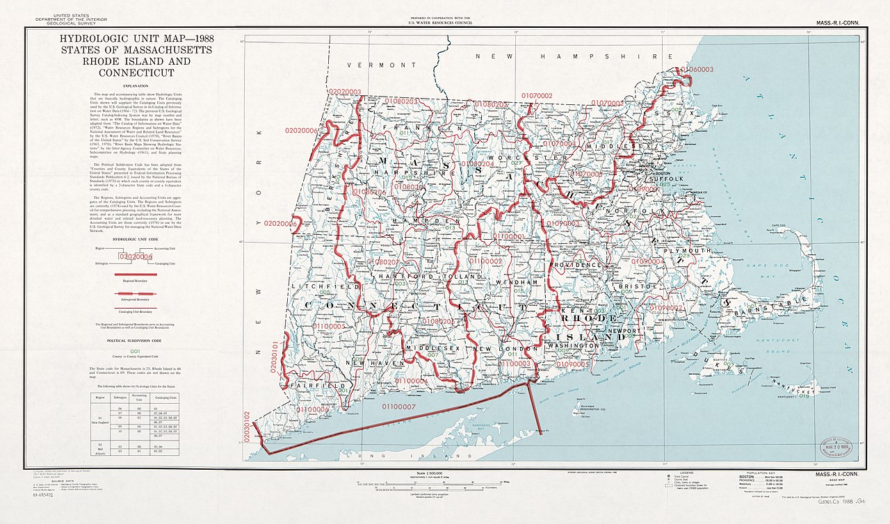
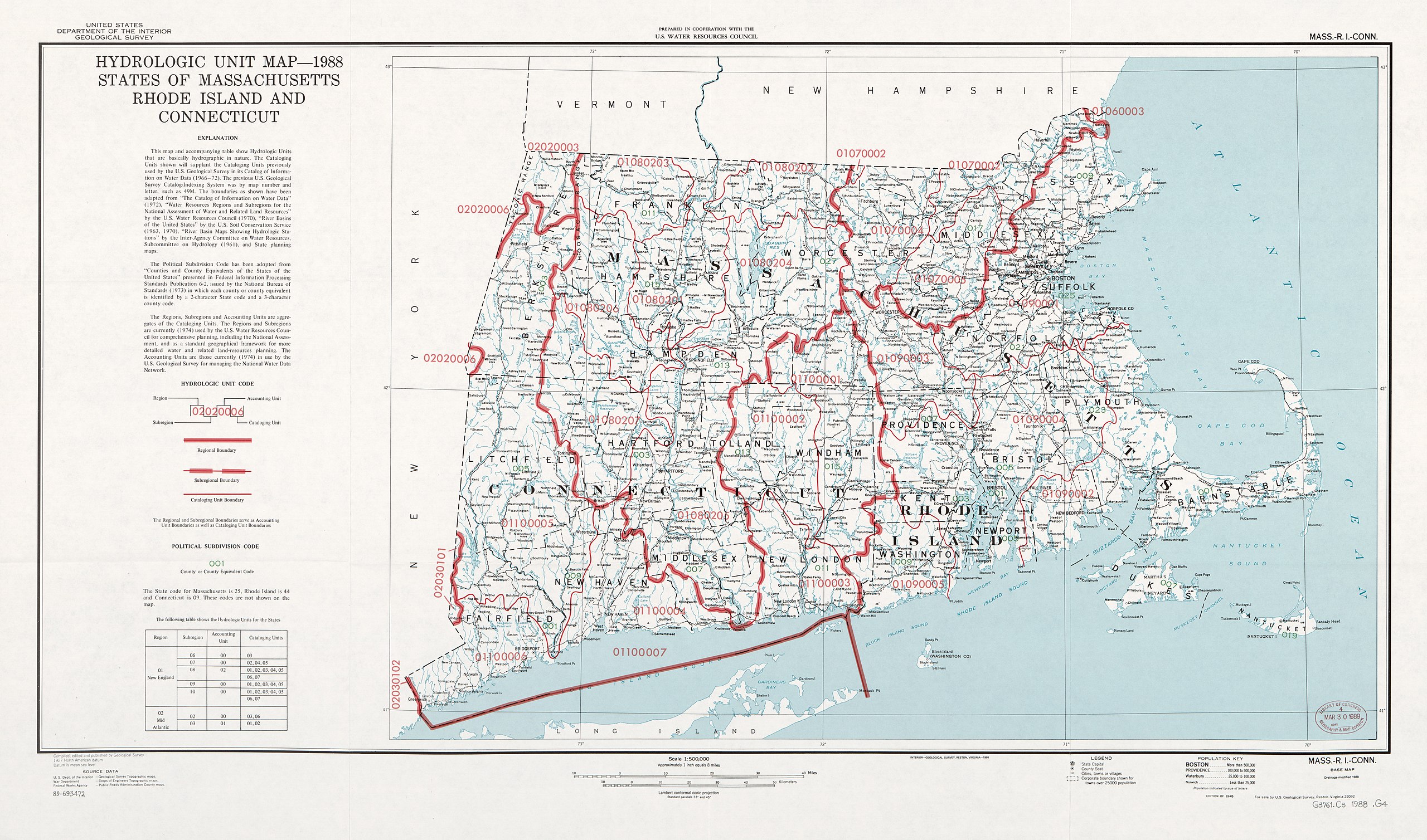
English: Shows hydrologic units and codes, planning districts, and watersheds. Relief shown by spot heights. Base map: Mass.-R.I.-Conn., base map. Drainage modified 1988. Edition of 1948. Base map title in right upper margin: Mass.-R.I.-Conn. Includes text and table of codes. Available also through the Library of Congress Web site as a raster image. |
||
| Title | Hydrologic unit map--1988, states of Massachusetts, Rhode Island, and Connecticut | ||
| Shelf ID | G3761.C3 1988 .G4 | ||
| Date | |||
| Source | https://www.loc.gov/item/89693472/ | ||
| Author | Geological Survey (U.S.); Water Resources Council (U.S.) | ||
| Permission (Reusing this file) |
|
||
| Other versions |
|
||
| Location | United States · Connecticut · Massachusetts · Rhode Island | ||
| Part of | American Memory · Catalog · Geography And Map Division · Additional Conservation And Environment Cartographic Items | ||
| Subject | Watershed Hydrology · Rhode Island · United States · Maps · Connecticut · Regional Planning Districts · Massachusetts |


Licensing edit
This work is in the public domain in the United States because it is a work prepared by an officer or employee of the United States Government as part of that person’s official duties under the terms of Title 17, Chapter 1, Section 105 of the US Code.
Note: This only applies to original works of the Federal Government and not to the work of any individual U.S. state, territory, commonwealth, county, municipality, or any other subdivision. This template also does not apply to postage stamp designs published by the United States Postal Service since 1978. (See § 313.6(C)(1) of Compendium of U.S. Copyright Office Practices). It also does not apply to certain US coins; see The US Mint Terms of Use.
|
 | |
| This file has been identified as being free of known restrictions under copyright law, including all related and neighboring rights. | ||
File history
Click on a date/time to view the file as it appeared at that time.
| Date/Time | Thumbnail | Dimensions | User | Comment | |
|---|---|---|---|---|---|
| current | 17:50, 8 September 2018 | | 11,593 × 6,830 (10.75 MB) | Fæ (talk | contribs) | LOC Maps https://www.loc.gov/item/89693472/ #16818 |
You cannot overwrite this file.
File usage on Commons
The following page uses this file: