File:I-15 at 600 North SPUI.jpg
Size of this preview: 750 × 600 pixels. Other resolutions: 300 × 240 pixels | 600 × 480 pixels | 1,000 × 800 pixels.
Original file (1,000 × 800 pixels, file size: 213 KB, MIME type: image/jpeg)
Captions
Captions
Add a one-line explanation of what this file represents
Summary edit
| Description |
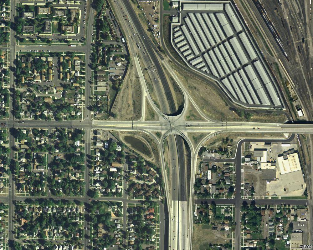
English: Aerial image of the Single point urban interchange at 600 North along Interstate 15 in Utah in Salt Lake City, Utah. |
|||
| Date | ||||
| Source | MSR Maps (September 18, 2003). "Salt Lake City, Utah, United States" (Map). Cartography by U.S. Geological Survey. | |||
| Author | United States Geological Survey (USGS) | |||
| Permission (Reusing this file) |
|
| Object location | | View this and other nearby images on: OpenStreetMap |
|---|
File history
Click on a date/time to view the file as it appeared at that time.
| Date/Time | Thumbnail | Dimensions | User | Comment | |
|---|---|---|---|---|---|
| current | 17:53, 5 February 2014 | | 1,000 × 800 (213 KB) | Admrboltz (talk | contribs) | == {{int:filedesc}} == {{Information | Description = {{en|1=Aerial image of the w:Single point urban interchange at 600 North along w:Interstate 15 in Utah in w:Salt Lake City, w:Utah.}} | Source = MSR Maps (Sept... |
You cannot overwrite this file.
File usage on Commons
There are no pages that use this file.