File:I-90-(WI)-map.png
Size of this preview: 800 × 474 pixels. Other resolutions: 320 × 190 pixels | 640 × 379 pixels | 906 × 537 pixels.
Original file (906 × 537 pixels, file size: 88 KB, MIME type: image/png)
Captions
Captions
Add a one-line explanation of what this file represents
Summary edit
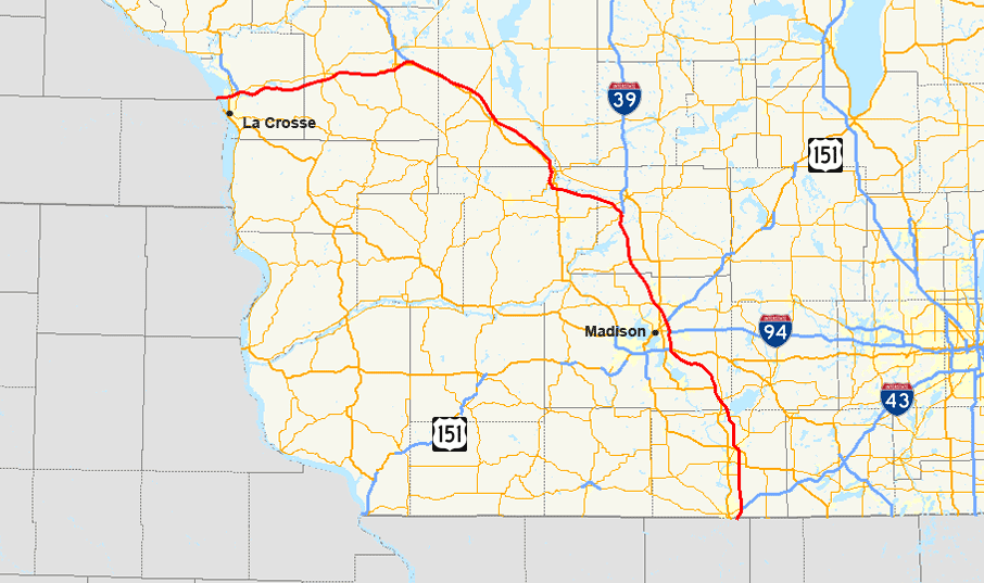
| Description |
English: Map of Interstate 90 in Wisconsin |
| Date | |
| Source | Own work (Highway information: National Highway Planning Network Data; Geographic information: TIGER Data Shapefiles) |
| Author | User: Master son |
Licensing edit
|


-map.png&action=edit§ion=1)
-map.png&action=edit§ion=2)
File history
Click on a date/time to view the file as it appeared at that time.
| Date/Time | Thumbnail | Dimensions | User | Comment | |
|---|---|---|---|---|---|
| current | 01:40, 16 January 2009 | | 906 × 537 (88 KB) | Master son (talk | contribs) | == Summary == {{Information |Description={{en|1=Map of w:Interstate 90 in Wisconsin}} |Source=Own work (Highway information: [http://www.fhwa.dot.gov/planning/nhpn/ National Highway Planning Network Data]; Geographic information: [http://www.esri.co |
You cannot overwrite this file.
File usage on Commons
The following page uses this file:
File usage on other wikis
The following other wikis use this file:
- Usage on www.wikidata.org
-map.png&oldid=452037850)