File:IANR North Local, Manly, Iowa - Flickr - chief huddleston.jpg

Size of this preview: 800 × 533 pixels. Other resolutions: 320 × 213 pixels | 640 × 427 pixels | 1,024 × 683 pixels | 1,280 × 853 pixels | 2,560 × 1,707 pixels | 6,067 × 4,045 pixels.
Original file (6,067 × 4,045 pixels, file size: 14.71 MB, MIME type: image/jpeg)
Captions
Captions
Add a one-line explanation of what this file represents
Summary edit
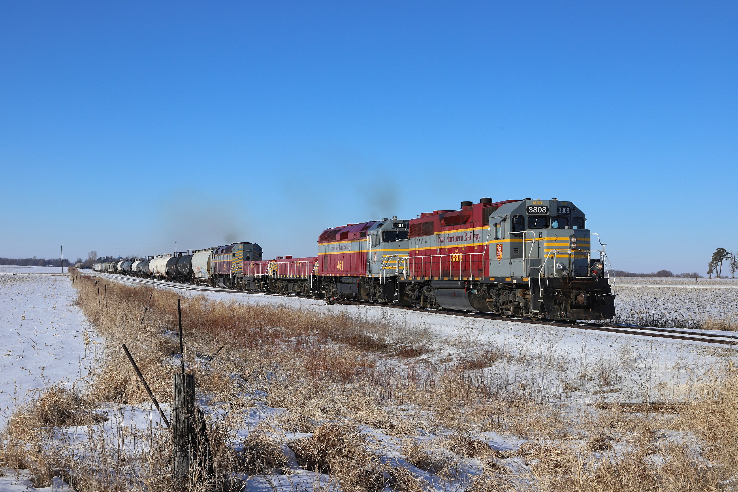
| Description | Iowa Northern's north local gets underway at Manly on a cold January afternoon. |
| Date | Taken on 28 January 2021, 15:32 |
| Source | IANR North Local, Manly, Iowa |
| Author | Jerry Huddleston from Hampton, Minnesota, US |
| Camera location | | View this and other nearby images on: OpenStreetMap |
|---|
Licensing edit
This file is licensed under the Creative Commons Attribution 2.0 Generic license.
- You are free:
- to share – to copy, distribute and transmit the work
- to remix – to adapt the work
- Under the following conditions:
- attribution – You must give appropriate credit, provide a link to the license, and indicate if changes were made. You may do so in any reasonable manner, but not in any way that suggests the licensor endorses you or your use.
| This image was originally posted to Flickr by chief_huddleston at https://flickr.com/photos/9265232@N04/50892322976. It was reviewed on 3 February 2021 by FlickreviewR 2 and was confirmed to be licensed under the terms of the cc-by-2.0. |
File history
Click on a date/time to view the file as it appeared at that time.
| Date/Time | Thumbnail | Dimensions | User | Comment | |
|---|---|---|---|---|---|
| current | 01:29, 3 February 2021 | | 6,067 × 4,045 (14.71 MB) | Red panda bot (talk | contribs) | In Flickr Explore: 2021-01-31 |
You cannot overwrite this file.
File usage on Commons
There are no pages that use this file.