File:IC Rzeszów Zachód.svg

Original file (SVG file, nominally 1,949 × 1,949 pixels, file size: 138 KB)
Captions
Captions
Summary edit
| Description |
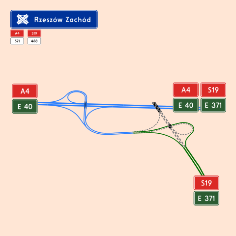
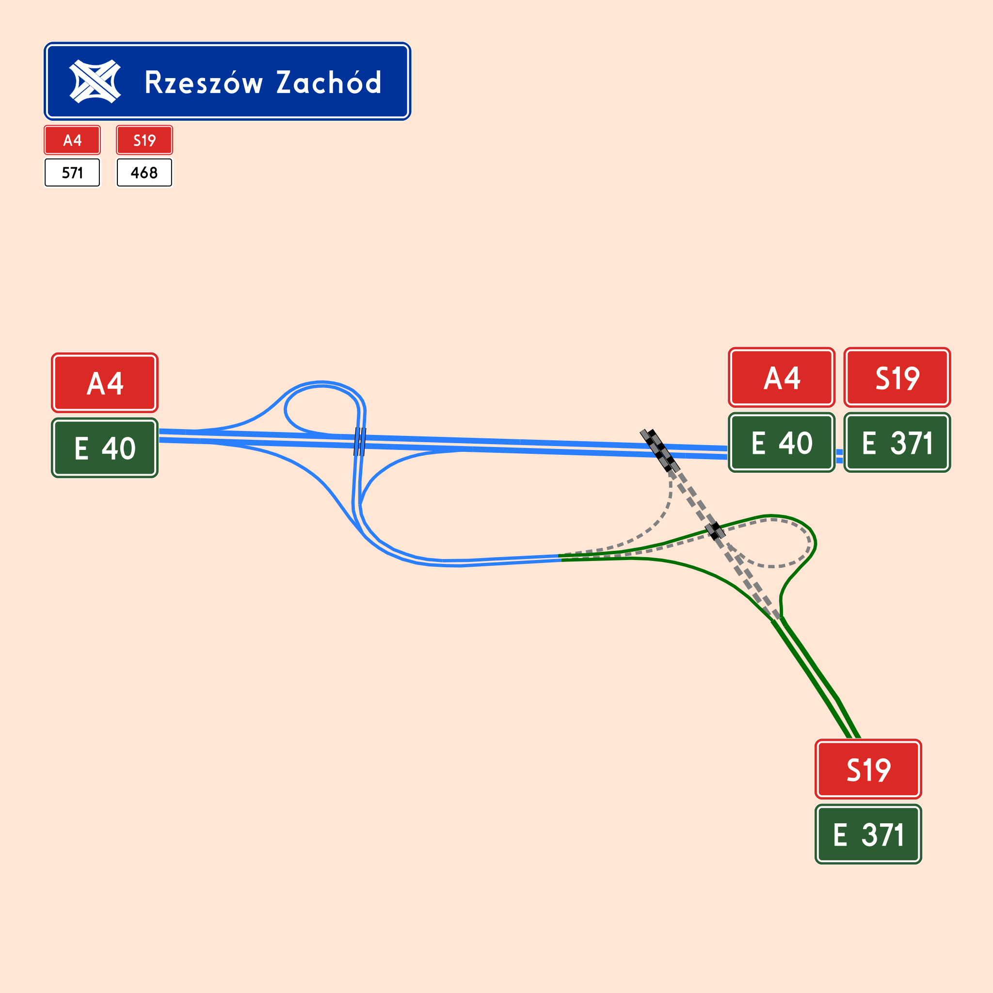
Polski: Węzeł autostradowy Rzeszów Zachód na skrzyżowaniu dróg A4 i S19
English: Motorway interchange Rzeszów Zachód near Rzeszów, Poland(A4, S19) |
| Date | |
| Source | Own work |
| Author | PółCzłowiek-półInfobox |
| Description |
Polski: Węzeł autostradowy Rzeszów Zachód
English: Motorway interchange Rzeszów Zachód near Rzeszów, Poland |
|||||||||
| Date | ||||||||||
| Source | You may find a page on the OpenStreetMap wiki page for Rzeszów | |||||||||
| Creator |
OpenStreetMap contributors OpenStreetMap contributors |
|||||||||
| Permission (Reusing this file) |
OpenStreetMap data is available under the Open Database License (details). Map tiles are licensed under the Creative Commons Attribution-ShareAlike 2.0 license (CC-BY-SA 2.0).
This file is licensed under the Creative Commons Attribution-Share Alike 2.0 Generic license.
|
|||||||||
| Geotemporal data | ||||||||||
| Bounding box |
|
|||||||||
| Georeferencing | If inappropriate please set warp_status = skip to hide. | |||||||||
Licensing edit
| This work contains information from OpenStreetMap, which is made available under the Open Database License (ODbL).
The ODbL does not require any particular license for maps produced from ODbL data. Prior to 1 August 2020, map tiles produced by the OpenStreetMap Foundation were licensed under the CC-BY-SA-2.0 license. Maps produced by other people may be subject to other licences. |
File history
Click on a date/time to view the file as it appeared at that time.
| Date/Time | Thumbnail | Dimensions | User | Comment | |
|---|---|---|---|---|---|
| current | 23:30, 22 June 2020 | | 1,949 × 1,949 (138 KB) | PółCzłowiek-półInfobox (talk | contribs) | curves instead of font |
| 18:41, 22 June 2020 |  | 1,949 × 1,949 (77 KB) | PółCzłowiek-półInfobox (talk | contribs) | =={{int:filedesc}}== {{Information |description={{pl|1=Węzeł autostradowy Rzeszów Zachód na skrzyżowaniu dróg A4 i S19}} {{en|1=Motorway interchange Rzeszów Zachód near Rzeszów, Poland(A4, S19)}} |date=2020-06-22 |source={{own}} |author=PółCzłowiek-półInfobox |permission= |other versions= }} {{OpenStreetMap | name = Rzeszów | description = {{pl|Węzeł autostradowy Rzeszów Wschód}} {{en|Motorway interchange Rzeszów Wschód near Rzeszów, Poland}} | top... |
You cannot overwrite this file.
File usage on Commons
The following page uses this file:
File usage on other wikis
The following other wikis use this file:
- Usage on cs.wikipedia.org
- Usage on pl.wikipedia.org
- Usage on www.wikidata.org