File:ISS012-E-23597 NASA Savai'i, central north coast.JPG
Size of this preview: 800 × 531 pixels. Other resolutions: 320 × 212 pixels | 640 × 424 pixels | 1,024 × 679 pixels | 1,280 × 849 pixels | 3,040 × 2,016 pixels.
Original file (3,040 × 2,016 pixels, file size: 1.83 MB, MIME type: image/jpeg)
Captions
Captions
Add a one-line explanation of what this file represents
Summary edit
| Description |
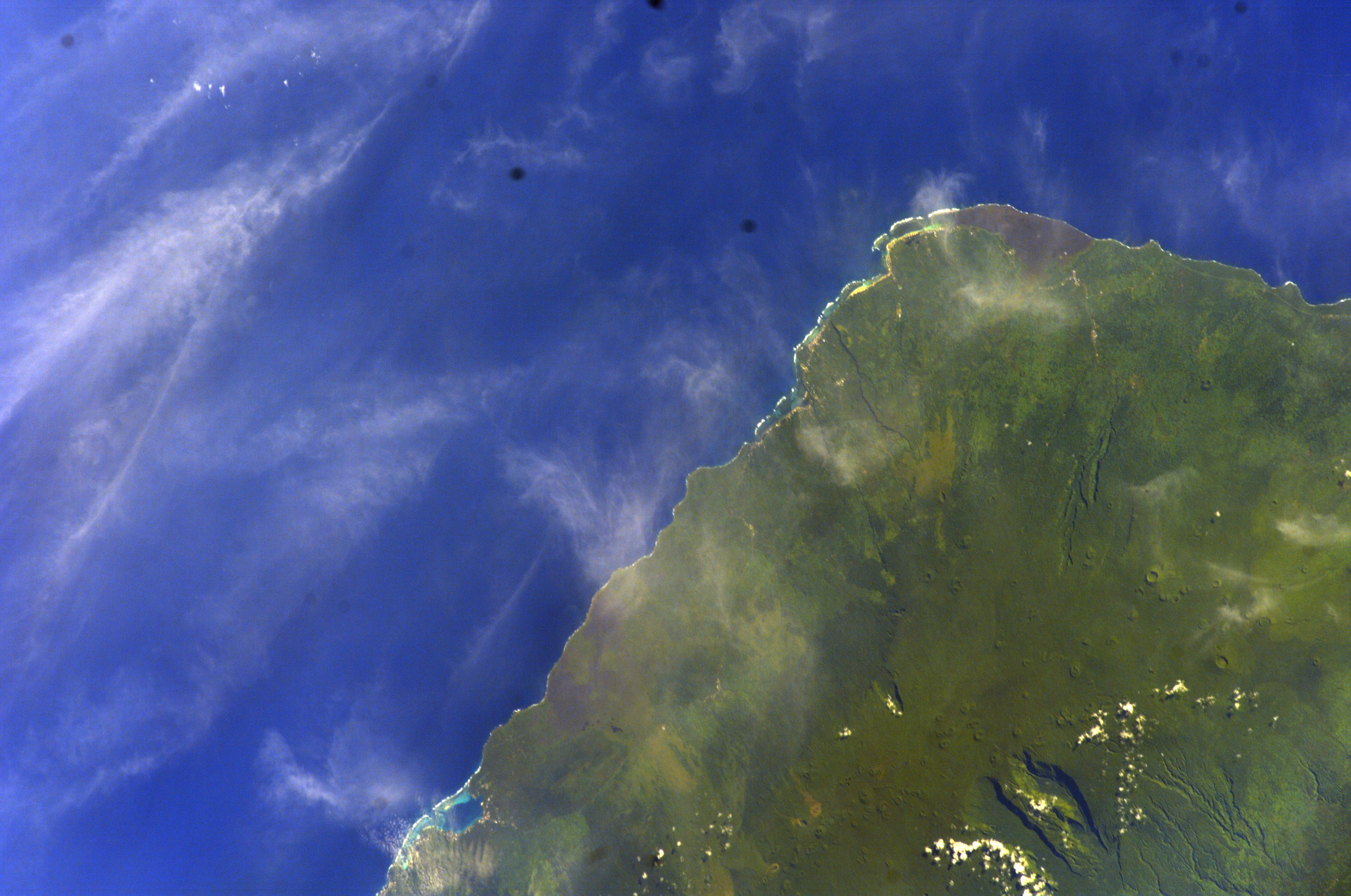
English: Savai'i island, Samoa, central north coast. Spacecraft Altitude: 188 nautical miles (348 km)
Русский: На острове Савайи, северное побережье, Самоа
Gagana Samoa: Savai'i le itu Gaga'emauga ma Gagaifomauga, Samoa |
| Date | |
| Source | <http://eol.jsc.nasa.gov/scripts/sseop/photo.pl?mission=ISS012&roll=E&frame=23597> (). Image Science and Analysis Laboratory, NASA-Johnson Space Center. "The Gateway to Astronaut Photography of Earth." |
| Author |
NASA
|
| Camera location | | View this and other nearby images on: OpenStreetMap |
|---|
Licensing edit
This file is in the public domain in the United States because it was created by the Image Science & Analysis Laboratory, of the NASA Johnson Space Center. NASA copyright policy states that "NASA material is not protected by copyright unless noted". (NASA media use guidelines or Conditions of Use of Astronaut Photographs).
Photo source: ISS012-E-23597.
|
File history
Click on a date/time to view the file as it appeared at that time.
| Date/Time | Thumbnail | Dimensions | User | Comment | |
|---|---|---|---|---|---|
| current | 15:22, 18 May 2013 | | 3,040 × 2,016 (1.83 MB) | Ras67 (talk | contribs) | new rendered from NASA's raw image data |
| 10:53, 30 January 2010 |  | 639 × 435 (59 KB) | Teinesavaii (talk | contribs) | rotated image 180 degrees so its more in geographic context | |
| 13:42, 25 January 2010 |  | 639 × 435 (62 KB) | Teinesavaii (talk | contribs) | {{Information |Description={{en|1=Savai'i island, Samoa, central north coast. Spacecraft Altitude: 188 nautical miles (348 km)}} |Source=<http://eol.jsc.nasa.gov/scripts/sseop/photo.pl?mission=ISS012&roll=E&frame=23597> (). Image Science and Analysis Labo |
You cannot overwrite this file.
File usage on Commons
There are no pages that use this file.
File usage on other wikis
The following other wikis use this file:
- Usage on bn.wikipedia.org
- Usage on de.wikipedia.org
- Usage on en.wikipedia.org
- Usage on hu.wikipedia.org
- Usage on la.wikipedia.org
- Usage on mk.wikipedia.org
- Usage on ru.wikipedia.org
- Usage on sk.wikipedia.org
- Usage on uk.wikipedia.org