File:ISS016-E-15827 - View of Cuba--isla de la Juventud and cayos to the east.jpg
Size of this preview: 800 × 530 pixels. Other resolutions: 320 × 212 pixels | 640 × 424 pixels | 1,024 × 678 pixels | 1,280 × 848 pixels | 3,032 × 2,008 pixels.
Original file (3,032 × 2,008 pixels, file size: 692 KB, MIME type: image/jpeg)
Captions
Captions
Add a one-line explanation of what this file represents
Summary edit
| Description |
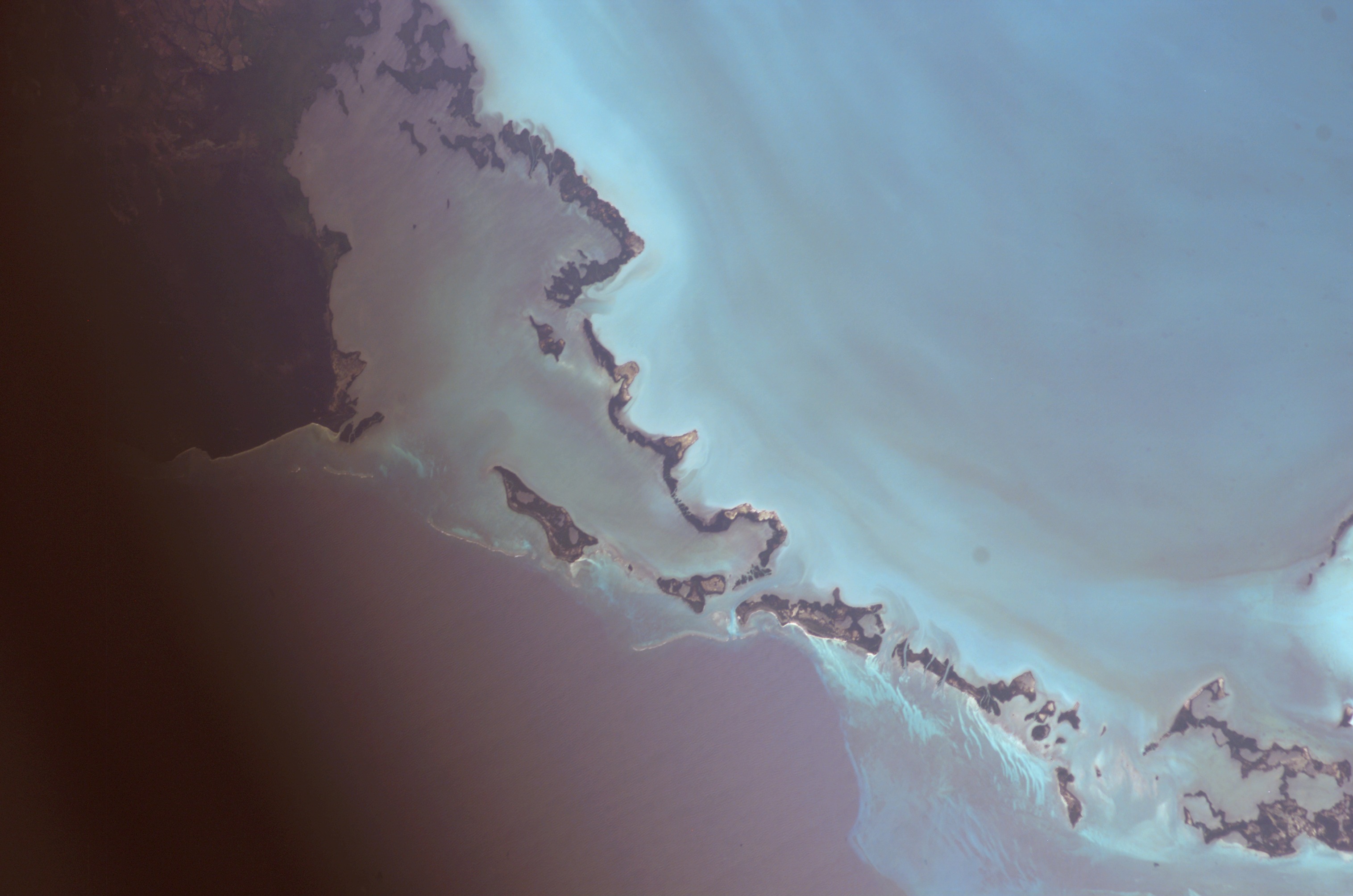
English: View of Cuba taken during ISS Expedition 16. Canarreos Archipelago, cayos just east of the Juventud island (we can see the tip of isla Juventud on the left edge, near the middle). Showing here North-west branch from cayo San Juan to cayo Palma, and East branch from isla Juventud to cayo Cantiles.
. Starting in the upper left corner, just missing cayos Alacránes a bit further north.
East branch
|
| Date | |
| Source | JSC Gateway to Astronaut Photography of Earth |
| Author | Earth Science and Remote Sensing Unit, Lyndon B. Johnson Space Center |
| Mission | ISS016 |
| Roll | E |
| Frame | 15827 |
| Geographic area | Cuba |
| Features | CANERREOS ARCH., ISLE OF PINES |
| Cloud percentage | 10% |
| Altitude | 181 nautical miles (335 km) |
| Look angle | 8 |
| Look direction | N |
| Sun Azimuth | 206° |
| Sun Elevation | 41° |
| Camera | Kodak DCS760c Electronic Still Camera |
| Focal length | 180 mm |
| Object location | | View this and other nearby images on: OpenStreetMap |
|---|
| Camera location | | View this and other nearby images on: OpenStreetMap |
|---|
This image or video was catalogued by Johnson Space Center of the United States National Aeronautics and Space Administration (NASA) under Photo ID: ISS016-E-15827. This tag does not indicate the copyright status of the attached work. A normal copyright tag is still required. See Commons:Licensing. Other languages:
|
Licensing edit
| This file is in the public domain in the United States because it was solely created by NASA. NASA copyright policy states that "NASA material is not protected by copyright unless noted". (See Template:PD-USGov, NASA copyright policy page or JPL Image Use Policy.) | ||
 |
Warnings:
|
Cite error: <ref> tags exist for a group named "c", but no corresponding <references group="c"/> tag was found
File history
Click on a date/time to view the file as it appeared at that time.
| Date/Time | Thumbnail | Dimensions | User | Comment | |
|---|---|---|---|---|---|
| current | 01:37, 30 September 2022 | | 3,032 × 2,008 (692 KB) | AskeBot (talk | contribs) | Cropped losslessly - removed unnecessary white bar at image edge with NASA photo ID |
| 11:05, 16 October 2021 |  | 3,032 × 2,064 (661 KB) | Askeuhd (talk | contribs) |
You cannot overwrite this file.
File usage on Commons
The following page uses this file:
- File:ISS016-E-15827 - View of Cuba.jpg (file redirect)
File usage on other wikis
The following other wikis use this file:
- Usage on fr.wikipedia.org