File:IZAPA.jpg

Size of this preview: 800 × 533 pixels. Other resolutions: 320 × 213 pixels | 640 × 427 pixels | 1,024 × 683 pixels | 1,280 × 853 pixels | 2,560 × 1,707 pixels | 3,693 × 2,462 pixels.
Original file (3,693 × 2,462 pixels, file size: 5.32 MB, MIME type: image/jpeg)
Captions
Captions
Add a one-line explanation of what this file represents
Summary edit
| Description |
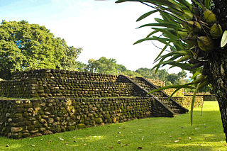
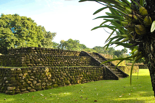
Español: El eje principal de Izapa esta alineado con el volcán Tacaná.
Esta zona arqueológica mide alrededor de 2 kilómetros cuadrados y se encuentra a 4 kilómetros de Tuxtla Chico y a 11 de Tapachula. Sus habitantes eran de filiación mixe-zoque.
|
||
| Date | |||
| Source | Own work | ||
| Author | Lorena Gutiérrez G |
Licensing edit
I, the copyright holder of this work, hereby publish it under the following license:
This file is licensed under the Creative Commons Attribution-Share Alike 3.0 Unported license.
- You are free:
- to share – to copy, distribute and transmit the work
- to remix – to adapt the work
- Under the following conditions:
- attribution – You must give appropriate credit, provide a link to the license, and indicate if changes were made. You may do so in any reasonable manner, but not in any way that suggests the licensor endorses you or your use.
- share alike – If you remix, transform, or build upon the material, you must distribute your contributions under the same or compatible license as the original.

|
This image was uploaded as part of Wiki Loves Monuments 2012.
|
 |
File history
Click on a date/time to view the file as it appeared at that time.
| Date/Time | Thumbnail | Dimensions | User | Comment | |
|---|---|---|---|---|---|
| current | 03:01, 25 September 2012 | | 3,693 × 2,462 (5.32 MB) | Lorena Gutiérrez G (talk | contribs) | User created page with UploadWizard |
You cannot overwrite this file.
File usage on Commons
There are no pages that use this file.
File usage on other wikis
The following other wikis use this file:
- Usage on es.wikipedia.org
- Usage on hu.wikipedia.org