File:Ile Europa.svg

Size of this PNG preview of this SVG file: 543 × 600 pixels. Other resolutions: 217 × 240 pixels | 435 × 480 pixels | 695 × 768 pixels | 927 × 1,024 pixels | 1,854 × 2,048 pixels | 545 × 602 pixels.
Original file (SVG file, nominally 545 × 602 pixels, file size: 106 KB)
Captions
Captions
Add a one-line explanation of what this file represents
Summary edit
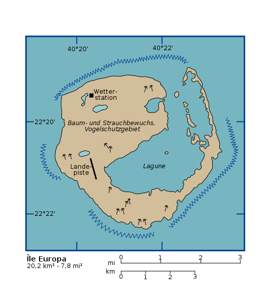
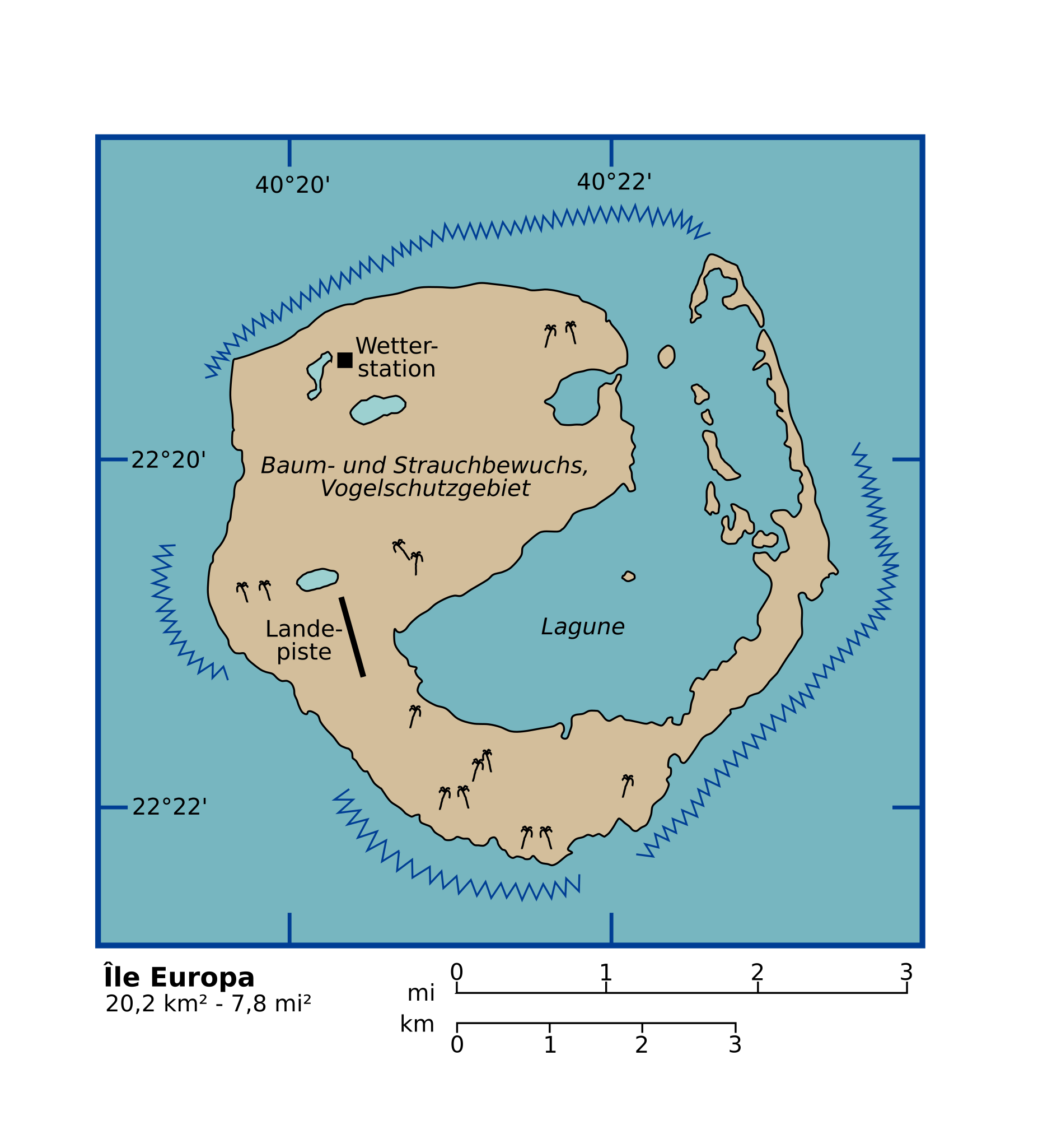
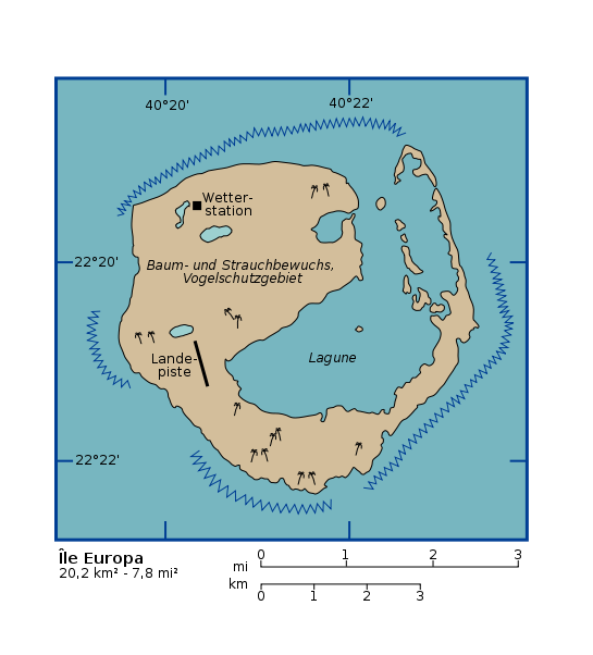
| Description |
Overview map of Île Europa (French territory). With German descriptions. Vectorized from Image:Ile europa 76.jpg which is PD. Template for translations. English descriptions can be read in the source file mentioned above. |
| Date | 5 October 2005 (original upload date) |
| Source | No machine-readable source provided. Own work assumed (based on copyright claims). |
| Author | No machine-readable author provided. L.m.k assumed (based on copyright claims). |
Licensing edit
I, the copyright holder of this work, hereby publish it under the following license:

|
Permission is granted to copy, distribute and/or modify this document under the terms of the GNU Free Documentation License, Version 1.2 or any later version published by the Free Software Foundation; with no Invariant Sections, no Front-Cover Texts, and no Back-Cover Texts. A copy of the license is included in the section entitled GNU Free Documentation License. |
| This file is licensed under the Creative Commons Attribution-Share Alike 3.0 Unported license. | ||
| ||
| This licensing tag was added to this file as part of the GFDL licensing update. |
File history
Click on a date/time to view the file as it appeared at that time.
| Date/Time | Thumbnail | Dimensions | User | Comment | |
|---|---|---|---|---|---|
| current | 14:36, 5 October 2005 | | 545 × 602 (106 KB) | L.m.k (talk | contribs) | Overview map of Île Europa (French territory). With German descriptions. Vectorized from Image:Ile europa 76.jpg which is PD. Template for translations. English descriptions can be read in the source file mentioned above. {{self|GFDL}} [[category |
You cannot overwrite this file.
File usage on Commons
There are no pages that use this file.
File usage on other wikis
The following other wikis use this file:
- Usage on de.wikipedia.org
- Usage on uk.wikipedia.org
- Usage on zh.wikipedia.org