File:IlesChesterfield 250m.jpg
Size of this preview: 400 × 600 pixels. Other resolutions: 160 × 240 pixels | 320 × 480 pixels | 1,000 × 1,500 pixels.
Original file (1,000 × 1,500 pixels, file size: 95 KB, MIME type: image/jpeg)
Captions
Captions
Add a one-line explanation of what this file represents
Summary edit
| Description |
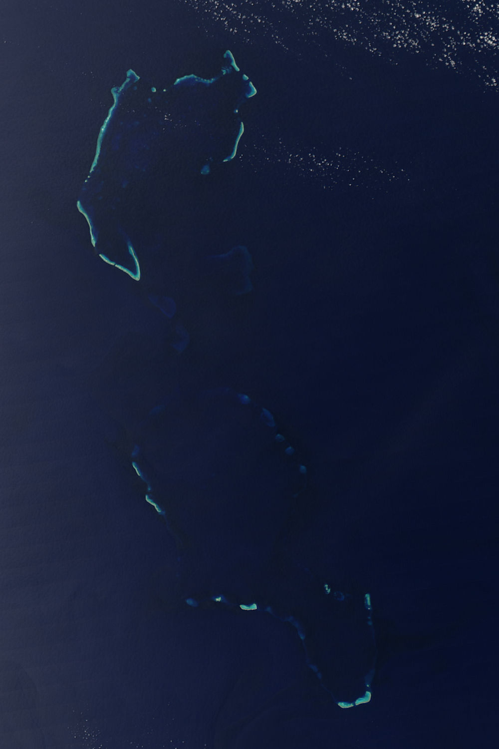
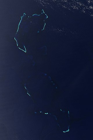
English: Îles Chesterfield/Chesterfield Reef. Credit Jacques Descloitres, MODIS Rapid Response Team, NASA/GSFC The underwater reefs around the Iles Chesterfield are easier to spot in this Moderate Resolution Imaging Spectroradiometer (MODIS) than the islands themselves. Tan slivers of land are barely visible in the image, but the underwater coral reflects light, making the ocean glow a brilliant blue. The islands are part of New Caledonia, a French territory, and are located roughly 1,000 kilometers northeast of Australia in the Coral Sea. MODIS on NASA’s Aqua satellite captured this image on October 7, 2004. |
| Date | |
| Source | https://visibleearth.nasa.gov/view.php?id=72128 |
| Author | NASA |
| Other versions |
|


Licensing edit
| This file is in the public domain in the United States because it was solely created by NASA. NASA copyright policy states that "NASA material is not protected by copyright unless noted". (See Template:PD-USGov, NASA copyright policy page or JPL Image Use Policy.) | ||
 |
Warnings:
|
| Annotations | This image is annotated: View the annotations at Commons |
File history
Click on a date/time to view the file as it appeared at that time.
| Date/Time | Thumbnail | Dimensions | User | Comment | |
|---|---|---|---|---|---|
| current | 22:49, 12 December 2008 | | 1,000 × 1,500 (95 KB) | Whodidwhat (talk | contribs) | Iles Chesterfield Chesterfield Reef |
You cannot overwrite this file.
File usage on Commons
The following 3 pages use this file:
_(without_Bellona_Reefs_cropped).jpg)
File usage on other wikis
The following other wikis use this file:
- Usage on de.wikipedia.org
- Usage on en.wikipedia.org
- Usage on et.wikipedia.org
- Usage on fr.wikipedia.org
- Usage on lt.wikipedia.org
- Usage on pl.wikipedia.org
- Usage on ru.wikipedia.org
- Usage on vi.wikipedia.org