File:India, Nepal, China border.jpg

Size of this preview: 764 × 599 pixels. Other resolutions: 306 × 240 pixels | 612 × 480 pixels | 979 × 768 pixels | 1,280 × 1,004 pixels | 2,149 × 1,686 pixels.
Original file (2,149 × 1,686 pixels, file size: 935 KB, MIME type: image/jpeg)
Captions
Captions
India, Nepal, China border
Summary edit
| Description |
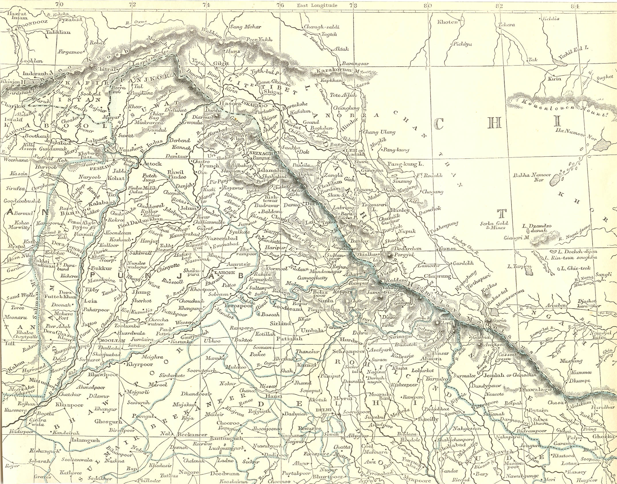
English: A map of India by W. J. Lowry of 1850 showing Kali river from Limpiyadhura as an International borderline between India and Nepal |
| Date | |
| Source | http://www.columbia.edu/itc/mealac/pritchett/00maplinks/colonial/lowry1850/ncmax.jpg |
| Author | J. W. Lowry |
Licensing edit
|
This work is in the public domain in its country of origin and other countries and areas where the copyright term is the author's life plus 70 years or fewer. This work is in the public domain in the United States because it was published (or registered with the U.S. Copyright Office) before January 1, 1929. | |
| This file has been identified as being free of known restrictions under copyright law, including all related and neighboring rights. | |
File history
Click on a date/time to view the file as it appeared at that time.
| Date/Time | Thumbnail | Dimensions | User | Comment | |
|---|---|---|---|---|---|
| current | 12:22, 24 May 2020 | | 2,149 × 1,686 (935 KB) | Raju Babu (talk | contribs) | Uploaded a work by J. W. Lowry from http://www.columbia.edu/itc/mealac/pritchett/00maplinks/colonial/lowry1850/ncmax.jpg with UploadWizard |
You cannot overwrite this file.
File usage on Commons
There are no pages that use this file.