File:India Tamil Nadu location map.svg

Size of this PNG preview of this SVG file: 483 × 600 pixels. Other resolutions: 193 × 240 pixels | 387 × 480 pixels | 619 × 768 pixels | 825 × 1,024 pixels | 1,650 × 2,048 pixels | 1,591 × 1,975 pixels.
Original file (SVG file, nominally 1,591 × 1,975 pixels, file size: 840 KB)
Captions
Captions
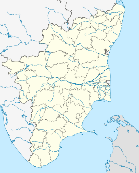
Geographical Map of Tamil Nadu, in India.
Summary edit
| Description |
Deutsch: Postionskarte von Tamil Nadu
Quadratische Plattkarte. Geographische Begrenzung der Karte:
English: Location map of Tamil Nadu
Equirectangular projection. Geographic limits of the map:
|
| Date | |
| Source | own work, using this file by Planemad |
| Author | Maximilian Dörrbecker (Chumwa) |
| Other versions |
|


|
This map has been made or improved in the German Kartenwerkstatt (Map Lab). You can propose maps to improve as well.
|
Licensing edit
I, the copyright holder of this work, hereby publish it under the following licenses:

|
Permission is granted to copy, distribute and/or modify this document under the terms of the GNU Free Documentation License, Version 1.2 or any later version published by the Free Software Foundation; with no Invariant Sections, no Front-Cover Texts, and no Back-Cover Texts. A copy of the license is included in the section entitled GNU Free Documentation License. |
This file is licensed under the Creative Commons Attribution-Share Alike 3.0 Unported license.
- You are free:
- to share – to copy, distribute and transmit the work
- to remix – to adapt the work
- Under the following conditions:
- attribution – You must give appropriate credit, provide a link to the license, and indicate if changes were made. You may do so in any reasonable manner, but not in any way that suggests the licensor endorses you or your use.
- share alike – If you remix, transform, or build upon the material, you must distribute your contributions under the same or compatible license as the original.
You may select the license of your choice.
File history
Click on a date/time to view the file as it appeared at that time.
| Date/Time | Thumbnail | Dimensions | User | Comment | |
|---|---|---|---|---|---|
| current | 00:54, 6 September 2021 | | 1,591 × 1,975 (840 KB) | C1MM (talk | contribs) | Corrected Tirunelveli/Tenkasi dist boundary |
| 16:43, 4 September 2021 |  | 1,591 × 1,975 (840 KB) | C1MM (talk | contribs) | Resized file | |
| 06:09, 4 September 2021 |  | 907 × 1,123 (880 KB) | C1MM (talk | contribs) | Removed extra river piece | |
| 04:35, 4 September 2021 |  | 907 × 1,123 (880 KB) | C1MM (talk | contribs) | Corrected rivers and dist boundaries | |
| 16:44, 20 February 2021 |  | 512 × 636 (727 KB) | C1MM (talk | contribs) | Corrected coastline | |
| 00:35, 18 December 2020 |  | 512 × 636 (257 KB) | C1MM (talk | contribs) | Relayered | |
| 22:06, 22 April 2020 |  | 512 × 636 (373 KB) | C1MM (talk | contribs) | Restore colors | |
| 20:03, 22 April 2020 |  | 512 × 636 (373 KB) | C1MM (talk | contribs) | Fixed colors and colored Pondicherry | |
| 14:18, 17 March 2020 |  | 512 × 636 (250 KB) | C1MM (talk | contribs) | Reverted to version as of 14:17, 17 March 2020 (UTC) | |
| 14:18, 17 March 2020 |  | 512 × 636 (249 KB) | C1MM (talk | contribs) | Reverted to version as of 03:04, 17 March 2020 (UTC) |
You cannot overwrite this file.
File usage on Commons
The following 43 pages use this file:
- User:Chumwa/Gallery
- File:India Tamil Nadu relief map.png
- Category:2018 in Tamil Nadu
- Category:Airports in Tamil Nadu
- Category:Archaeological sites in Tamil Nadu
- Category:Bodies of water in Tamil Nadu
- Category:Bridges in Tamil Nadu
- Category:Bus stations in Tamil Nadu
- Category:Canals in Tamil Nadu
- Category:Dams in Tamil Nadu
- Category:Dhanushkodi
- Category:Disasters and accidents in Tamil Nadu
- Category:Festivals of Tamil Nadu
- Category:Flora of Tamil Nadu
- Category:Forts in Tamil Nadu
- Category:Gurudwaras in Tamil Nadu
- Category:Hill stations in Tamil Nadu
- Category:Hills of Tamil Nadu
- Category:Hindu temples in Tamil Nadu
- Category:Hospitals in Tamil Nadu
- Category:Jain temples in Tamil Nadu
- Category:Lakes of Tamil Nadu
- Category:Lighthouses in Tamil Nadu
- Category:Maps of Tamil Nadu
- Category:Municipal corporations in Tamil Nadu
- Category:Palaces in Tamil Nadu
- Category:People of Tamil Nadu
- Category:Populated places in Tamil Nadu
- Category:Postcards of Tamil Nadu
- Category:Power plants in Tamil Nadu
- Category:Rail transport in Tamil Nadu
- Category:Railway junction stations in Tamil Nadu
- Category:Railway stations in Tamil Nadu
- Category:Reservoirs in Tamil Nadu
- Category:Rivers of Tamil Nadu
- Category:Roads in Tamil Nadu
- Category:Shiva temples in Tamil Nadu
- Category:Tamil Nadu
- Category:Temple tanks in Tamil Nadu
- Category:Villages in Tamil Nadu
- Category:Visitor attractions in Tamil Nadu
- Category:Waterfalls in Tamil Nadu
- Category:Wind farms in Tamil Nadu
File usage on other wikis
The following other wikis use this file:
- Usage on ar.wikipedia.org
- Usage on as.wikipedia.org
- Usage on azb.wikipedia.org
- چنای
- باتی پاراسری
- باتی پینایور
- باتی کالاتور
- وینانجنی
- ویراوانور
- پیانویلای
- پتای, ویلوپورام
- پتای, کارایکال
- پتای, کودالور
- ویرامودایاناتام
- ویراسولاپورام
- ویراپانچاترام
- پرونقودی, تیروچیراپالی
- پرونقودی, پودوکوتای
- وانامادوی
- ساتانور
- ساتیوایال
- ساتیراکوندان
- ساتانور, پرامبالور
- ساراسواتی ناقار
- سانتیپالایام
- سانتاناقوپالاپورام
- سانانالور
- سانکاراپورام
- سانکاراپاندیاپورام
- کالاکودی
- کالییور
- کالینجییام
- ماتییامپاتی
- کالایور
- کالاتور ت
- دوغو کالاتور
- کالاتیمادام
- کالانقانی
- ماروقالپاتی
- مارودور, کویمباتور
- مارتاندانتورای
- کالاییور
- ساماناتام
- سامالپاتی
- سالوپاپاتی
- ونتریلینقاپورام
- سالیپری
- کاکیوادانپاتی
- ومباکام
View more global usage of this file.