File:India Uttar Pradesh location map.svg

Original file (SVG file, nominally 1,006 × 981 pixels, file size: 776 KB)
Captions
Captions
Summary edit
| Description |
Quadratische Plattkarte, N-S-Streckung 112 %. Geographische Begrenzung der Karte:
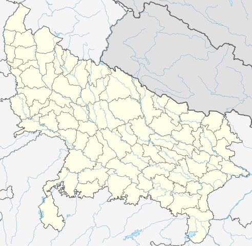
Equirectangular projection, N/S stretching 112 %. Geographic limits of the map:
|
|
| Date | ||
| Source |
Own work, using
|
|
| Author | NordNordWest | |
| Permission (Reusing this file) |
This file is licensed under the Creative Commons Attribution-Share Alike 3.0 Germany license.
 This file is licensed under the Creative Commons Attribution-Share Alike 3.0 Germany license.
|


|
This map has been made or improved in the German Kartenwerkstatt (Map Lab). You can propose maps to improve as well.
|
File history
Click on a date/time to view the file as it appeared at that time.
| Date/Time | Thumbnail | Dimensions | User | Comment | |
|---|---|---|---|---|---|
| current | 06:40, 1 May 2023 | | 1,006 × 981 (776 KB) | C1MM (talk | contribs) | c borders |
| 04:44, 5 January 2022 |  | 1,066 × 927 (777 KB) | C1MM (talk | contribs) | Corrected rivers and dist boundaries | |
| 22:54, 12 February 2021 |  | 909 × 886 (262 KB) | C1MM (talk | contribs) | Added Chhattisgarh | |
| 00:41, 8 January 2021 |  | 909 × 886 (261 KB) | C1MM (talk | contribs) | Added Amethi district | |
| 21:29, 22 April 2020 |  | 909 × 886 (249 KB) | NordNordWest (talk | contribs) | Reverted to version as of 19:51, 9 October 2012 (UTC); no need to change colours | |
| 21:00, 22 April 2020 |  | 909 × 886 (292 KB) | C1MM (talk | contribs) | Fixed rivers | |
| 20:51, 22 April 2020 |  | 909 × 886 (290 KB) | C1MM (talk | contribs) | Fixed colors and made rivers along borders | |
| 19:51, 9 October 2012 |  | 909 × 886 (249 KB) | NordNordWest (talk | contribs) | =={{int:filedesc}}== {{Information |Description= {{de|Positionskarte von Uttar Pradesh, Indien}} Quadratische Plattkarte, N-S-Streckung 112 %. Geographische Begrenzung der Karte: * N: 30.5° N * S: 23.8° N * W: 77.... |
You cannot overwrite this file.
File usage on Commons
The following 42 pages use this file:
- Atlas of Uttar Pradesh
- User:NordNordWest/Gallery/Location maps
- Category:Airports in Uttar Pradesh
- Category:Archaeological sites in Uttar Pradesh
- Category:Births in Uttar Pradesh
- Category:Bodies of water in Uttar Pradesh
- Category:Bridges in Uttar Pradesh
- Category:Buddhism in Uttar Pradesh
- Category:Buddhist temples in Uttar Pradesh
- Category:Canals in Uttar Pradesh
- Category:Cricket in Uttar Pradesh
- Category:Dams in Uttar Pradesh
- Category:Deaths in Uttar Pradesh
- Category:Engineers from Uttar Pradesh
- Category:Festivals of Uttar Pradesh
- Category:Flora of Uttar Pradesh
- Category:Forts in Uttar Pradesh
- Category:Gardens in Uttar Pradesh
- Category:Hindu temples in Uttar Pradesh
- Category:Hospitals in Uttar Pradesh
- Category:Jain temples in Uttar Pradesh
- Category:Lakes of Uttar Pradesh
- Category:Locator maps of Uttar Pradesh
- Category:Maps of Uttar Pradesh
- Category:Mosques in Uttar Pradesh
- Category:Palaces in Uttar Pradesh
- Category:People of Uttar Pradesh
- Category:Populated places in Uttar Pradesh
- Category:Postcards of Uttar Pradesh
- Category:Power plants in Uttar Pradesh
- Category:Rail transport in Uttar Pradesh
- Category:Railway junction stations in Uttar Pradesh
- Category:Railway stations in Uttar Pradesh
- Category:Rivers of Uttar Pradesh
- Category:Roads in Uttar Pradesh
- Category:Shiva temples in Uttar Pradesh
- Category:Sports in Uttar Pradesh
- Category:Temples in Uttar Pradesh
- Category:Transport in Uttar Pradesh
- Category:Uttar Pradesh
- Category:Visitor attractions in Uttar Pradesh
- Category:Waterfalls in Uttar Pradesh
File usage on other wikis
The following other wikis use this file:
- Usage on ar.wikipedia.org
- Usage on as.wikipedia.org
- Usage on awa.wikipedia.org
- Usage on azb.wikipedia.org
- اتاوه
- کینتور
- علیپورا
- فولپور
- فولی (هیندوستان)
- ففنا (هیندوستان)
- فارندا
- سارسای ناوار
- ساروخیپورا
- ساراوان, جاونپور
- ساراسارا, یوتار پرادش
- ساراییا بور
- سارایبیرو
- مداوارا کالا
- سانخنی
- ماوجامپور
- ماسکانوا
- سانای, بوداون
- سامرر (هیندوستان)
- کالاند, ایندیا
- مارتین پوروا
- سامبالهرا
- کاکورا
- سالارپور, بوداون
- کایتورا, جاونپور
- ساییان, آقرا
- ساینتال, یوتار پرادش
- سایفای
- کاقارول
- سایدناقار
- ساهاجانپور
- هالاور
- سافدارقانج
- سادپور, یوتار پرادش
- روپایدیها
- رابارلی
- کادار چووک
View more global usage of this file.