File:India rivers and lakes map-es.svg

Size of this PNG preview of this SVG file: 532 × 600 pixels. Other resolutions: 213 × 240 pixels | 426 × 480 pixels | 681 × 768 pixels | 908 × 1,024 pixels | 1,817 × 2,048 pixels | 1,650 × 1,860 pixels.
Original file (SVG file, nominally 1,650 × 1,860 pixels, file size: 1.38 MB)
Captions
Captions
Add a one-line explanation of what this file represents
Summary edit
| Description |
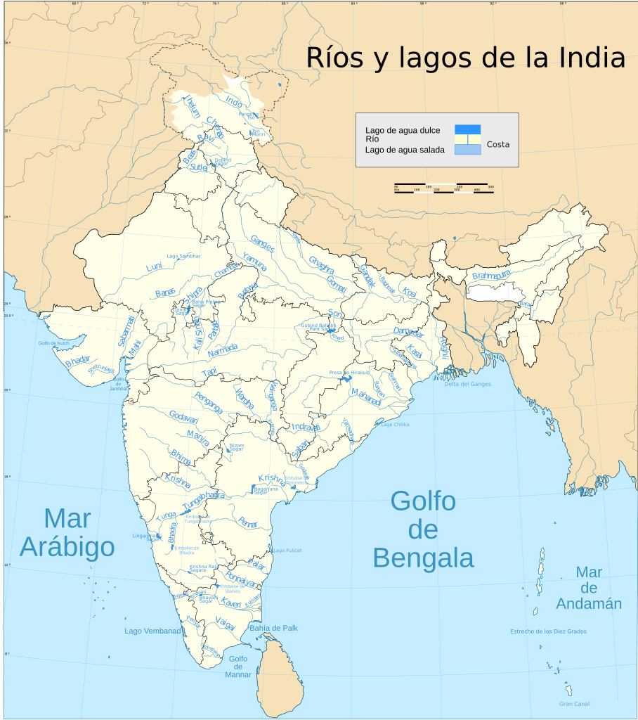
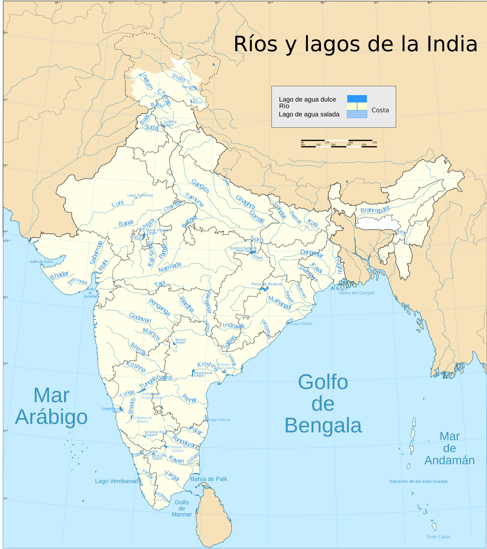
Español: Mapa con los principales ríos, lagos y embalses de la India. |
| Date | |
| Source |
This file was derived from: India rivers and lakes map.svg : Planemad |
| Author |
|
Licensing edit
I, the copyright holder of this work, hereby publish it under the following license:
This file is licensed under the Creative Commons Attribution-Share Alike 4.0 International license.
- You are free:
- to share – to copy, distribute and transmit the work
- to remix – to adapt the work
- Under the following conditions:
- attribution – You must give appropriate credit, provide a link to the license, and indicate if changes were made. You may do so in any reasonable manner, but not in any way that suggests the licensor endorses you or your use.
- share alike – If you remix, transform, or build upon the material, you must distribute your contributions under the same or compatible license as the original.
File history
Click on a date/time to view the file as it appeared at that time.
| Date/Time | Thumbnail | Dimensions | User | Comment | |
|---|---|---|---|---|---|
| current | 10:23, 9 February 2017 | | 1,650 × 1,860 (1.38 MB) | Rowanwindwhistler (talk | contribs) | States added back |
| 10:22, 9 February 2017 |  | 1,650 × 1,860 (1.12 MB) | Rowanwindwhistler (talk | contribs) | Fake text added. Some useless layers removed | |
| 11:46, 11 December 2015 |  | 1,650 × 1,860 (1.29 MB) | Rowanwindwhistler (talk | contribs) | States and some other shapes redrawn to fit with one another (no overlap of objects), colours changed | |
| 05:48, 30 August 2014 |  | 1,650 × 1,860 (461 KB) | Rowanwindwhistler (talk | contribs) | User created page with UploadWizard |
You cannot overwrite this file.
File usage on Commons
The following 5 pages use this file:
File usage on other wikis
The following other wikis use this file: