File:Indian Mill Bridge.jpg

Size of this preview: 450 × 600 pixels. Other resolutions: 180 × 240 pixels | 360 × 480 pixels | 576 × 768 pixels | 768 × 1,024 pixels | 2,112 × 2,816 pixels.
Original file (2,112 × 2,816 pixels, file size: 2.81 MB, MIME type: image/jpeg)
Captions
Captions
Add a one-line explanation of what this file represents
| Camera location | | View this and other nearby images on: OpenStreetMap |
|---|
| Description |
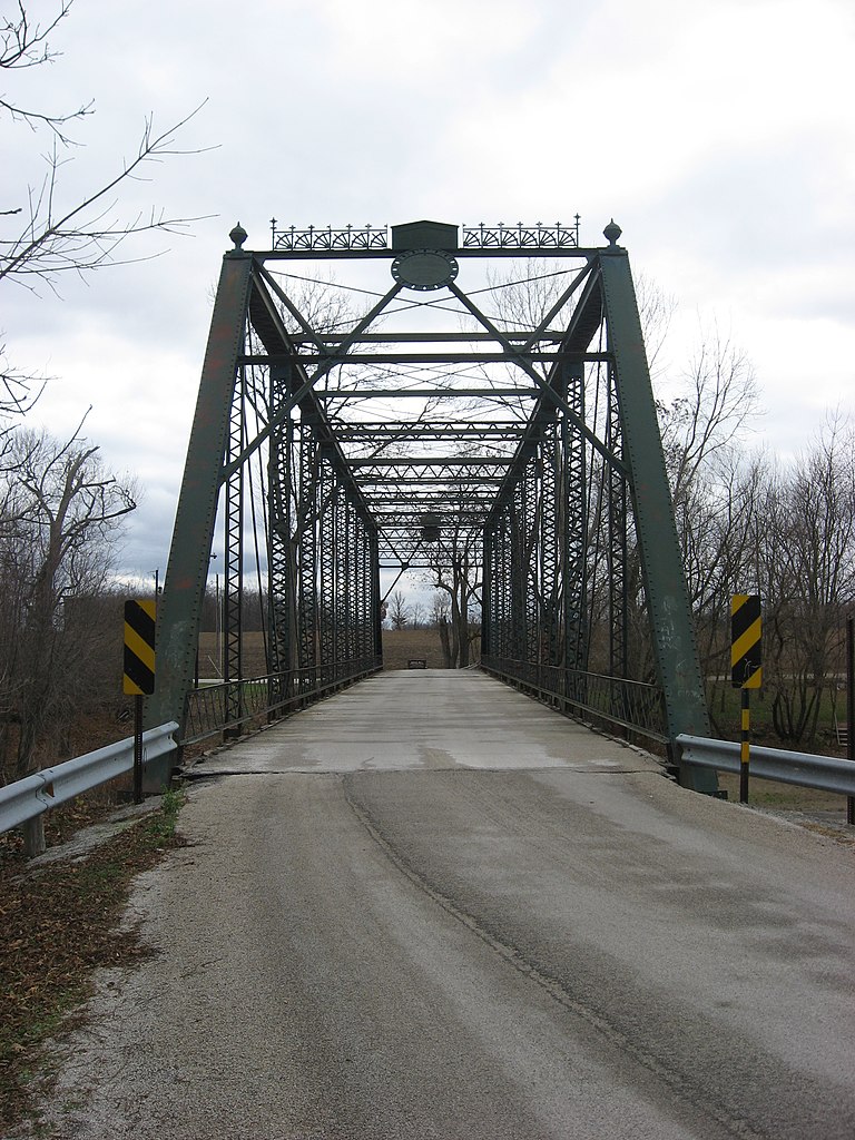
English: Western end of the Indian Mill Bridge, which carries County Road 47 over the Sandusky River northeast of Upper Sandusky in Crane Township, Wyandot County, Ohio, United States. The Pratt through truss bridge was built in 1913. |
||
| Date | Taken on 30 November 2009 | ||
| Source | Own work | ||
| Author | Nyttend | ||
| Permission (Reusing this file) |
|
File history
Click on a date/time to view the file as it appeared at that time.
| Date/Time | Thumbnail | Dimensions | User | Comment | |
|---|---|---|---|---|---|
| current | 15:19, 1 December 2009 | | 2,112 × 2,816 (2.81 MB) | Nyttend (talk | contribs) | {{Location|40|51|47.6|N|83|15|14.4|W}} {{Information |Description={{en|Western end of the Indian Mill Bridge, which carries County Road 47 over the {{w|Sandusky River}} northeast of {{w|Upper Sandusky, Ohio|Upper Sandusky}} in {{w|Crane Township, Wyandot |
You cannot overwrite this file.
File usage on Commons
There are no pages that use this file.