File:Inizio sentiero da Narro a Ossino.jpg
Size of this preview: 799 × 599 pixels. Other resolutions: 320 × 240 pixels | 640 × 480 pixels | 1,024 × 768 pixels | 1,280 × 960 pixels | 2,560 × 1,920 pixels | 3,321 × 2,491 pixels.
Original file (3,321 × 2,491 pixels, file size: 3.02 MB, MIME type: image/jpeg)
Captions
Captions
Add a one-line explanation of what this file represents
Summary edit
| Description |
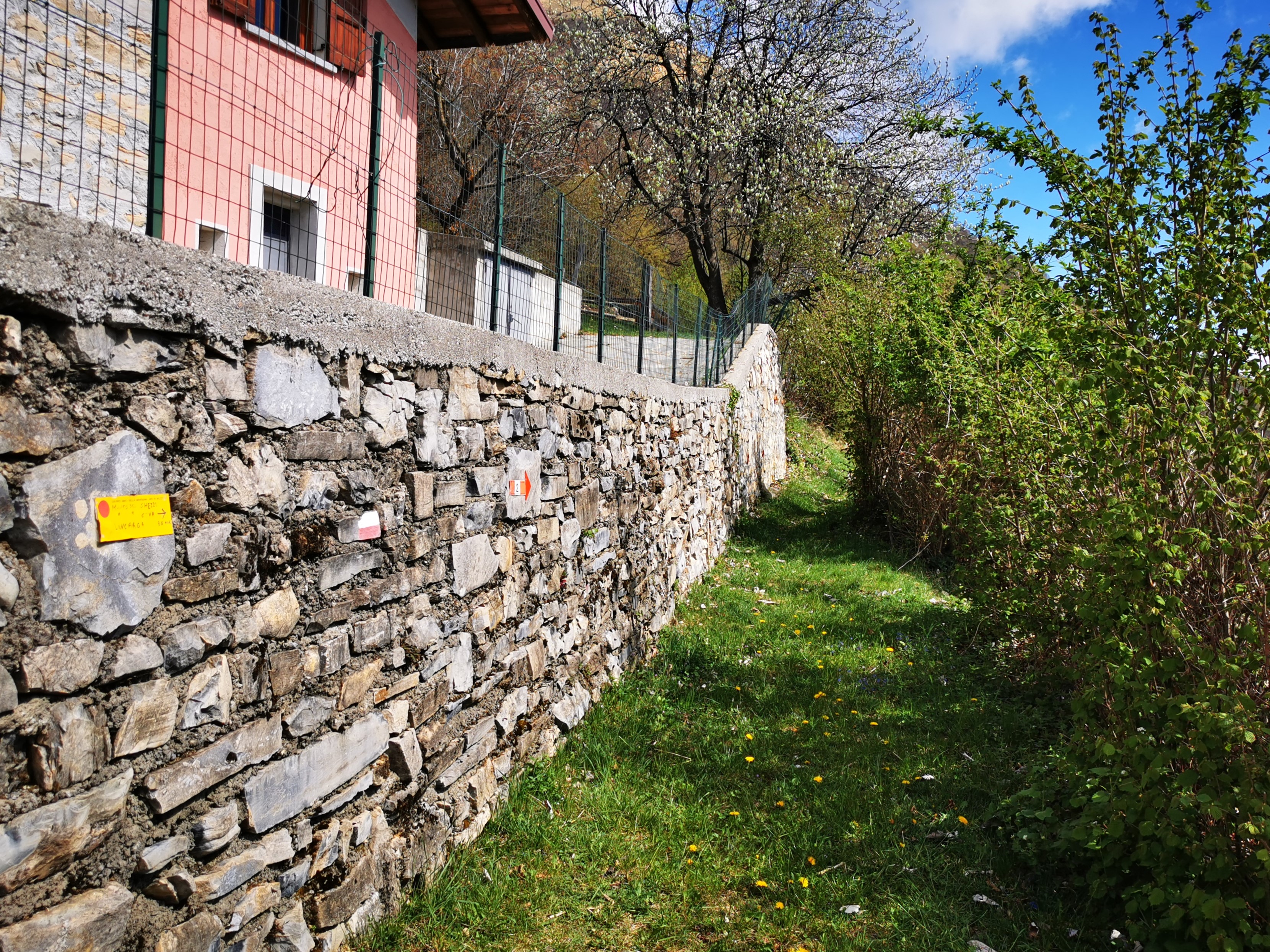
Italiano: Inizio a Narro del sentiero in direzione di Ossino. Percorso di attraversamento a mezza costa con poco dislivello. Pur non essendo difficile , il sentiero è talvolta stretto e con tratti franati. Presenta alcuni tratti esposti e non protetti in corrispondenza dell'attraversamento di alcune vallette, da percorrere con attenzione. Generalmente ben evidente, in alcuni punti bisogna fare attenzione ai segnali a vernice o alle targhette segnaletiche per non mancare cambi di direzione inaspettati. Essendo il tratto tra Narro e Ossino poco frequentato, la vegetazione (rovi e alberi caduti) può rallentare il cammino. |
| Date | |
| Source | Own work |
| Author | Kaitu |
| Camera location | | View this and other nearby images on: OpenStreetMap |
|---|
Licensing edit
I, the copyright holder of this work, hereby publish it under the following license:
This file is licensed under the Creative Commons Attribution-Share Alike 4.0 International license.
- You are free:
- to share – to copy, distribute and transmit the work
- to remix – to adapt the work
- Under the following conditions:
- attribution – You must give appropriate credit, provide a link to the license, and indicate if changes were made. You may do so in any reasonable manner, but not in any way that suggests the licensor endorses you or your use.
- share alike – If you remix, transform, or build upon the material, you must distribute your contributions under the same or compatible license as the original.
| Annotations | This image is annotated: View the annotations at Commons |
File history
Click on a date/time to view the file as it appeared at that time.
| Date/Time | Thumbnail | Dimensions | User | Comment | |
|---|---|---|---|---|---|
| current | 12:27, 2 May 2022 | | 3,321 × 2,491 (3.02 MB) | Kaitu (talk | contribs) | Uploaded own work with UploadWizard |
You cannot overwrite this file.
File usage on Commons
The following page uses this file: