File:Innherredsferja map.svg

Size of this PNG preview of this SVG file: 800 × 564 pixels. Other resolutions: 320 × 225 pixels | 640 × 451 pixels | 1,024 × 721 pixels | 1,280 × 902 pixels | 2,560 × 1,803 pixels | 1,140 × 803 pixels.
Original file (SVG file, nominally 1,140 × 803 pixels, file size: 396 KB)
Captions
Captions
Add a one-line explanation of what this file represents
| Description |
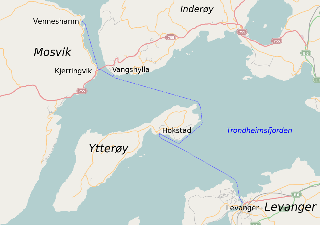
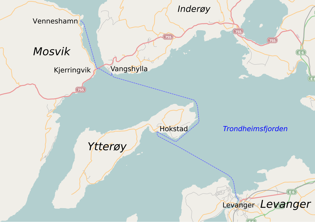
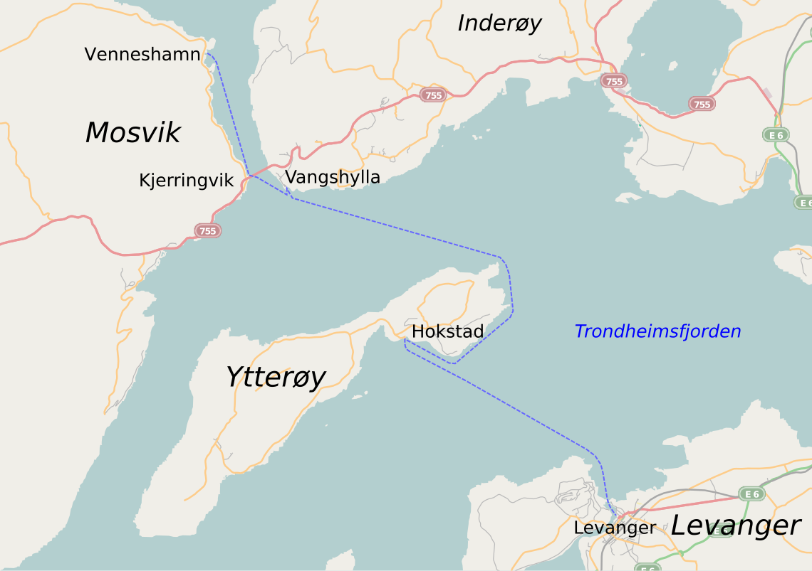
English: A map showing the initial cross-fjord service operated by Innherredsferja from 1958 to 1964. Note: the roads are the current, and differ from those available while the route was operated. |
| Date | |
| Source | Based in part on OpenStreetMap; additional work by myself |
| Author | OpenStreetMap and Arsenikk |
This file is licensed under the Creative Commons Attribution-Share Alike 2.0 Generic license.
- You are free:
- to share – to copy, distribute and transmit the work
- to remix – to adapt the work
- Under the following conditions:
- attribution – You must give appropriate credit, provide a link to the license, and indicate if changes were made. You may do so in any reasonable manner, but not in any way that suggests the licensor endorses you or your use.
- share alike – If you remix, transform, or build upon the material, you must distribute your contributions under the same or compatible license as the original.
File history
Click on a date/time to view the file as it appeared at that time.
| Date/Time | Thumbnail | Dimensions | User | Comment | |
|---|---|---|---|---|---|
| current | 19:37, 5 April 2010 | | 1,140 × 803 (396 KB) | Arsenikk (talk | contribs) | {{Information |Description={{en|1=A map showing the initial cross-fjord service operated by Innherredsferja from 1958 to 1964. Note: the roads are the current, and differ from those available while the route was operated.}} |Source=Based in part on OpenSt |
You cannot overwrite this file.
File usage on Commons
There are no pages that use this file.
File usage on other wikis
The following other wikis use this file:
- Usage on en.wikipedia.org
- Usage on no.wikipedia.org
- Usage on pl.wiktionary.org