File:Inormation board on Sant'Eufemia (Ossuccio, Tremezzina).jpg
Size of this preview: 432 × 599 pixels. Other resolutions: 173 × 240 pixels | 346 × 480 pixels | 554 × 768 pixels | 739 × 1,024 pixels | 2,044 × 2,833 pixels.
Original file (2,044 × 2,833 pixels, file size: 1.98 MB, MIME type: image/jpeg)
Captions
Captions
Add a one-line explanation of what this file represents
Summary edit
.jpg&action=edit§ion=1)
| Description |
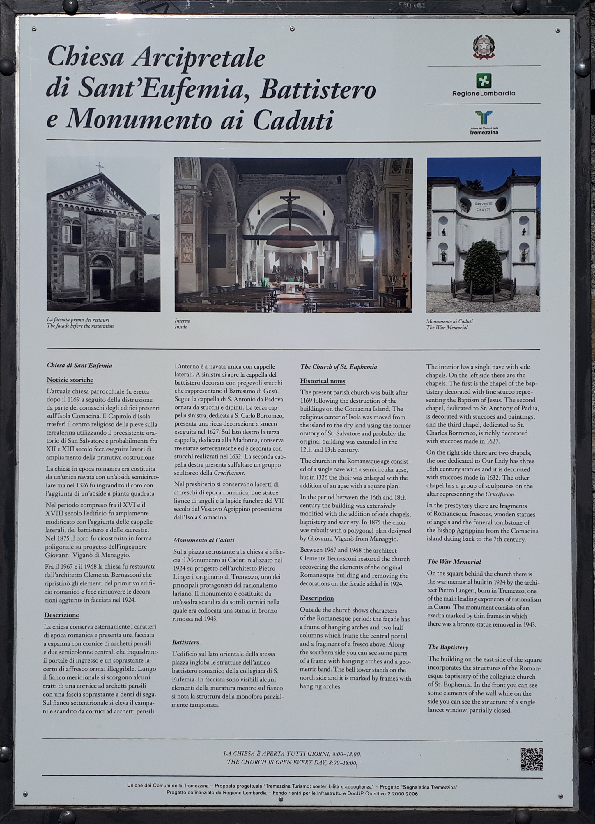
Italiano: Pannello informativo sulla chiesa di Sant'Eufemia (Ossuccio, Tremezzina) e sul monumento ai caduti di Ossuccio |
| Date | |
| Source | Own work |
| Author | Kaitu |
| Camera location | | View this and other nearby images on: OpenStreetMap |
|---|
.jpg¶ms=045.967626_N_0009.184556_E_globe:Earth_type:camera_heading:351.21&language=en)
|
Inormation board on Sant'Eufemia (Ossuccio, Tremezzina).jpg has an entry on OpenStreetMap (show). |
Licensing edit
.jpg&action=edit§ion=2)
I, the copyright holder of this work, hereby publish it under the following license:
| This file is made available under the Creative Commons CC0 1.0 Universal Public Domain Dedication. | |
| The person who associated a work with this deed has dedicated the work to the public domain by waiving all of their rights to the work worldwide under copyright law, including all related and neighboring rights, to the extent allowed by law. You can copy, modify, distribute and perform the work, even for commercial purposes, all without asking permission.
|
File history
Click on a date/time to view the file as it appeared at that time.
| Date/Time | Thumbnail | Dimensions | User | Comment | |
|---|---|---|---|---|---|
| current | 15:14, 14 February 2024 | | 2,044 × 2,833 (1.98 MB) | Kaitu (talk | contribs) | Uploaded own work with UploadWizard |
You cannot overwrite this file.
File usage on Commons
The following 2 pages use this file:
_02.jpg)
.jpg&oldid=851789573)