File:Interbedded shale and limestone (Bethel Member, Girkin Limestone, Upper Mississippian; Houchins Narrows, Mammoth Cave, Kentucky, USA) 3 (51285097494).jpg
Original file (3,024 × 4,032 pixels, file size: 5.71 MB, MIME type: image/jpeg)
Captions
Captions
Summary edit
_3_(51285097494).jpg&action=edit§ion=1)
| Description |
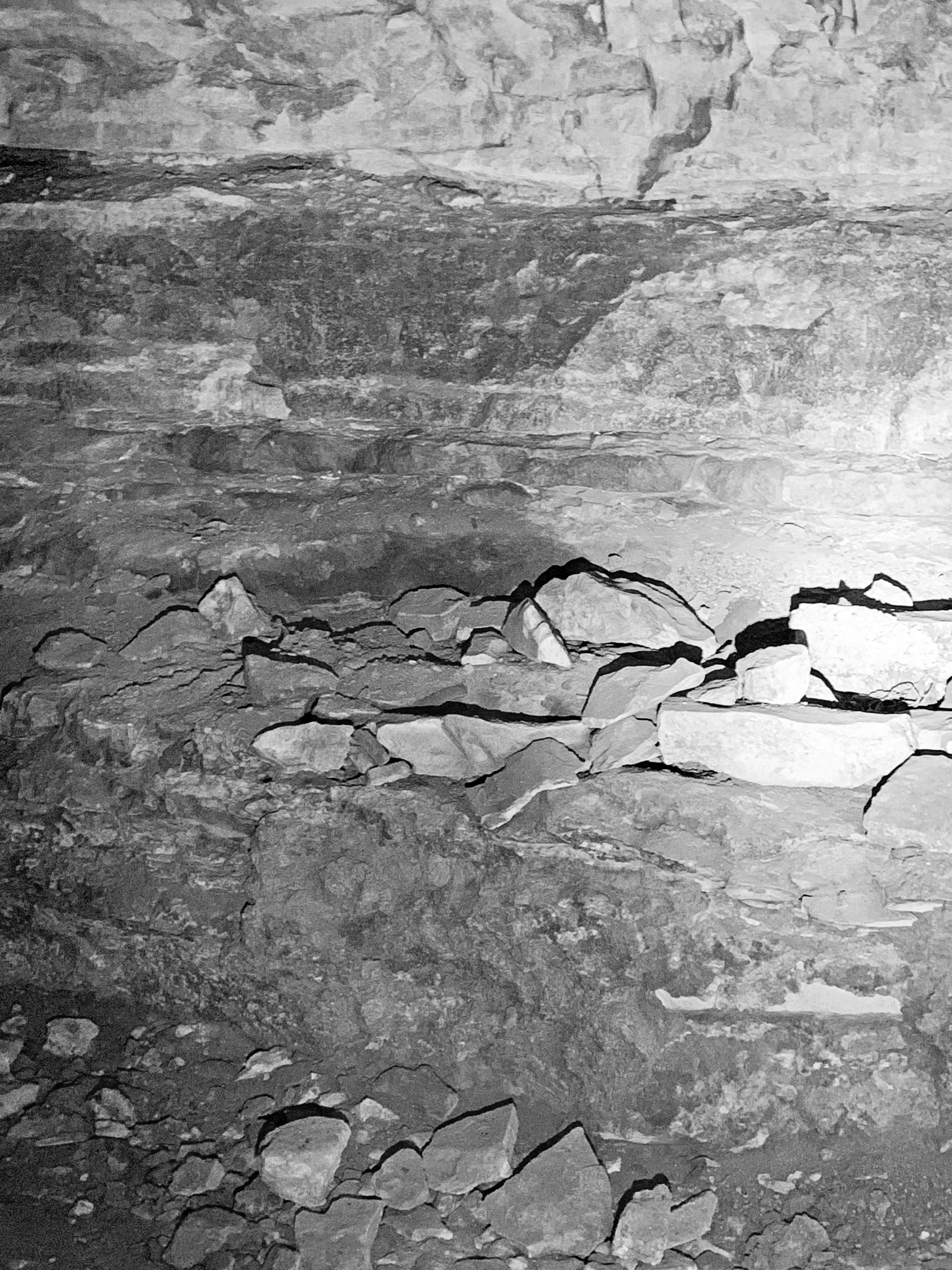
Interbedded shale (= darker gray) and limestone (= lighter gray) in the Mississipipian of Kentucky, USA. (photo by Ljubomir Risteski) Western Kentucky's Mammoth Cave is the longest known cave on Earth, with 412 mapped miles, as of March 2019. The cave is developed in three Mississippian-aged limestone formations. Common lithologies include lime mudstones (micritic limestones), fossilferous wackestones, oolitic limestones, and intraclastic limestones. Other lithologies include dolomitic limestones, dolostones, chert, argillaceous limestones, and shales. Seen here is a thin interval of interbedded limestone and shale along Houchins Narrows, which is the first cave passage after entering the mouth of the cave (Historic Entrance). This is the Bethel Member of the Girkin Limestone. Apart from this unit, the Girkin consists of relatively pure limestones. Based on regional and intercontinental correlation, deposition of the Bethel Member's shales represents the onset of glaciation in Gondwana on the old South Pole. Glaciations result in global sea level drops (regressions). The limestones of the Mammoth Cave area were deposited in a warm, shallow ocean environment, so a sea level drop will result in an influx of siliciclastic sediments - in this case, fine-grained muds. Houchins Narrows is a relatively short cave passage, but it was probably originally connected with nearby Dixon Cave, which itself drained into the Green River long ago. The floor of Houchins Narrows is packed sediments, which extend downward to an unknown depth. The original passage ceiling is mostly removed by erosion (breakdown). Areas with preserved ceiling have scallops, a common dissolutional feature in caves. Their morphology indicates flow direction when the passage was active with a flowing underground river - they indicate that flow was to the northwest, toward the Green River. Houchins Narrows is part of Mammoth Cave's level B, the 2nd-highest level of passages, formed before 3.25 million years ago (Late Pliocene or before). Level B's passageways are now dry - they are currently well above the present water table. Stratigraphy: Bethel Member, Girkin Limestone, lower Upper Mississippian Locality: southwestern wall of Houchins Narrows (between the Historic Entrance and the Rotunda), Mammoth Cave National Park, Kentucky, USA |
| Date | |
| Source | Interbedded shale and limestone (Bethel Member, Girkin Limestone, Upper Mississippian; Houchins Narrows, Mammoth Cave, Kentucky, USA) 3 |
| Author | James St. John |
Licensing edit
_3_(51285097494).jpg&action=edit§ion=2)
- You are free:
- to share – to copy, distribute and transmit the work
- to remix – to adapt the work
- Under the following conditions:
- attribution – You must give appropriate credit, provide a link to the license, and indicate if changes were made. You may do so in any reasonable manner, but not in any way that suggests the licensor endorses you or your use.
| This image was originally posted to Flickr by James St. John at https://flickr.com/photos/47445767@N05/51285097494. It was reviewed on 20 January 2022 by FlickreviewR 2 and was confirmed to be licensed under the terms of the cc-by-2.0. |
File history
Click on a date/time to view the file as it appeared at that time.
| Date/Time | Thumbnail | Dimensions | User | Comment | |
|---|---|---|---|---|---|
| current | 00:26, 20 January 2022 | | 3,024 × 4,032 (5.71 MB) | SeichanGant (talk | contribs) | Transferred from Flickr via #flickr2commons |
You cannot overwrite this file.
File usage on Commons
There are no pages that use this file.
_3_(51285097494).jpg&oldid=812389280)