File:Interstate 375 (Michigan) map.svg

Size of this PNG preview of this SVG file: 800 × 566 pixels. Other resolutions: 320 × 227 pixels | 640 × 453 pixels | 1,024 × 725 pixels | 1,280 × 906 pixels | 2,560 × 1,812 pixels | 1,215 × 860 pixels.
Original file (SVG file, nominally 1,215 × 860 pixels, file size: 211 KB)
Captions
Captions
Add a one-line explanation of what this file represents
Summary edit
_map.svg&action=edit§ion=1)
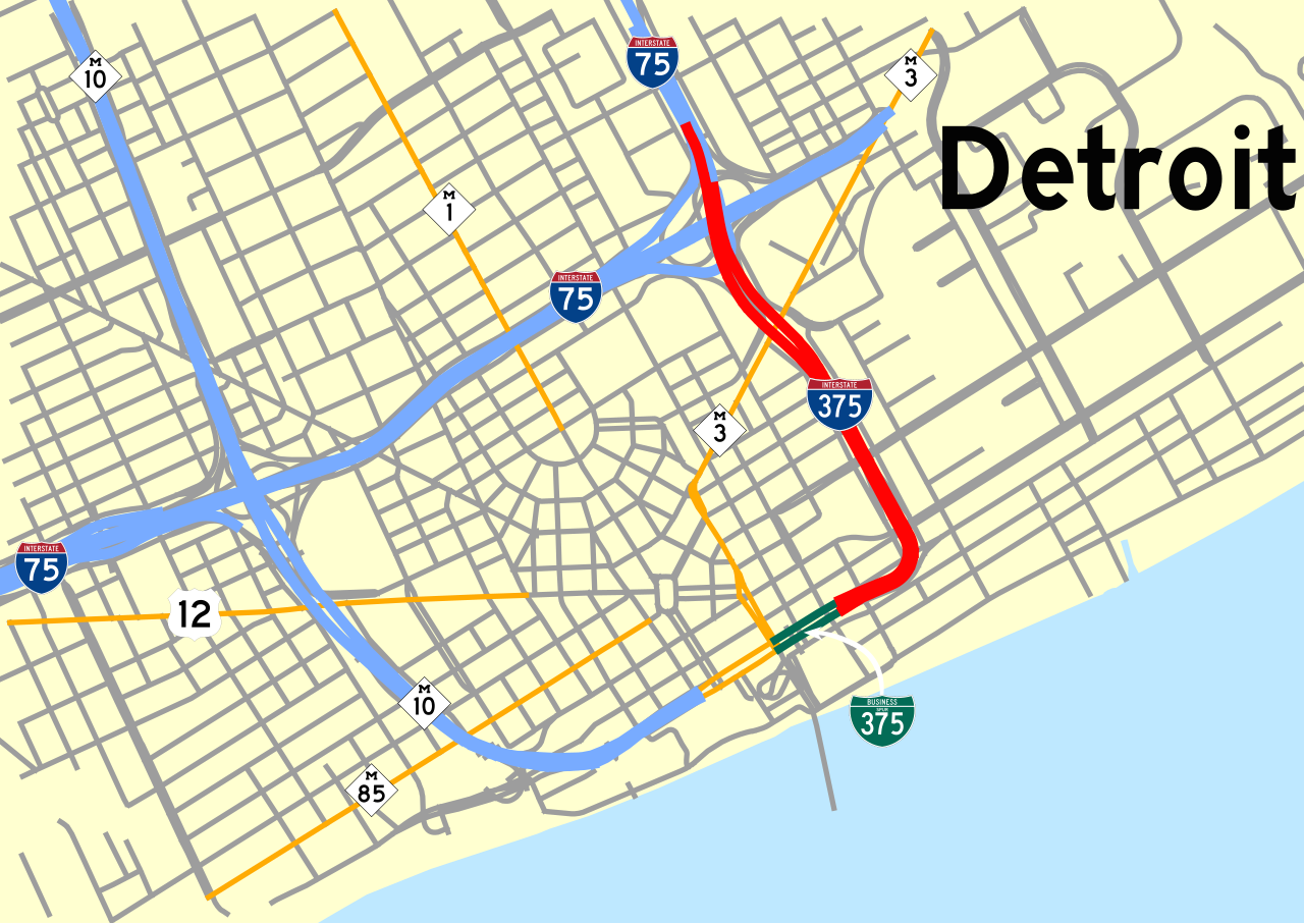
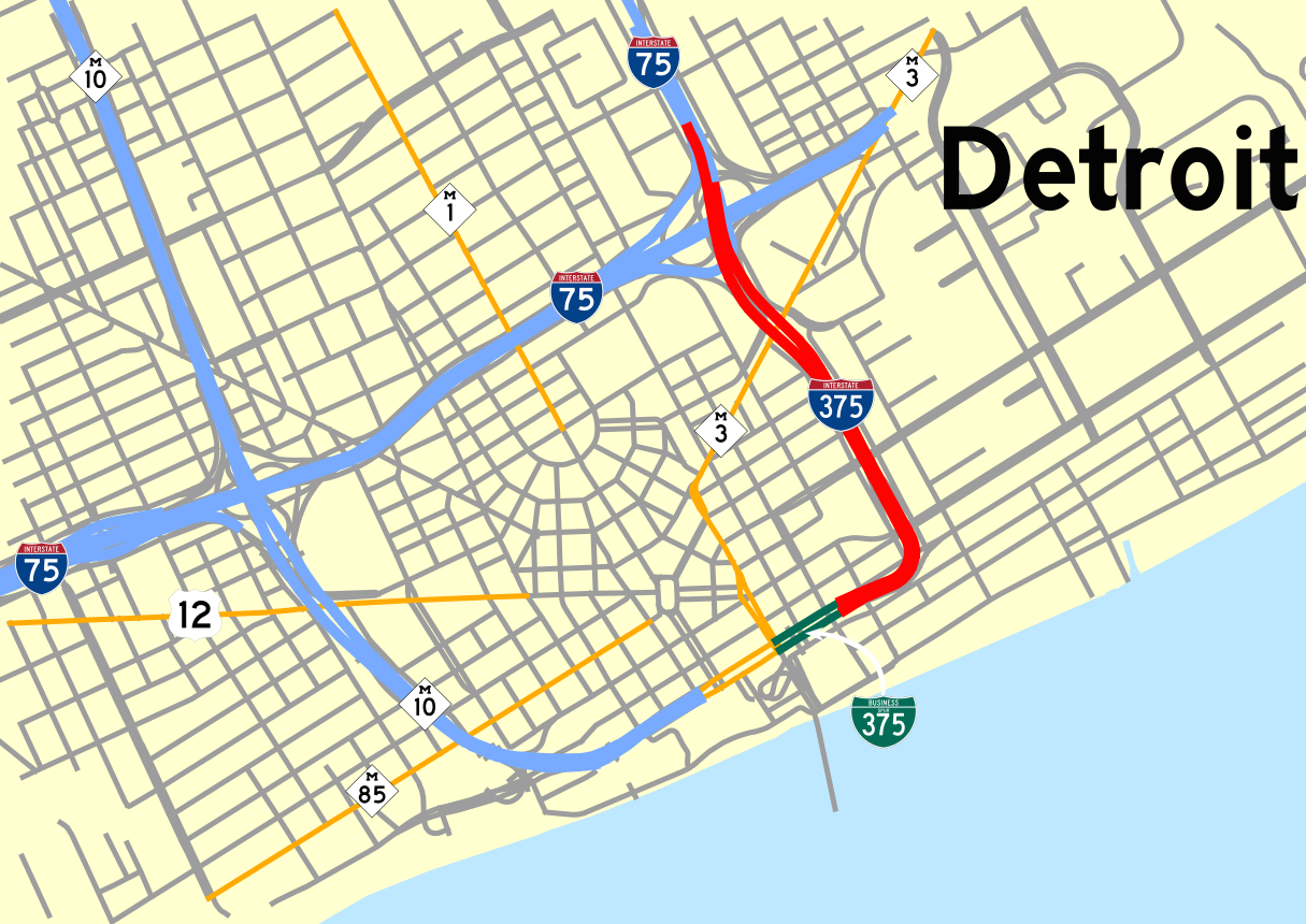
| Description | Map of downtown Detroit with I-375 and BS-375 highlighted. |
| Date | |
| Source | Own work |
| Author | Kelley Cook |
Licensing edit
_map.svg&action=edit§ion=2)
| I, the copyright holder of this work, release this work into the public domain. This applies worldwide. In some countries this may not be legally possible; if so: I grant anyone the right to use this work for any purpose, without any conditions, unless such conditions are required by law. |
File history
Click on a date/time to view the file as it appeared at that time.
| Date/Time | Thumbnail | Dimensions | User | Comment | |
|---|---|---|---|---|---|
| current | 19:49, 2 October 2008 | | 1,215 × 860 (211 KB) | KelleyCook (talk | contribs) | Exact same thing just nominally 5x bigger |
| 19:35, 2 October 2008 |  | 243 × 172 (210 KB) | KelleyCook (talk | contribs) | Version saved as Plain | |
| 19:25, 2 October 2008 |  | 243 × 172 (204 KB) | KelleyCook (talk | contribs) | {{Information |Description=Map of downtown Detroit with I-375 and BS-375 highlighted |Source=Own Work |Date=2008-10-02 |Author=Kelley Cook |Permission= |other_versions= }} 375 Category:Interstate 375 (Michigan) <!- |
You cannot overwrite this file.
File usage on Commons
The following page uses this file:
_map.png)
File usage on other wikis
The following other wikis use this file:
_map.svg&oldid=587250314)