File:Interstate 4 map.svg

Size of this PNG preview of this SVG file: 601 × 599 pixels. Other resolutions: 241 × 240 pixels | 481 × 480 pixels | 770 × 768 pixels | 1,027 × 1,024 pixels | 2,054 × 2,048 pixels | 3,671 × 3,660 pixels.
Original file (SVG file, nominally 3,671 × 3,660 pixels, file size: 202 KB)
Captions
Captions
Add a one-line explanation of what this file represents
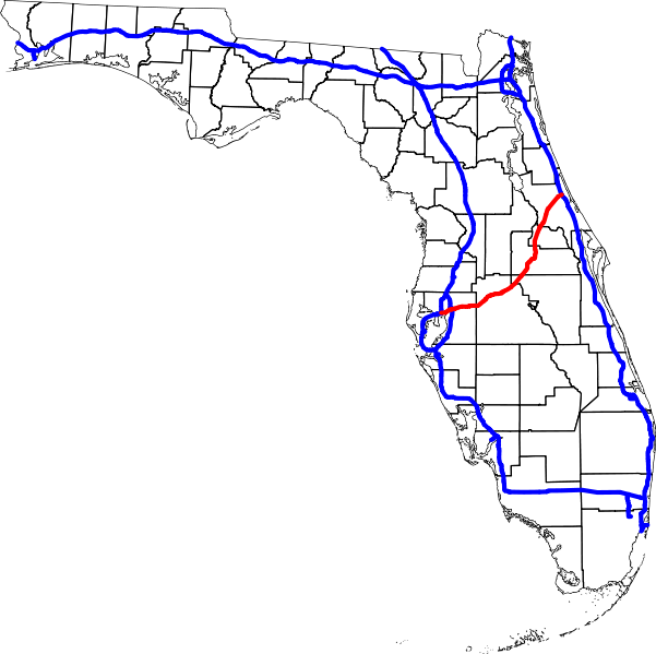
A map of Florida, with Interstate Highways in blue, and Interstate 4 in red.
David Benbennick made this map with data from nationalatlas.gov. The map uses azimuthal equidistant projection, centered on (-81.7667 west, 28.1333 north).
| I, the copyright holder of this work, release this work into the public domain. This applies worldwide. In some countries this may not be legally possible; if so: I grant anyone the right to use this work for any purpose, without any conditions, unless such conditions are required by law. |
File history
Click on a date/time to view the file as it appeared at that time.
| Date/Time | Thumbnail | Dimensions | User | Comment | |
|---|---|---|---|---|---|
| current | 23:02, 5 April 2007 | | 3,671 × 3,660 (202 KB) | Augiasstallputzer~commonswiki (talk | contribs) | Setting a srceencompatible size. To print, please download the image and edit the size values in real measures (metric or inch). |
You cannot overwrite this file.
File usage on Commons
The following page uses this file:
File usage on other wikis
The following other wikis use this file:
- Usage on bg.wikipedia.org